Category:Aerial photographs of Allentown, Pennsylvania
Media in category "Aerial photographs of Allentown, Pennsylvania"
The following 91 files are in this category, out of 91 total.
-
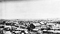
 1900 - Eighth And Chew Looking North - Allentown PA.jpg 2,500 × 1,406; 697 KB
-
 1900 - View to Northwest From Hotel Allen - Seventh And Hamilton - Allentown PA.jpg 2,500 × 1,406; 550 KB
-
 1905 - Looking West over Allentown PA from Eighth and Turner Street.jpg 1,600 × 958; 295 KB
-
 1909 - Seventh and Linden - Looking Northwest - Postcard - Allentown PA.jpg 1,600 × 1,029; 508 KB
-
 1910 - Lehigh River Looking West Over First Ward - Allentown PA.jpg 2,600 × 1,462; 472 KB
-
 1910 - Looking Southwest from Eighth and Turner Streets Allentown PA.jpg 1,024 × 673; 160 KB
-
 1910 - Seventh Street looking north from Center Square Allentown PA.jpg 1,600 × 1,011; 505 KB
-
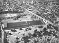
 1920 - Allentown Fairgrounds.jpg 1,593 × 1,181; 486 KB
-
 1920 - Eighth Street Bridge - Looking South - Aerial - Allentown PA.jpg 4,096 × 2,731; 1.15 MB
-
 1920 - Eighth Street Bridge - Looking South - Aerial 2 - Allentown PA.jpg 4,096 × 2,731; 1.35 MB
-
 1922 - Southwest Allentown - Allentown PA.jpg 1,500 × 897; 235 KB
-
 1925 - Aerial Allentown 1st and 9th Wards.jpg 1,524 × 1,948; 495 KB
-
 1925 - Aerial Allentown CBD.jpg 1,541 × 1,890; 465 KB
-
 1925 - Looking East from 9th between Tilghman and Allen to Lehigh River.jpg 1,582 × 1,931; 617 KB
-
-
 1925 - South of Hamilton 2d and 3d Wards looking East.jpg 1,611 × 1,897; 649 KB
-
 1925 - Union Boulevard East of Lehigh River - Allentown PA.jpg 1,300 × 1,740; 343 KB
-
 1925 - West End 17th and 11th Wards.jpg 1,558 × 1,950; 599 KB
-
 1925 - West End looking west from Mack Trucks Plant 3A.jpg 1,551 × 1,897; 561 KB
-

-
 1928 - Northeast Allentown - 19 May MC - Allentown PA.jpg 3,872 × 4,824; 3.39 MB
-
 1929 - Union Boulevard Construction - Allentown PA.jpg 1,517 × 1,900; 361 KB
-
 1930 - Fairview Cemetary and 3d Ward looking North.jpg 1,511 × 1,106; 396 KB
-
 1930 - Second Ward Looking West - Allentown PA.jpg 2,400 × 1,350; 802 KB
-
 1930 - South First Ward Looking West From Lehigh River - Allentown PA.jpg 2,500 × 1,406; 777 KB
-
 1930 - Union Boulevard and Plymouth Street - 15th Ward - East Allentown PA.jpg 2,400 × 1,878; 838 KB
-
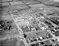
 1931 - Cedar Crest College - Looking West - Allentown PA.jpg 2,400 × 1,854; 647 KB
-
 1931 - Central Business District - Airphoto - Allentown PA.jpg 2,048 × 1,614; 795 KB
-
 1931 - Mountainville - 4th Street - Looking North - Allentown PA.jpg 2,400 × 1,926; 827 KB
-
 1931 - Muhlenburg College - Campus Looking Northeast - Allentown PA.jpg 2,400 × 1,840; 860 KB
-
 1931 - Muhlenburg College - West Campus - Allentown PA.jpg 2,400 × 1,880; 866 KB
-
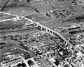 1931 - Tilghman Street Viaduct - Looking East - Allentown PA.jpg 2,400 × 1,922; 1.04 MB
-
 1937 - Aerial view of Allentown Bethlehem Easton Airport - Northward - Allentown PA.jpg 2,400 × 1,859; 607 KB
-
 1938 - Central Business District - Looking East - Allentown PA.jpg 2,400 × 1,883; 745 KB
-
 1938 - Central Business District - Looking East 2 - Allentown PA.jpg 2,400 × 1,880; 810 KB
-
 1938 - Central Business District - Looking East 3 - Allentown PA.jpg 2,400 × 1,867; 935 KB
-
 1938 - Central Business District - Looking NorthEast - Allentown PA.jpg 2,400 × 1,942; 1,001 KB
-
 1938 - Eleventh Ward looking East - Allentown PA.jpg 2,400 × 1,880; 1.04 MB
-
 1938 - Fairgrounds looking East - Allentown PA.jpg 2,400 × 1,965; 1.13 MB
-
 1938 - Fairgrounds looking East 2 - Allentown PA.jpg 2,400 × 1,933; 1.05 MB
-
 1938 - Fairgrounds looking North West Allentown PA.jpg 2,400 × 1,931; 1.02 MB
-
 1938 - Fairgrounds looking Northeast - Allentown PA.jpg 2,400 × 1,933; 1.08 MB
-
 1938 - Fairgrounds looking Northeast 2 - Allentown PA.jpg 2,400 × 1,959; 1.19 MB
-
 1938 - Fairgrounds looking Northeast 3 - Allentown PA.jpg 2,400 × 1,930; 1.15 MB
-
 1938 - Mack Plant 3 and 3A - Allentown PA.jpg 2,400 × 1,895; 838 KB
-
 1938 - Mack Plant 4 - Allentown PA.jpg 2,400 × 1,949; 752 KB
-
 1939 - Air Photo - Allentown Fair - Allentown PA.jpg 2,048 × 1,675; 685 KB
-
 1939 - Air Photo 2 - Allentown Fair - Allentown PA.jpg 2,048 × 1,147; 542 KB
-
 1939 - Air Photo 3 - Allentown Fair - Allentown PA.jpg 3,045 × 1,376; 530 KB
-
 1939 - Air Photo 4 - Allentown Fair - Allentown PA.jpg 3,110 × 1,348; 736 KB
-
 1939 - Air Photo 5 - Allentown Fair - Allentown PA.jpg 2,048 × 1,684; 679 KB
-
 1940 - Central Business District Looking West - Allentown PA.jpg 1,200 × 675; 248 KB
-
 1940 - Fourth And Liberty Street Looking North - Allentown PA.jpg 2,500 × 1,406; 620 KB
-
 1940 - Industrial Area West of Lehigh River - Allentown PA.jpg 2,500 × 1,406; 573 KB
-
 1940 - View Looking East From Eighth Street Bridge - Allentown PA.jpg 2,500 × 1,406; 519 KB
-
 1941 - Aerial Photograph of West End - Allentown PA.jpg 2,000 × 1,331; 770 KB
-
 1945 - Mack Trucks - Monthly Magazine - Nov - Allentown PA.jpg 944 × 1,400; 456 KB
-
 1950 - Highland Park Apartments - Airphoto - Allentown PA.jpg 1,400 × 681; 348 KB
-
 1958 - Airport Drive-In Airphoto - Allentown PA.jpg 2,048 × 1,152; 286 KB
-
 1959 - Lehigh Structural Steel Company Allentown PA.jpg 2,000 × 1,672; 1.06 MB
-
 1960 - Cedar Crest Boulevard and Hamilton Street - Dorneyville - Allentown PA.jpg 2,500 × 1,406; 540 KB
-
 1962 - View Of Central Buisness District Looking Northeast - Allentown PA.jpg 2,500 × 1,406; 699 KB
-
 1964 - Cedar Beach Pool - Allentown PA.jpg 1,500 × 960; 252 KB
-
 1965 - 4th and Linden Looking N - East Side - 1 Apr - Allentown PA.jpg 2,000 × 1,334; 657 KB
-
 1965 - 4th and Linden Looking N - West Side - 1 Apr - Allentown PA.jpg 2,000 × 1,333; 739 KB
-
 1965 - 5th and Hamilton Streets - 1 Apr - Allentown PA.jpg 2,000 × 1,334; 651 KB
-
 1965 - Allentown School District Offices - 1 Apr - Allentown PA.jpg 1,350 × 900; 285 KB
-
 1965 - Allentown Terminal RR Station - 1 Apr - Allentown PA.jpg 2,000 × 1,334; 774 KB
-
 1965 - Central Buisness District Looking NW - 1 Apr - Allentown PA.jpg 2,000 × 2,000; 1.38 MB
-
 1965 - Fourth Street Redevelopment Area - Looking E - 1 Apr - Allentown PA.jpg 2,000 × 1,333; 503 KB
-
 1965 - Fourth Street Redevelopment Area - Looking N - 1 Apr - Allentown PA.jpg 2,000 × 1,337; 982 KB
-
 1965 - Fourth Street Redevelopment Area - Looking SE - 1 Apr - Allentown PA.jpg 2,000 × 1,348; 826 KB
-
 1965 - Fourth Street Redevelopment Area - LVRR Freight Yard - 1 Apr - Allentown PA.jpg 2,000 × 1,332; 635 KB
-
 1965 - Fourth Street Redevelopment Area - Phoenix Silk Mill - 1 Apr - Allentown PA.jpg 2,000 × 1,336; 801 KB
-
 1965 - Fourth Street Redevelopment Area -1st Ward South End - 1 Apr - Allentown PA.jpg 2,000 × 1,334; 674 KB
-
 1965 - Lehigh County Court Houses - Looking N - 1 Apr - Allentown PA.jpg 2,000 × 1,334; 719 KB
-
 1965 - Lehigh Valley Railroad Freight Yard - 1 Apr - Allentown PA.jpg 2,000 × 1,333; 592 KB
-
 1965 - Old Lehigh County Prison - 1 Apr - Allentown PA.jpg 2,000 × 1,332; 600 KB
-
 1965 - Phoenix Mills - 1 Apr - Allentown PA.jpg 2,000 × 1,333; 891 KB
-
 1965 - UGI Gas Tower - 1 Apr - Allentown PA.jpg 2,000 × 1,333; 702 KB
-
 1965 - Union Street and Little Lehigh - 1 Apr - Allentown PA.jpg 2,000 × 1,333; 962 KB
-
 1967 - 7th Street Pike - Airphoto - Allentown PA.jpg 2,048 × 1,575; 988 KB
-
 1968 - Aerial Photograph Central Business District- Allentown PA.jpg 1,551 × 1,053; 656 KB
-
 1968 - Allentown PA Aireal Photograph.jpg 1,552 × 1,072; 445 KB
-
 1969 - Airphoto - Dorney Park - Allentown PA.jpg 1,024 × 695; 272 KB
-
 1976 - Shankweiler Drive-in Airphoto - 15 Apr MC - Allentown PA.jpg 1,453 × 915; 401 KB
-
 2021 - 1100 Block Hamilton Street - NW - Drone - Allentown PA.jpg 4,096 × 2,721; 1.42 MB
-
 2021 - 500 Block Hamilton Street - North Side - Drone - Allentown PA.jpg 4,096 × 2,720; 1.68 MB
-
 2021 - 600 Block Hamilton Street - NE View - Drone - Allentown PA.jpg 4,096 × 2,720; 1.39 MB
-
 Allentown, Pennsylvania (1) (2895771731).jpg 1,280 × 960; 69 KB
-
 Allentown, Pennsylvania (2896613266).jpg 1,280 × 960; 80 KB


_(2895771731).jpg)
.jpg)