Category:Aerial photographs of Anchorage, Alaska
Because the Municipality of Anchorage is a combined City and Borough, it includes substantial non-urban areas and some smaller distinct communities. As an aid to those without detailed knowledge of the area, it may be appropriate to continue to classify those under Category:Aerial Photographs of South-Central Alaska and Category:Aerial photographs of populated places in Alaska rather than here.
Media in category "Aerial photographs of Anchorage, Alaska"
The following 51 files are in this category, out of 51 total.
-
 1964 Alaska Quake L Street Slide.jpg 3,936 × 2,571; 3.95 MB
-
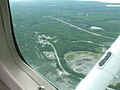
 1964 Alaska Quake Portage Townsite.jpg 3,592 × 2,401; 5.14 MB
-
 Aerial view of Anchorage, Alaska, looking northwest, 2006.jpg 2,272 × 1,704; 984 KB
-
 Aerial view of Chugiak, Alaska (cropped).jpg 1,567 × 1,431; 631 KB
-
 Aerial view of Chugiak, Alaska.jpg 2,272 × 1,704; 1.01 MB
-
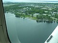
 Aerial view of Eagle River, Alaska.jpg 2,272 × 1,704; 1.03 MB
-

-
 Aerial view of Glenn Highway and Old Glenn Highway interchange.jpg 2,272 × 1,704; 1,016 KB
-
 Aerial view of the southern and southeastern Anchorage bowl, Anchorage, Alaska.jpg 2,272 × 1,704; 709 KB
-
 Aerial view of West Anchorage, Lake Spenard in foreground 2.jpg 2,272 × 1,704; 978 KB
-
 Aerial view of West Anchorage, Lake Spenard in foreground.jpg 2,272 × 1,704; 994 KB
-
 Alaska fire island.jpg 3,440 × 2,240; 4.27 MB
-
 AlaskaQuake-Turnagain.jpg 1,000 × 666; 160 KB
-
 ANC-a.jpg 683 × 888; 1.02 MB
-
 Anchorage - Ted Stevens International (ANC - PANC) AN0529432.jpg 1,200 × 900; 503 KB
-
 Anchorage 149.88577W 61.13721N.jpg 1,280 × 958; 344 KB
-
 Anchorage ak from space.jpg 595 × 861; 74 KB
-
 Anchorage Alaska aerial view.jpg 1,500 × 901; 986 KB
-
 Anchorage International Airport - US-AK.jpg 3,648 × 2,736; 614 KB
-
 Anchorage International Airport and Cook Inlet.jpg 2,272 × 1,325; 460 KB
-
 Anchorage surroundings 432 pan crop 15 (28288718263).jpg 7,718 × 10,986; 54.81 MB
-
 Anchorage surroundings 751 pan crop 15 (28828342181).jpg 7,718 × 10,986; 55.57 MB
-
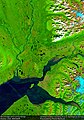
 Anchorage, AK (ASTER).jpg 2,000 × 2,011; 526 KB
-
 Approach to Anchorage, Alaska (3333913037) (cropped).jpg 2,514 × 1,380; 442 KB
-
 Approach to Anchorage, Alaska (3333913037).jpg 3,032 × 2,251; 707 KB
-
 Capitol International Airways Flight 3-26.jpg 398 × 560; 72 KB
-
 Cityscape (7041945893).jpg 3,648 × 1,684; 3.6 MB
-
 Convair 580, Era Aviation AN0244228.jpg 1,024 × 683; 404 KB
-
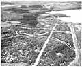 Early aerial view of lake hood Anchorage.jpg 2,100 × 1,726; 246 KB
-
 Earth from Space- Anchorage, Alaska ESA24904982.jpg 9,364 × 6,161; 10.98 MB
-
 Earth from Space- Anchorage, Alaska ESA24904982.tiff 18,728 × 12,322; 660.25 MB
-
 Elmendorf AFB Alaska - 10sep2002.jpg 772 × 562; 133 KB
-
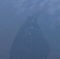 Fire Island Alaska from airliner.jpg 2,781 × 2,732; 2.2 MB
-
 Fire Lake, Eagle River, Alaska.jpg 2,272 × 1,704; 981 KB
-
 Glenn Highway bridge over Eagle River, 1950s.jpg 1,916 × 2,044; 4.54 MB
-
 Hospital Landslide (16263358059).jpg 3,716 × 4,084; 1.94 MB
-

-

-
 Kulis ANGB Aerial.png 300 × 334; 232 KB
-
 Lake Hood Gravel Strip - Z41.jpg 2,634 × 1,794; 2 MB
-
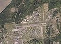
 Lake Hood Seaplane Base and Gravel Strip.jpg 1,040 × 780; 581 KB
-
 Lake Hood Seaplane Base.jpg 1,023 × 818; 196 KB
-
 Looking back to Little O'Malley and Anchorage (5512290578).jpg 3,648 × 2,736; 8.46 MB
-
 Looking toward the Nike site and Anchorage in the background (3822839151).jpg 3,504 × 2,336; 1.31 MB
-
 Minnesota Drive After.jpg 1,080 × 624; 267 KB
-
 Minnesota Drive Before.jpg 1,080 × 619; 237 KB
-
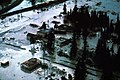
 No caption. (Earthquake damage in the Turnagain Arm residential area) (25318527591).jpg 4,254 × 3,396; 9.5 MB
-
 Powerline Pass.jpg 1,024 × 768; 211 KB
-
 Subsidence at portage.jpg 977 × 667; 273 KB
-
 Ted Stevens Anchorage International Airport.jpg 560 × 409; 34 KB
-


.jpg)


_AN0529432.jpg)


.jpg)
.jpg)
.jpg)
_(cropped).jpg)
.jpg)

.jpg)


.jpg)
.jpg)
.jpg)


.jpg)
.jpg)


_(25318527591).jpg)


