Category:Aerial photographs of Cook County, Illinois
Subcategories
This category has only the following subcategory.
Media in category "Aerial photographs of Cook County, Illinois"
The following 19 files are in this category, out of 19 total.
-
 Corwith Intermodal Facility.jpg 2,400 × 1,600; 2.82 MB
-
 Ford City Road (40035984365).jpg 2,400 × 1,600; 1.96 MB
-
 I-294 Aerial at I-190 I-90 Exit (50561717477).jpg 2,400 × 3,600; 4.45 MB
-
 I-55 Industrial Canal Aerial - Facing East (50561717852).jpg 2,400 × 3,600; 5.1 MB
-
 IL50 North Aerial - Cicero Avenue Chicago (27105365398).jpg 1,600 × 2,400; 2.52 MB
-
 Interstate 55 at IL171 Aerial (50561726587).jpg 3,600 × 2,400; 3.37 MB
-
 Interstate 57 - Chicago Swerve (40035983765).jpg 2,400 × 3,600; 4.08 MB
-
 Milwaukee and Elston Avenues - Chicago (50561720977).jpg 2,400 × 3,600; 4.53 MB
-
 Presence Resurection Medical Center (50561590831).jpg 3,600 × 2,400; 3.81 MB
-
 Red Box and Tower (40221460824).jpg 2,400 × 1,600; 1.93 MB
-
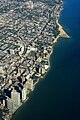 Rogers Park Aerial Along Lake Michigan (50561589666).jpg 2,400 × 3,600; 4.3 MB
-
 Rogers Park Aerial Along Lake Michigan 2 (50561720147).jpg 2,400 × 3,600; 4.27 MB
-
 Rogers Park Aerial Along Lake Michigan 3 (50561589996).jpg 3,600 × 2,400; 4.81 MB
-
 Skokie Evanston Aerial (50561720717).jpg 2,400 × 3,600; 5.16 MB
-
 Three Blocks Worth Near Midway (40221459664).jpg 2,400 × 1,600; 2.27 MB
-
 Three Petal Cloverleaf (50561590506).jpg 3,600 × 2,400; 4.29 MB
-
 US12 US45 North Near I-190 Aerial (50561717282).jpg 2,400 × 3,600; 4.14 MB
-
 Vulcan Materials Mining Along Interstate 55 (50561596381).jpg 3,600 × 2,400; 3.27 MB
-
 West Ridge Neighborhood of Chicago Aerial (50560849138).jpg 3,600 × 2,400; 5.61 MB

.jpg)
.jpg)
.jpg)
.jpg)
.jpg)
.jpg)
.jpg)
.jpg)
.jpg)
.jpg)
.jpg)
.jpg)
.jpg)
.jpg)
.jpg)
.jpg)
.jpg)
.jpg)