Category:Aerial photographs of East Ayrshire
Media in category "Aerial photographs of East Ayrshire"
The following 31 files are in this category, out of 31 total.
-
 Ayrshire Loch Doon Aerial alt.jpg 5,472 × 3,648; 17.19 MB
-
 Ayrshire Loch Doon Aerial alt2.jpg 5,472 × 3,648; 18.53 MB
-
 Ayrshire Loch Doon Aerial Pan180.jpg 8,192 × 2,728; 18.67 MB
-
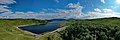
 Ayrshire Loch Doon Aerial.jpg 5,472 × 3,648; 17.73 MB
-
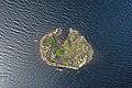
 Ayrshire Loch Doon Castle Aerial alt.jpg 5,472 × 3,648; 19.22 MB
-
 Ayrshire Loch Doon Castle Aerial alt2.jpg 5,472 × 3,648; 20.28 MB
-
 Ayrshire Loch Doon Castle Aerial Original Top.jpg 5,472 × 3,648; 18.51 MB
-
 Ayrshire Loch Doon Castle Aerial Top.jpg 5,472 × 3,648; 22.14 MB
-
 Ayrshire Loch Doon Castle Aerial.jpg 5,472 × 3,648; 21.58 MB
-
 Ayrshire New Cumnock Mine Aerial.jpg 5,472 × 3,648; 15.1 MB
-
 Ayrshire River Doon Aerial alt.jpg 5,472 × 3,648; 17.39 MB
-
 Ayrshire River Doon Aerial alt2.jpg 5,472 × 3,648; 16.48 MB
-
 Ayrshire River Doon Aerial Pan180.jpg 8,192 × 2,740; 20.4 MB
-
 Ayrshire River Doon Aerial.jpg 5,472 × 3,648; 16.93 MB
-
 Darvel from the air (geograph 5559579).jpg 640 × 480; 150 KB
-
 Drongan 2020278.jpg 1,024 × 768; 79 KB
-
 East Ayrshire - geograph.org.uk - 1737819.jpg 3,872 × 2,592; 3.06 MB
-
 Fenwick from the air (geograph 5019764).jpg 640 × 480; 140 KB
-
 Galston from the air (geograph 2071561).jpg 2,592 × 1,944; 3.96 MB
-
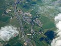
 GreaterKilmarnock.jpg 632 × 465; 138 KB
-
 Kennox House Aerial.jpg 3,992 × 2,242; 2.13 MB
-
 Killoch colliery - geograph.org.uk - 1737384.jpg 2,585 × 2,176; 892 KB
-
 Martyrs' Moss - geograph.org.uk - 1737831.jpg 3,680 × 2,366; 2 MB
-
 Mullwharchar - geograph.org.uk - 1709155.jpg 640 × 344; 124 KB
-
 Newmilns from the air (geograph 2071545).jpg 2,592 × 1,944; 3.71 MB
-
 Pant Wood - geograph.org.uk - 1737343.jpg 3,872 × 2,592; 1.31 MB
-
 River Ayr at Stair - geograph.org.uk - 1737322.jpg 3,872 × 2,592; 2.69 MB
-
 River Ayr, east of Stair.jpg 551 × 640; 152 KB
-
 South Ayrshire and the Firth of Clyde - geograph.org.uk - 1714763.jpg 3,872 × 2,160; 2.02 MB
-
 Stair and Stair House Farm.jpg 3,264 × 2,448; 3.23 MB
-
 Waterhead opencast mine - geograph.org.uk - 1737854.jpg 3,872 × 2,592; 2.59 MB


.jpg)


.jpg)
.jpg)


.jpg)


