Category:Aerial photographs of Grenada
Countries of North America: The Bahamas · Barbados · Belize · Canada · Costa Rica · Cuba · Dominica · Dominican Republic · El Salvador · Grenada · Guatemala · Haiti · Honduras · Jamaica · Mexico · Nicaragua · Panama · Saint Kitts and Nevis · Trinidad and Tobago‡ · United States of America‡
Other territories: Anguilla · Bermuda · British Virgin Islands · Cayman Islands · Florida Keys · Greenland · Guadeloupe · Martinique · Montserrat · Puerto Rico · Saint Barthélemy · Saint Pierre and Miquelon · Turks and Caicos Islands · United States Virgin Islands
‡: partly located in North America
Other territories: Anguilla · Bermuda · British Virgin Islands · Cayman Islands · Florida Keys · Greenland · Guadeloupe · Martinique · Montserrat · Puerto Rico · Saint Barthélemy · Saint Pierre and Miquelon · Turks and Caicos Islands · United States Virgin Islands
‡: partly located in North America
Subcategories
This category has only the following subcategory.
Media in category "Aerial photographs of Grenada"
The following 8 files are in this category, out of 8 total.
-
 Carriacou Flight - panoramio.jpg 2,288 × 1,520; 920 KB
-
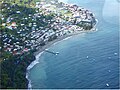 Gouyave town aerial view.jpg 720 × 540; 113 KB
-
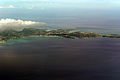
 Grenada Flight View - panoramio.jpg 2,288 × 1,712; 949 KB
-
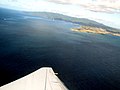
 Grenada Flight View Airport - panoramio.jpg 2,288 × 1,712; 892 KB
-
 Grenada South Flight - panoramio.jpg 2,288 × 1,712; 757 KB
-
 Grenada South West Flight - panoramio.jpg 2,288 × 1,520; 1.01 MB
-
 Grenada South West Flight View - panoramio.jpg 2,288 × 1,712; 881 KB
-
 Grenada2010.jpg 2,448 × 1,632; 3.7 MB


