Category:Aerial photographs of Hudson Bay
Media in category "Aerial photographs of Hudson Bay"
The following 12 files are in this category, out of 12 total.
-
 Frlight FRA - SFO - panoramio.jpg 3,072 × 2,304; 2.8 MB
-
 Frozen Moonrise.jpg 5,568 × 3,712; 4.2 MB
-
 Frozen Moonrise1.jpg 720 × 480; 248 KB
-
 Hudson Bay aerial view late summer gjb.jpg 4,032 × 3,024; 2.92 MB
-
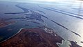
 Mouth of the Churchill River at Hudson Bay (7461042054).jpg 1,280 × 853; 300 KB
-
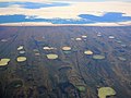 Permafrost thaw ponds in Hudson Bay Canada near Greenland (cropped).jpg 3,869 × 2,912; 5.18 MB
-
 Permafrost thaw ponds in Hudson Bay Canada near Greenland.jpg 4,088 × 2,912; 5.44 MB
-
 Sanikiluaq peneplain.JPG 2,400 × 1,514; 1.62 MB
-
 Sanikiluaq rocks -d.jpg 2,164 × 1,792; 1.1 MB
-
 Sanikiluaq rocks -e.jpg 2,394 × 1,362; 685 KB
-
 Sea ice on Hudson Bay near Cape Churchill.JPG 3,008 × 2,000; 2.62 MB
-
 Weißwal 8-1999.jpg 922 × 583; 108 KB


.jpg)
.jpg)


