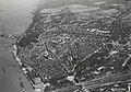
Category:Aerial photographs of Nijmegen
Media in category "Aerial photographs of Nijmegen"
The following 136 files are in this category, out of 136 total.
-
 "Huize Vijverhof" F29442.jpeg 1,736 × 1,230; 590 KB
-
 Aerial photograph of Nijmegen, 1943 (15934 GN15890).jpg 3,764 × 4,616; 2.41 MB
-
 Aerial photograph of Nijmegen, 1943 (15934 GN15891).jpg 3,620 × 4,480; 1.98 MB
-
 Aerial photograph of Nijmegen, 1943 (15934 GN15892).jpg 3,630 × 4,483; 2.09 MB
-
 Bejaardenoord huize Vijverhof F20214.jpeg 1,651 × 1,235; 584 KB
-

-
 Broerenkerk Nijmegen op Luchtfoto GN15640.jpg 1,873 × 1,346; 651 KB
-

-

-
 De in aanbouw zijnde wijk de Voorstenkamp F20440.jpeg 2,806 × 2,098; 1.36 MB
-
 De in aanbouw zijnde wijk de Voorstenkamp F20549.jpeg 2,716 × 2,146; 1.25 MB
-

-

-

-
 De rivier de Waal bij hoog water en de Waalkade F58197.jpeg 2,027 × 2,706; 1.01 MB
-
 De rivier de Waal bij hoog water. F58200.jpeg 2,698 × 2,013; 1,022 KB
-
 De sluis in het Maas Waalkanaal F60497.jpeg 2,782 × 2,143; 1.65 MB
-
 De Staddijk ?, ca.1975 F58538.jpeg 2,706 × 2,144; 1.11 MB
-
 De Staddijk F58483.jpeg 2,811 × 2,088; 1.4 MB
-
 De Staddijk, met rechts de wijk Aldenhof, 6 augustus 1977 F20438.jpeg 2,810 × 2,098; 1.14 MB
-
 De Verlengde Groenestraat en de Groenewoudseweg met viaduct F20582.jpeg 2,716 × 2,150; 1.14 MB
-

-

-

-

-

-
 Exterieur LUCHTFOTO - Nijmegen - 20264253 - RCE.jpg 1,200 × 768; 209 KB
-
 F58195.jpeg 2,662 × 2,097; 1.02 MB
-
 F58196.jpeg 1,810 × 1,510; 776 KB
-
 F60062.jpeg 1,490 × 2,039; 366 KB
-
 GN14945.jpeg 3,771 × 3,213; 1.94 MB
-

-

-
 Hazenkamp; linksonder de Lourdeskerk aan de Hatertseweg, linksboven de Goffert F20613.jpeg 2,716 × 2,126; 1.39 MB
-
 NIMH - 2011 - 9902-20-02 - Aerial photograph of Nijmegen, The Netherlands.jpg 4,000 × 2,736; 2.78 MB
-
 NIMH - 2011 - 9903-07-01 - Aerial photograph of Nijmegen, The Netherlands.jpg 4,000 × 3,177; 1.66 MB
-
 NIMH - 2155 027941 - Aerial photograph of Nijmegen, The Netherlands.jpg 3,508 × 2,520; 1.59 MB
-
 NIMH - 2155 027942 - Aerial photograph of Nijmegen, The Netherlands.jpg 3,508 × 2,408; 1.13 MB
-
 Het bouwrijp maken van grond t.b.v. woningbouw in de Voorstenkamp F20551.jpeg 2,808 × 2,118; 1.01 MB
-

-

-
 Het gezicht in de richting van de Ooy F20862.jpeg 2,062 × 2,724; 1.1 MB
-

-

-
 Het Keizer Karelplein en omgevende bebouwing, F60372.jpeg 2,992 × 2,416; 1.79 MB
-

-

-

-

-

-

-
 In de richting van Meijhorst F11503.jpeg 2,000 × 1,440; 853 KB
-
 Knooppunt Neerbosch.jpg 429 × 306; 26 KB
-

-

-
 Luchtfoto GN15640.jpeg 4,935 × 3,244; 1.88 MB
-
 Luchtfoto NTC vanuit 52.jpg 4,032 × 3,024; 5.3 MB
-

-
 Luchtfoto Opname van de Hazenkamp en het Willemskwartier ca.1980 F58385.jpeg 2,720 × 2,122; 1.57 MB
-
 Luchtfoto Opname van het haven-en industrieterrein ca.1985 F58453.jpeg 2,749 × 2,157; 1.4 MB
-

-

-

-
 Luchtfoto van de binnen- en benedenstad ? GN15637.jpeg 4,837 × 3,123; 1.89 MB
-
 Luchtfoto van de binnen- en benedenstad GN15638.jpeg 4,944 × 3,228; 1.93 MB
-

-

-

-

-

-

-
 Luchtfoto van de Waalbocht, links onder de Waalbrug 19 dec. 1977 F20935.jpeg 2,118 × 2,820; 1.16 MB
-

-

-

-

-

-
 Luchtfoto van het Dominicanenklooster Albertinum.jpg 4,806 × 3,072; 1.39 MB
-
 Luchtfoto van het Goffertstadion F57394.jpeg 2,753 × 2,166; 1.24 MB
-

-

-

-

-

-

-
 Luchtfoto van Malden 15 juli 1981 F20606.jpeg 2,756 × 2,090; 1.43 MB
-

-

-

-

-

-
 Maas Waalkanaal, en de wijken Malvert en Lankforst, 27 april 1988 F60059.jpeg 1,500 × 2,040; 476 KB
-
 Maaswaalkanaal.jpg 600 × 450; 51 KB
-
 Nieuwbouwterrein F20552.jpeg 2,800 × 2,098; 1.39 MB
-
 Nijmegen 5.80926E 51.82851N.jpg 1,280 × 958; 350 KB
-
 Nijmegen tijdens de gevechten om de brug.jpg 2,488 × 3,083; 688 KB
-
 NIMH - 2011 - 0384 - Aerial photograph of Nijmegen, The Netherlands - 1920 - 1940.jpg 3,500 × 2,536; 2.23 MB
-
 NIMH - 2011 - 0385 - Aerial photograph of Nijmegen, The Netherlands - 1920 - 1940.jpg 3,500 × 2,575; 2.56 MB
-
 NIMH - 2011 - 0386 - Aerial photograph of Nijmegen, The Netherlands - 1920 - 1940.jpg 3,500 × 2,562; 2.43 MB
-
 NIMH - 2011 - 0387 - Aerial photograph of Nijmegen, The Netherlands - 1920 - 1940.jpg 3,500 × 2,586; 2.31 MB
-
 NIMH - 2011 - 0388 - Aerial photograph of Nijmegen, The Netherlands - 1920 - 1940.jpg 3,500 × 2,569; 1.95 MB
-
 NIMH - 2011 - 0389 - Aerial photograph of Nijmegen, The Netherlands - 1920 - 1940.jpg 3,500 × 2,550; 2.04 MB
-
 NIMH - 2011 - 0390 - Aerial photograph of Nijmegen, The Netherlands - 1920 - 1940.jpg 3,500 × 2,568; 2.16 MB
-
 NIMH - 2011 - 0391 - Aerial photograph of Nijmegen, The Netherlands - 1920 - 1940.jpg 3,500 × 2,520; 2.43 MB
-
 NIMH - 2011 - 0767 - Aerial photograph of Nijmegen, The Netherlands - 1920 - 1940.jpg 3,500 × 2,543; 2.61 MB
-
 NIMH - 2011 - 0768 - Aerial photograph of Nijmegen, The Netherlands - 1920 - 1940.jpg 3,500 × 2,535; 2.36 MB
-
 NIMH - 2011 - 0769 - Aerial photograph of Nijmegen, The Netherlands - 1920 - 1940.jpg 3,500 × 2,549; 2.59 MB
-
 NIMH - 2011 - 0770 - Aerial photograph of Nijmegen, The Netherlands - 1920 - 1940.jpg 3,500 × 2,520; 1.87 MB
-
 NIMH - 2011 - 0771 - Aerial photograph of Nijmegen, The Netherlands - 1920 - 1940.jpg 3,500 × 2,568; 2.06 MB
-
 NIMH - 2011 - 0772 - Aerial photograph of Nijmegen, The Netherlands - 1920 - 1940.jpg 3,500 × 2,543; 2.12 MB
-
 NIMH - 2011 - 0994 - Aerial photograph of Lent, The Netherlands - 1920 - 1940.jpg 3,500 × 2,592; 2.48 MB
-
 NIMH - 2011 - 5055 - Aerial photograph of Arnhem Nijmegen, The Netherlands.jpg 4,000 × 2,717; 2.31 MB
-
 NIMH - 2011 - 5170 - Aerial photograph of Nijmegen, The Netherlands.jpg 4,000 × 2,795; 2.41 MB
-
 NIMH - 2011 - 5171 - Aerial photograph of Nijmegen, The Netherlands.jpg 4,000 × 2,726; 2.95 MB
-
 NIMH - 2011 - 5172 - Aerial photograph of Nijmegen, The Netherlands.jpg 4,000 × 2,784; 2.21 MB
-
 NIMH - 2011 - 5173 - Aerial photograph of Nijmegen, The Netherlands.jpg 4,000 × 2,770; 2.36 MB
-
 NIMH - 2011 - 5174 - Aerial photograph of Nijmegen, The Netherlands.jpg 4,000 × 2,727; 2.97 MB
-
 NIMH - 2011 - 5175 - Aerial photograph of Nijmegen, The Netherlands.jpg 4,000 × 2,797; 3.34 MB
-
 NIMH - 2011 - 9902-18-02 - Aerial photograph of Nijmegen, The Netherlands.jpg 4,000 × 2,738; 2.38 MB
-
 NIMH - 2155 013871 - Aerial photograph of Lent, The Netherlands.jpg 3,520 × 1,662; 1.37 MB
-
 NIMH - 2155 013872 - Aerial photograph of Lent, The Netherlands.jpg 3,520 × 1,687; 1.38 MB
-
 NIMH - 2155 013873 - Aerial photograph of Nijmegen, The Netherlands.jpg 3,520 × 1,805; 1.26 MB
-
 NIMH - 2155 013874 - Aerial photograph of Nijmegen, The Netherlands.jpg 3,520 × 1,718; 1.2 MB
-
 NIMH - 2155 027937 - Aerial photograph of Nijmegen, The Netherlands.jpg 3,508 × 2,479; 1.39 MB
-
 NIMH - 2155 027938 - Aerial photograph of Nijmegen, The Netherlands.jpg 3,508 × 2,454; 1.63 MB
-
 NIMH - 2155 027939 - Aerial photograph of Nijmegen, The Netherlands.jpg 3,508 × 2,454; 1.59 MB
-
 NIMH - 2155 027940 - Aerial photograph of Nijmegen, The Netherlands.jpg 3,508 × 2,562; 1.16 MB
-
 Opname van het westelijk gedeelte van de benedenstad F58152.jpeg 1,189 × 1,650; 475 KB
-

-
 Vanuit de St.Stevenstoren in de richting van Weurt; rechts de spoorbrug . F65462.jpeg 2,693 × 1,882; 849 KB
-

-
 Verwoestingen Nijmegen na bombardement.jpg 4,198 × 3,050; 973 KB
-
 Vliegveld ten zuiden van Nijmegen door de geallieerden aangelegd.jpg 2,475 × 3,088; 563 KB
-

-
 Aerial view of the bridge across the Waal River.jpg 2,480 × 1,715; 915 KB
-
 Wijk Voorstenkamp in de Lindenholt F20852.jpeg 2,800 × 2,090; 1.09 MB

.jpg)
.jpg)
.jpg)


_en_Neerbosch-Oost_(rechts)._F60061.jpeg)


_F20933.jpeg)
_en_de_Bottendaal_(Rechtsboven)._In_F20568.jpeg)


,_de_Ooijpolder_en_de_Over_Betuwe,_van_onder_naar_boven._F58535.jpeg)


