Category:Aerial photographs of Nottinghamshire
Ceremonial counties of England: Bedfordshire · Berkshire · Buckinghamshire · Cambridgeshire · Cheshire · Cornwall · Cumbria · Derbyshire · Devon · Dorset · Durham · East Riding of Yorkshire · East Sussex · Essex · Gloucestershire · Greater London · Greater Manchester · Hampshire · Herefordshire · Hertfordshire · Isle of Wight · Kent · Lancashire · Leicestershire · Lincolnshire · Merseyside · Norfolk · North Yorkshire · Northamptonshire · Northumberland · Nottinghamshire · Oxfordshire · Shropshire · Somerset · South Yorkshire · Staffordshire · Suffolk · Surrey · Tyne and Wear · Warwickshire · West Midlands · West Sussex · West Yorkshire · Wiltshire · Worcestershire
City-counties: Bristol · City of London
Former historic counties: Middlesex · Sussex · Yorkshire
Other former counties:
City-counties: Bristol · City of London
Former historic counties: Middlesex · Sussex · Yorkshire
Other former counties:

Subcategories
This category has only the following subcategory.
A
Media in category "Aerial photographs of Nottinghamshire"
The following 11 files are in this category, out of 11 total.
-
 Aerial photo of Surgeys Lane - geograph.org.uk - 51789.jpg 640 × 452; 124 KB
-
 Balderton-18apr44.jpg 600 × 713; 92 KB
-
-
 Bull ring - Barrows Hill Lane, Westwood. - geograph.org.uk - 355867.jpg 640 × 427; 120 KB
-
 Langar-sep43.jpg 600 × 257; 40 KB
-
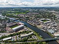 Nottingham stadium river trent aerial view.jpg 5,055 × 3,785; 15.58 MB
-
 Nottingham the city ground stadium forest.jpg 3,916 × 2,933; 10.83 MB
-
 Nottingham.jpg 470 × 470; 152 KB
-
 Ratcliffe Power Station from the Air - geograph.org.uk - 507561.jpg 640 × 480; 45 KB
-
 Worksop Manor- aerial 2017 (2) - geograph 5542991.jpg 640 × 427; 55 KB
-


_-_geograph_5542991.jpg)
