Category:Aerial photographs of Peoria, Illinois
Media in category "Aerial photographs of Peoria, Illinois"
The following 20 files are in this category, out of 20 total.
-

-

-
 Bradley U Campus Aerial.jpg 1,024 × 620; 258 KB
-
 Bradley University Aerial Photo.jpg 1,280 × 778; 359 KB
-
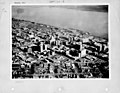
 Downtown Peoria from Air 1971.jpg 1,150 × 756; 567 KB
-
 IL Peoria June 1911.jpg 3,566 × 420; 561 KB
-
 Illinois - Peoria - NARA - 23939929.jpg 4,385 × 3,382; 3.48 MB
-
 Illinois - Peoria - NARA - 23939931.jpg 4,385 × 3,382; 3.24 MB
-
 Illinois - Peoria - NARA - 23939933.jpg 4,385 × 3,382; 2.64 MB
-
 Lutheran Hillside Village aerial view.jpg 3,342 × 1,212; 1.67 MB
-
 Northwest Peoria from Air 1974 Northwoods Mall I-74 & US 150.jpg 1,100 × 735; 553 KB
-
 Peoria - Glen Avenue from the Air 1974.jpg 1,200 × 804; 540 KB
-
 Peoria Aerial - Facing North (42241118264).jpg 2,400 × 1,600; 2.24 MB
-
 Peoria Aerial - Facing Northwest (42058196655).jpg 2,400 × 1,600; 2.19 MB
-
 Peoria Aerial - Facing West (42058196825).jpg 2,400 × 1,600; 2.28 MB
-
 Peoria and Illinois River from Air 1974.jpg 1,250 × 729; 553 KB
-
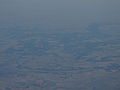
 Peoria from the Air over Tazewell County 1977.jpg 1,200 × 667; 307 KB
-
 Peoria, Illinois (7235200280).jpg 4,000 × 3,000; 1.95 MB
-
 Peoria, Illinois, mid-20th century (NBY 3079).jpg 3,600 × 2,911; 1.46 MB
-
 Taft Homes Peoria.JPG 434 × 403; 37 KB


.jpg)
.jpg)
.jpg)


.jpg)
.jpg)
