Category:Aerial photographs of Redwood City, California
Media in category "Aerial photographs of Redwood City, California"
The following 15 files are in this category, out of 15 total.
-
 2009 04 19 lax-sfo 381 (3494531025).jpg 2,484 × 1,636; 2.46 MB
-
 Aerial photograph of Redwood Creek and Bair Island.jpg 4,096 × 1,940; 2.55 MB
-
 Aerial photograph of Westpoint Harbor, San Francisco Bay, CA 2.jpg 4,096 × 1,940; 2.22 MB
-
 Aerial photograph of Westpoint Harbor, San Francisco Bay, CA.jpg 4,096 × 1,940; 2.5 MB
-
 Aerial view of Fair Oaks, September 2019.JPG 5,184 × 3,888; 5.21 MB
-
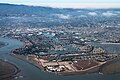
 Aerial view of Redwood City, September 2019.JPG 5,184 × 3,888; 5.62 MB
-
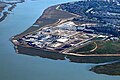 Aerial view of Silicon Valley Clean Water treatment plant, September 2023.JPG 4,645 × 3,098; 8.12 MB
-
 Artemia breeding ponds.jpg 3,504 × 2,336; 4.59 MB
-
 Atherwood Aerial.png 3,528 × 1,980; 10.76 MB
-
 Bair Island aerial view, February 2018.JPG 5,184 × 3,888; 4.14 MB
-
 Bair Island aerial.jpg 2,037 × 1,114; 480 KB
-
 Bair Island State Marine Park (49811217791).jpg 3,600 × 2,400; 3.59 MB
-
 Redwood City aerial view, February 2018.JPG 5,184 × 3,888; 4.69 MB
-
 Redwood City and Foster City aerial photo.jpg 4,608 × 3,456; 10.54 MB
-
 Redwood Shores California Aerial (49811517012).jpg 3,600 × 2,400; 3.89 MB
.jpg)


.jpg)


.jpg)