Category:Aerial photographs of Rhode Island
States of the United States: Alabama · Alaska · Arizona · Arkansas · California · Colorado · Connecticut · Delaware · Florida · Georgia · Hawaii · Idaho · Illinois · Indiana · Iowa · Kansas · Kentucky · Louisiana · Maine · Maryland · Massachusetts · Michigan · Minnesota · Mississippi · Missouri · Montana · Nebraska · Nevada · New Hampshire · New Jersey · New Mexico · New York · North Carolina · North Dakota · Ohio · Oklahoma · Oregon · Pennsylvania · Rhode Island · South Carolina · South Dakota · Tennessee · Texas · Utah · Vermont · Virginia · Washington · West Virginia · Wisconsin · Wyoming – District of Columbia: Washington, D.C.
insular area of the United States: American Samoa · Guam · Northern Mariana Islands · Puerto Rico · United States Virgin Islands – United States Minor Outlying Islands: Baker Island · Midway Atoll · Wake Island
insular area of the United States: American Samoa · Guam · Northern Mariana Islands · Puerto Rico · United States Virgin Islands – United States Minor Outlying Islands: Baker Island · Midway Atoll · Wake Island
Subcategories
This category has the following 4 subcategories, out of 4 total.
Media in category "Aerial photographs of Rhode Island"
The following 77 files are in this category, out of 77 total.
-
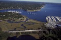
 80-G-K-1016 Gould Island, Narragansett Bay, Rhode Island.jpg 1,280 × 1,044; 206 KB
-
 80-G-K-1017 Naval Air Station (NAS) Quonset Point, Rhode Island.jpg 1,280 × 1,017; 226 KB
-
 80-G-K-1019 Naval Air Station (NAS) Quonset Point, Rhode Island.jpg 1,280 × 1,022; 276 KB
-
 80-G-K-1020 Naval Air Station (NAS) Quonset Point, Rhode Island.jpg 1,280 × 1,022; 246 KB
-
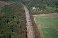
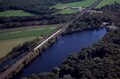
 A test run of the high-speed Amtrak Acela train through New England LCCN2011632939.tif 2,303 × 1,519; 20.04 MB
-
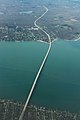
 Aerial view of Claiborne Pell Bridge, commonly known as the Newport Bridge.jpg 8,688 × 5,792; 28.87 MB
-
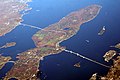
 Aerial view of Conanicut Island on Narragansett Bay.jpg 8,037 × 5,358; 29.33 MB
-

-
 Aerial view of Kingston interlocking tower.jpg 5,000 × 3,870; 3.7 MB
-
 Aerial view of Kingston Railroad Station 1.jpg 5,000 × 3,913; 3.8 MB
-
 Aerial view of Kingston Railroad Station 2.jpg 5,000 × 3,940; 3.97 MB
-
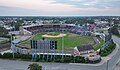 Aerial view of McCoy Stadium Pawtucket (Quintin Soloviev).jpg 5,240 × 3,066; 12.37 MB
-

-

-
 Aerial view of Ninigret National Wildlife Refuge (RI) (8158466019).jpg 5,616 × 3,744; 6.82 MB
-
 Aerial view of one of the newer mansions in Newport.jpg 8,688 × 5,792; 32 MB
-
 Aerial view of the junction of Interstate 95 and Rhode Island Route 37.jpg 1,024 × 768; 97 KB
-
 Aerial view of Trustom Pond breach, post-Hurricane Sandy (RI) (8158458806).jpg 5,616 × 3,744; 6.16 MB
-
 Aerial view of Trustom Pond National Wildlife Refuge (RI) (8158417032).jpg 5,616 × 3,744; 5.61 MB
-
 Aerial View PAS.jpg 960 × 539; 129 KB
-
 Amtrak Acela train doing a test run in New England before going into service LCCN2011632767.tif 2,293 × 1,514; 20.01 MB
-
 Barrier beach Overwash (RI) (8157775739).jpg 640 × 480; 77 KB
-
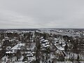 Barrington Rhode Island after a snow.jpg 4,000 × 3,000; 5.12 MB
-
 Bonnet Shores RI - Aerial (38643494125).jpg 2,400 × 1,600; 1.78 MB
-
 Breach at Trustom Pond (RI) (8158425737).jpg 5,616 × 3,744; 6.76 MB
-
 Channel6transmittersite.jpg 2,729 × 1,803; 3.24 MB
-

-

-

-

-

-

-

-
 ConanicutIsland.jpg 2,048 × 1,536; 1.12 MB
-
 Cranston, Rhode Island.jpg 3,820 × 2,745; 2.2 MB
-
 Debris on entrance road to Sachuest Point National Wildlife Refuge (RI) (8158435754).jpg 5,616 × 3,744; 6.57 MB
-
 Debris on Moonstone Beach (RI) (8158389221).jpg 5,616 × 3,744; 5.1 MB
-
 Debris on Moonstone Beach (RI) (8158419014).jpg 5,616 × 3,744; 5.54 MB
-
 East Providence Seekonk I-195 Aerial (25669072448).jpg 1,600 × 2,400; 2.21 MB
-
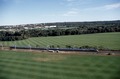
 FARMLANDS NEAR MIDDLETOWN - NARA - 547684.jpg 3,000 × 2,037; 967 KB
-
 Floods - Rhode Island - NARA - 68158646.jpg 6,851 × 5,398; 17 MB
-
 Floods - Rhode Island - NARA - 68158648.jpg 6,851 × 5,398; 18.87 MB
-
 Floods - Rhode Island - NARA - 68158650.jpg 6,851 × 5,398; 18.82 MB
-
 Floods - Rhode Island - NARA - 68158654.jpg 5,398 × 6,851; 5.7 MB
-
 Floods - Rhode Island - NARA - 68158656.jpg 6,851 × 5,398; 17.65 MB
-
 Floods - Rhode Island - NARA - 68158658.jpg 6,851 × 5,398; 17.58 MB
-
 Floods - Rhode Island - NARA - 68158660.jpg 6,983 × 5,398; 16.08 MB
-
 Floods - Rhode Island - NARA - 68158662.jpg 6,851 × 5,398; 17.24 MB
-
 Floods - Rhode Island - NARA - 68158664.jpg 6,851 × 5,398; 17.27 MB
-
 Floods - Rhode Island - NARA - 68158666.jpg 6,932 × 5,398; 16.44 MB
-
 Floods - Rhode Island - NARA - 68158668.jpg 6,968 × 5,398; 15.13 MB
-
 Floods - Rhode Island - NARA - 68158670.jpg 6,929 × 5,462; 15.18 MB
-
 HiRes BlockIsland Aerial 7-23-2015.jpg 3,840 × 2,160; 981 KB
-
 I-95+295 Split Over Warwick and Cranston Night - December 2016 (43272189000).jpg 2,400 × 1,600; 1.96 MB
-

-

-
 NEW HOUSING ON BARRIER BEACH DUNE - NARA - 547644.jpg 3,000 × 2,044; 839 KB
-
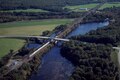
 Newport Bridge, Narragansett Bay-2.jpg 3,504 × 2,336; 6.8 MB
-
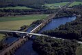
 Newport Bridge, Narragansett Bay.jpg 3,504 × 2,336; 4.54 MB
-

-
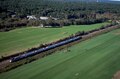
 Pawtucket-Central Falls station looking north, April 1977.jpg 5,000 × 3,849; 3.73 MB
-
 Pawtucket-Central Falls station looking northeast, April 1977.jpg 5,000 × 3,822; 3.41 MB
-
 Point Street Bridge - Rhode Island - NARA - 68158654 (cropped).jpg 2,752 × 2,174; 1.22 MB
-
 Pomham Rocks Lighthouse Aerial (38830793254).jpg 1,600 × 2,400; 1.87 MB
-
 Providence River, aerial photograph.jpg 2,736 × 3,648; 9.01 MB
-
 RI117 - WarwickAve Aerial (38830796914).jpg 2,400 × 1,600; 2.11 MB
-
 RI138 Jamestown Bridge Aerial (25669069318).jpg 1,600 × 2,400; 1.37 MB
-

-
-
-

-
-
-
-
-
-
 Warren-Barrington Aerial RI103-114 (25669070908).jpg 1,600 × 2,400; 1.98 MB

_Quonset_Point,_Rhode_Island.jpg)
_Quonset_Point,_Rhode_Island.jpg)
_Quonset_Point,_Rhode_Island.jpg)


.jpg)


_(8158466019).jpg)


_(8158458806).jpg)
_(8158417032).jpg)

_(8157775739).jpg)

.jpg)
_(8158425737).jpg)


_(8158435754).jpg)
_(8158389221).jpg)
_(8158419014).jpg)
.jpg)


.jpg)


.jpg)
.jpg)

.jpg)
.jpg)
.jpg)