Category:Aerial photographs of Sai Kung District
Subcategories
This category has only the following subcategory.
Media in category "Aerial photographs of Sai Kung District"
The following 19 files are in this category, out of 19 total.
-
 201806 High Island Reservoir.jpg 4,032 × 3,024; 1.4 MB
-
 Clear Water Bay Peninsula 1.jpg 1,600 × 1,200; 1.65 MB
-
 High Island Leung Shuen Wan and Sha Kiu Tau 201704.jpg 3,992 × 2,992; 6.9 MB
-
 Hong Kong Bay (526443609).jpg 800 × 600; 59 KB
-
 Kau Sai Chau.JPG 1,600 × 1,200; 229 KB
-
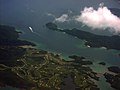
 Outlying Hong Kong (14113853814).jpg 1,600 × 1,200; 553 KB
-
 Po Toi O Clear Water Bay Golf Course 2014.jpg 2,048 × 1,360; 2.62 MB
-
 Sai Kung Town Aerial View 201706.jpg 1,600 × 1,200; 1.42 MB
-
 Sai Kung town from air.jpg 2,848 × 1,540; 772 KB
-
 Sharp Island and Pak Sha Chau (cropped).jpg 1,958 × 1,306; 609 KB
-
 Sharp Island and Pak Sha Chau.jpg 5,616 × 3,744; 4.05 MB
-
 Shaw Studio Aerial view 202002.jpg 1,600 × 1,067; 1.56 MB
-
 Tai Chik Sha 201407.jpg 1,052 × 1,253; 1.14 MB
-
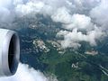
 Tai She Wan Sai Kung 2017.jpg 3,992 × 2,992; 7.25 MB
-
 The Clearwater Bay Golf & Country Club 201407-1.jpg 2,048 × 1,118; 2.06 MB
-
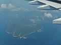
 Tung Lung Chau Aerial.jpg 5,472 × 3,648; 4.19 MB
-
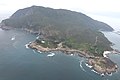
 Tung Lung Chau NE shoreline.jpg 3,648 × 5,472; 6.35 MB
-
 大蛇灣.jpg 3,992 × 2,992; 6.81 MB
-
 大蛇灣渡假村.jpg 3,992 × 2,992; 7.27 MB


.jpg)

.jpg)


.jpg)


