Category:Aerial photographs of Tasmania
States of Australia: New South Wales · Queensland · South Australia · Tasmania · Victoria · Western Australia
Internal territories of Australia: Australian Capital Territory · Northern Territory
External territories of Australia:
Internal territories of Australia: Australian Capital Territory · Northern Territory
External territories of Australia:
Subcategories
This category has only the following subcategory.
B
Media in category "Aerial photographs of Tasmania"
The following 95 files are in this category, out of 95 total.
-
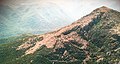
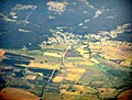
 Aerial shot of Pilgrim Hill and Lucaston.jpg 1,801 × 1,200; 236 KB
-
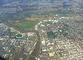 Aerial view of Launceston.jpg 2,560 × 1,873; 2.84 MB
-
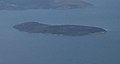
 Anderson Island aerial.jpg 1,047 × 847; 612 KB
-
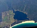 Ansons Bay Aerial.jpg 2,288 × 1,712; 656 KB
-
 Avoca-aerial.jpg 1,957 × 1,417; 2.16 MB
-
 Babel Island Aerial.jpg 1,907 × 1,297; 457 KB
-
 Boobyalla aerial.jpg 2,288 × 1,712; 3.03 MB
-
 BowlersLagoon-RushyLagoon-PC220273.JPG 2,288 × 1,478; 577 KB
-
 Buckland aerial1.jpg 2,002 × 1,310; 2.12 MB
-
 Buckland aerial2.jpg 1,720 × 1,244; 1.73 MB
-
 Cape Barren Island Settlement 1.jpg 1,797 × 969; 1.27 MB
-
 Cape Barren Island Settlement 2.jpg 1,889 × 1,360; 2.1 MB
-

-
 Chalky Island aerial.jpg 633 × 350; 161 KB
-
 Clarke Island aerial.jpg 2,288 × 1,712; 2.55 MB
-
 Copping fire 4 Jan 2013.jpg 2,434 × 1,723; 2.54 MB
-
 CSIRO ScienceImage 3112 Clouds over north coast of Tasmania at dawn.jpg 2,657 × 1,771; 2.32 MB
-
 CSIRO ScienceImage 3163 Clouds over north coast of Tasmania at dawn.jpg 2,657 × 1,771; 2.37 MB
-
 CSIRO ScienceImage 3609 Lowlying clouds in valleys near Cambridge Tasmania.jpg 2,657 × 1,771; 2.22 MB
-
 Darwin Dam, Tasmania from air.JPG 3,095 × 1,496; 1.33 MB
-
 Devonport, TAS.JPG 3,888 × 2,592; 4.44 MB
-
 Eldon Peak from air, from north.JPG 2,356 × 1,449; 1.23 MB
-
 Eldon Peak from south east.JPG 3,923 × 2,082; 2.81 MB
-
 Eldon Peak, from west.JPG 3,215 × 1,522; 1.43 MB
-
 Fingal Aerial.jpg 2,117 × 1,383; 624 KB
-
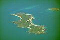
 Forsyth Island Passage Island.jpg 2,288 × 1,712; 2.16 MB
-
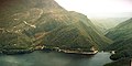
 Franklin meets Gordon River Tasmania 1.jpg 2,000 × 1,333; 2.13 MB
-
 Geilston Bay 1946 0015 949 detail.jpg 1,701 × 1,323; 299 KB
-
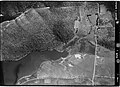 Geilston Bay 1946 01.jpg 1,058 × 764; 206 KB
-
 Geilston Bay 1969.jpg 623 × 478; 76 KB
-
 Geilston Bay 2002.jpg 798 × 566; 136 KB
-
 Great Dog Isand aerial.jpg 527 × 465; 86 KB
-
 Hobart from the air.jpg 2,500 × 1,394; 2.5 MB
-
 Hobart-Tasmania-Australia16.JPG 3,789 × 2,526; 7.21 MB
-
 Hobbs Lagoon Aerial.jpg 2,288 × 1,712; 731 KB
-
 Huxley from air 75.JPG 2,421 × 1,897; 1.02 MB
-
 Inner-Sister-Island.jpg 1,418 × 999; 1.14 MB
-
 Kent Group, Bass Strait from the air.jpg 1,330 × 877; 308 KB
-
 King river at macquarie harbour.jpg 892 × 586; 174 KB
-
 Lake Beatrice from the air 2000 from the east.jpg 6,992 × 4,512; 2.45 MB
-
 Lake Leake Aerial.jpg 2,285 × 1,509; 699 KB
-
 Lake Yaleena aerial.jpg 2,288 × 1,712; 886 KB
-
 Little Dog Isand.jpg 339 × 259; 29 KB
-
 Little Green Island.jpg 319 × 281; 33 KB
-
 Long Island Tasmania aerial.jpg 1,569 × 905; 1.05 MB
-
 Mathinna-PC220299.JPG 2,288 × 1,712; 532 KB
-
 Midway Point Aerial.jpg 1,455 × 597; 161 KB
-
 Mount Huxley from air.jpg 4,652 × 3,031; 3.9 MB
-
 Mount Huxley from the air.jpg 1,667 × 1,320; 1.07 MB
-
 Mount Jukes and burbury.JPG 3,382 × 1,702; 1.82 MB
-
 Mt McCall track from the air in the 1970s.jpg 4,176 × 2,720; 842 KB
-
 Neds Reef aerial.jpg 363 × 235; 59 KB
-
 North Coast of Tasmania.jpg 1,600 × 1,165; 723 KB
-
 North of Eldon air looking south.jpg 1,764 × 1,164; 628 KB
-
 North west Flinders Island aerial.jpg 2,288 × 1,712; 2.9 MB
-
 Northern end of Mount Darwin, Tasmania.jpg 4,553 × 3,003; 3.7 MB
-
 Oatlands from the air.JPG 2,176 × 1,652; 360 KB
-
 OceanBeachCarpark from the air.jpg 2,592 × 3,872; 3.3 MB
-
 OceanBeachwest from air.jpg 1,765 × 1,182; 383 KB
-
 Outer-Sister-Island.jpg 1,913 × 1,013; 1.67 MB
-
 Penna Aerial.jpg 951 × 503; 79 KB
-
 Pioneer aerial.jpg 2,017 × 1,625; 2.78 MB
-
 Point Puer Isle Dead.jpg 1,280 × 960; 323 KB
-
 Port Arthur aerial1.jpg 1,280 × 960; 311 KB
-
 PortArthur aerial2.jpg 1,280 × 960; 312 KB
-
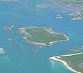
 Preservation Island aerial.jpg 481 × 305; 112 KB
-
 Prime-Seal island.jpg 1,947 × 691; 1,006 KB
-
 Pyengana aerial.jpg 2,288 × 1,712; 3 MB
-
 Queenstown aerodrome from the air.jpg 3,872 × 2,592; 4.16 MB
-
 Ringarooma aerial.jpg 2,169 × 1,456; 2.53 MB
-
 Royal George Aerial.jpg 1,841 × 1,125; 427 KB
-
 Sloping Island and Hog Island.jpg 1,088 × 329; 211 KB
-
 Sloping Island and surrounding area.jpg 3,543 × 780; 584 KB
-
 Sloping Island.jpg 616 × 329; 189 KB
-
 Smoke from fires over Australia captured by Envisat ESA206221.jpg 1,181 × 1,181; 679 KB
-
 Smoke from fires over Australia captured by Envisat ESA206221.tiff 2,268 × 2,268; 11.57 MB
-
 Sorell Aerial.jpg 2,151 × 775; 358 KB
-
 St Helens aerial.jpg 2,069 × 1,469; 2.33 MB
-
 St Marys aerial.jpg 1,931 × 1,468; 2.85 MB
-
 St-Helens-out.jpg 2,283 × 951; 1.75 MB
-
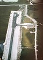
 Strahan Airport landing strip from north.JPG 3,301 × 1,256; 817 KB
-
 Strahan Airport landing strip.JPG 2,340 × 3,255; 1.71 MB
-
 Swan Island Aerial.jpg 1,839 × 1,217; 1.19 MB
-
 SwanIsland-CapePortland-PC220269.JPG 2,288 × 1,436; 799 KB
-
 SwanIsland-PC220272.JPG 1,890 × 896; 264 KB
-
 TasmanIsland2.jpg 1,280 × 960; 319 KB
-
 TasmanIsland3.jpg 1,280 × 960; 315 KB
-
 Tin Kettle Island.jpg 437 × 339; 98 KB
-
 Tomahawk aerial.jpg 2,288 × 1,712; 2.87 MB
-
 Tooms Lake Village Aerial.jpg 2,288 × 1,712; 552 KB
-
 Vansittart Island Tasmania.jpg 887 × 589; 205 KB
-
 Waterhouse Island.jpg 2,244 × 1,124; 2.05 MB
-
 West Coast Range - from above Tyndalls looking south.jpg 3,072 × 2,304; 853 KB
-
 Whitemark aerial.jpg 2,288 × 1,712; 2.57 MB
-
 York Park, Launceston aerial view.jpg 399 × 266; 100 KB


