Category:Aerial photographs of airports in Yukon
Media in category "Aerial photographs of airports in Yukon"
The following 12 files are in this category, out of 12 total.
-
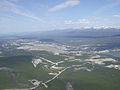 Aerial view of Whitehorse and the Yukon River -b.jpg 2,048 × 1,536; 1.03 MB
-
 Aerial view of Whitehorse, Yukon, July 1990.jpg 541 × 326; 73 KB
-
 Dawson City Airport.JPG 1,024 × 768; 385 KB
-
 Landing Fields - Canada - NARA - 68159244 (cropped).jpg 5,287 × 4,180; 12.81 MB
-
 Landing Fields - Canada - NARA - 68159244.jpg 6,770 × 5,274; 18.25 MB
-
 Landing Fields - Canada - NARA - 68159246.jpg 6,770 × 5,274; 16.84 MB
-
 Landing Fields - Canada - NARA - 68159275.jpg 6,748 × 6,032; 18.18 MB
-
 Landing Fields - Canada - NARA - 68159277.jpg 5,274 × 6,770; 5.78 MB
-
 Landing Fields - Canada - NARA - 68159283.jpg 6,770 × 6,250; 21.19 MB
-
 Watson Lake 4.jpg 1,510 × 1,174; 1.88 MB
-
 Watson Lake Airport, Watson Lake, Yukon Territory.jpg 2,705 × 1,870; 1.91 MB
-
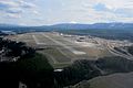 Whitehorse Airport, Yukon Territory.jpg 3,468 × 2,300; 2.74 MB


.jpg)


