Category:Aerial photographs of highways
Subcategories
This category has the following 4 subcategories, out of 4 total.
C
G
Media in category "Aerial photographs of highways"
The following 30 files are in this category, out of 30 total.
-
-

-
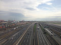
 405 freeway from the air.jpg 3,024 × 4,032; 3.07 MB
-
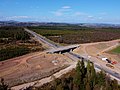 A9 dualling Gelly Overbridge.jpg 3,999 × 2,998; 8.34 MB
-
 Aerial view of the Platte River and I-80 at Gothenburg, Nebraska.jpg 3,024 × 4,032; 2.97 MB
-
 Bay Bridge Toll Plaza (21315559111).jpg 3,696 × 2,474; 4.32 MB
-
 Bay Bridge Toll Plaza early 1970s (21292826331).jpg 3,685 × 2,443; 3.84 MB
-
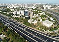 Biu Aerial photograph of Bar-Ilan University (21004322376).jpg 4,864 × 3,488; 6.1 MB
-
 CA State Route 237 aerial (cropped).jpg 1,512 × 851; 727 KB
-
 CA-237 looking east near exit 5.jpg 4,000 × 3,000; 4.4 MB
-
 Dr. Sedyatmo Road.jpg 4,320 × 3,240; 1.91 MB
-
 Fotografia (10-11-2023) - 0.jpg 3,992 × 2,992; 3.99 MB
-
 Fotografia (10-11-2023) - 1.jpg 3,992 × 2,992; 4.26 MB
-
 Hungary Göd with Samsung IMG 0199 E77.JPG 5,184 × 3,456; 7.94 MB
-
 Hungary Göd with Samsung IMG 0200 E77.JPG 4,094 × 2,601; 5.1 MB
-
 Hungary Göd with Samsung IMG 0201 E77.JPG 3,655 × 2,825; 4.67 MB
-
 Hämeenlinnanväylä.jpg 855 × 1,860; 809 KB
-
 I 90 bridge La Crosse.jpg 4,000 × 5,212; 13.45 MB
-
 I-35W & Lake Street station from above.jpg 4,000 × 2,250; 2.79 MB
-
 I-405 at I-105 aerial.jpg 1,456 × 2,342; 626 KB
-
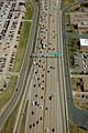 I-494 East - Exits 1AB for MSP Terminals (30620048348).jpg 1,600 × 2,400; 2.28 MB
-
 I-94 Ess Aerial Minneapolis (44440252602).jpg 1,600 × 2,400; 2.43 MB
-
 M5 - freeway.jpg 1,039 × 734; 279 KB
-
 Melb aerial 2020 - Keilor Park looking E.jpg 2,880 × 2,160; 1.91 MB
-
 Szeleste látképe madártávlatból.jpg 600 × 400; 128 KB
-
 Szent László híd a magasból.jpg 600 × 400; 96 KB
-
 Tempat istirahat.jpg 3,264 × 2,448; 1.02 MB
-
 Valtatie 3 aerial.jpg 3,456 × 5,184; 7.43 MB
-
 Vantaa Valtatie 3 aerial.jpg 3,456 × 5,184; 8.6 MB
-
 Őszeszéki-tó látképe madártávlatból.jpg 600 × 400; 150 KB


.jpg)
.jpg)
.jpg)
.jpg)


_-_0.jpg)
_-_1.jpg)


.jpg)
.jpg)


