Category:Aerial photographs of interchanges in Ontario
Media in category "Aerial photographs of interchanges in Ontario"
The following 19 files are in this category, out of 19 total.
-
 427 and Airport.JPG 3,648 × 2,736; 4.32 MB
-
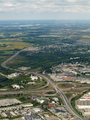
 Conestoga and Freeport interchange Aerial (6235760469).png 3,264 × 2,448; 10.76 MB
-
 Courtney Park and 410.JPG 2,048 × 1,536; 892 KB
-
 Freeman Interchange.JPG 3,648 × 2,736; 9.68 MB
-
 Hanlon Parkway interchange.png 3,264 × 1,014; 4.34 MB
-
 Hespeler Bypass.png 2,448 × 3,264; 10.09 MB
-
 Highway 401 at Hurontario Street 9192877703.jpg 1,920 × 1,440; 2.34 MB
-
 Highway 401 at Yonge St. (6403115507).jpg 2,500 × 1,625; 3.76 MB
-
 Highway 401 between 403 and 410.jpg 2,560 × 1,920; 3.68 MB
-
 Highway 410 Start.jpg 2,560 × 1,920; 3.58 MB
-
 Highway 410-401-403.JPG 2,272 × 1,704; 1.43 MB
-
 Holt Road Dogbone.png 1,622 × 1,080; 2.65 MB
-
 ON401 Aerial at Mississauga Road (30659618088).jpg 2,400 × 1,600; 2.35 MB
-
 ON401 Exit 357 - Weston Road (28455423675).jpg 1,200 × 800; 651 KB
-
 ON401DixonRoadTorontoAerial (27839419623).jpg 1,200 × 800; 648 KB
-
 ON401ewON404nsInterchangesToronto-Aerial-May2015 (27839429063).jpg 1,200 × 800; 759 KB
-
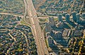
 Ontario Highway 400 and 401 interchange.JPG 3,648 × 2,736; 3.45 MB
-
 Ottawa River Parkway interchange.jpg 2,288 × 1,712; 1.08 MB
-
 TorontoFromSky (2411410465).jpg 1,280 × 960; 189 KB

.png)


.jpg)


.jpg)
.jpg)
.jpg)
.jpg)


.jpg)