Category:Aerial photographs of lakes of Hungary
Subcategories
This category has the following 11 subcategories, out of 11 total.
A
B
S
T
Media in category "Aerial photographs of lakes of Hungary"
The following 52 files are in this category, out of 52 total.
-
 - Rézparti-víztározó, 2016 Magyarnándor 5.jpg 600 × 400; 108 KB
-
 A császári horgásztó légi felvételen.jpg 600 × 400; 108 KB
-
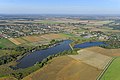
 A Hortobágy légi fotón.jpg 600 × 400; 67 KB
-
 A kabai tavak légi felvételen.jpg 600 × 400; 147 KB
-
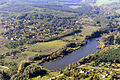
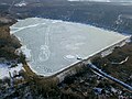
 A lázbérci víztározó légi felvétele.jpg 900 × 600; 148 KB
-
 A tatai Derítő-tó.jpg 600 × 400; 81 KB
-
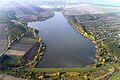
 A Váli-tó és a Velencei-tó - panoramio.jpg 4,608 × 3,456; 5.04 MB
-
 Alsómocsolád látképe madártávlatból.jpg 600 × 400; 123 KB
-
 Apc 6.jpg 600 × 400; 142 KB
-
 Biatorbagy and Biai-to lake IMG 7964.jpg 2,592 × 3,772; 2.18 MB
-
 Biatorbagy and Biai-to lake IMG 7965.jpg 2,592 × 3,755; 2.42 MB
-
 Boti tó, Etyek légifotó4.jpg 480 × 340; 25 KB
-
 Bőszénfa 4.jpg 600 × 400; 98 KB
-

-
 Csesztreg1.jpg 480 × 338; 40 KB
-
 Desedacivertanlegi.jpg 600 × 400; 81 KB
-
 Domonyvölgy légi fotó 1.jpg 600 × 400; 105 KB
-
 Dunakeszi tőzegtavak.jpg 1,280 × 720; 248 KB
-
 Dunavarsány Rukkel-tó.jpg 480 × 339; 26 KB
-
 Gyál3.jpg 480 × 339; 31 KB
-
 Gyál4.jpg 480 × 341; 28 KB
-
 Göd5.jpg 480 × 340; 34 KB
-
 Kecel, Kenderföldi tó a magasból.jpg 600 × 400; 151 KB
-
 Király-tó.jpg 1,000 × 667; 764 KB
-
 Kiskunság légi fotó galéria 8.jpg 600 × 400; 94 KB
-
 Kiskunsági Nemzeti Park a levegőből.jpg 600 × 400; 123 KB
-
 Kiskunsági Nemzeti Park a magasból.jpg 600 × 400; 96 KB
-
 Kiskunsági Nemzeti Park madártávlatból.jpg 600 × 400; 102 KB
-
 Kiskunsági Nemzeti Park, Kolon-tó légi felvételen.jpg 600 × 400; 133 KB
-
 Kisszékely, Gyulaj Zrt. vadászház és tó, légifotó.jpg 480 × 340; 37 KB
-
 Kolon-tó - Légi fotó (Kiskunsági Nemzeti Park).jpg 600 × 400; 128 KB
-
 Lajoskomárom látképe távlati légi felvételen.jpg 600 × 400; 129 KB
-
 Lajosmizse.jpg 480 × 338; 33 KB
-
 Malomtó - légi fotó (Ács).jpg 600 × 400; 133 KB
-
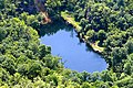
 Megyer-hegyi tengerszem.jpg 480 × 336; 45 KB
-
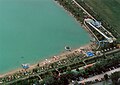
 Nagykanizsa boating lake 2018.jpg 4,000 × 2,250; 3.19 MB
-
 Nagykanizsa3.jpg 344 × 480; 22 KB
-
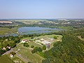
 Naplás-tó és kiserdő légi fotón.jpg 900 × 675; 644 KB
-
 Notincsito.jpg 700 × 387; 146 KB
-
 Orfű, tórendszer a levegőből.jpg 600 × 400; 176 KB
-
 Palotás légi fotó2.jpg 600 × 400; 76 KB
-
 Somogytarnóca, halastavak a levegőből.jpg 400 × 600; 147 KB
-
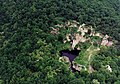
 Somogyvár, bencés kolostor légi fotón.jpg 900 × 675; 320 KB
-
 Szárföld, a bányatavak látképe madártávlatból.jpg 600 × 400; 99 KB
-
 Szücsi légi fotó3.jpg 600 × 400; 109 KB
-
 Sárvíz Lake, aerial, Gersekarát.jpg 480 × 336; 28 KB
-
 Tinye, Garancsi-tó. Az Üvegtigris forgatási helyszíne légifotón 1.jpg 600 × 400; 136 KB
-
 Vaskeresztes, horgásztó légi felvételen.jpg 600 × 400; 153 KB
-
 Zalaszentmihály a magasból.jpg 600 × 400; 44 KB
-
 Ásványráró.jpg 480 × 338; 37 KB
-
 Őszeszéki-tó látképe madártávlatból.jpg 600 × 400; 150 KB
-
 Őszeszéki-tó légi felvételen.jpg 600 × 400; 143 KB


.jpg)


.jpg)


