Category:Aerial photographs of rivers of India
Media in category "Aerial photographs of rivers of India"
The following 19 files are in this category, out of 19 total.
-
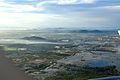 Aerial view of Chennai during floods - 2.jpg 2,000 × 1,325; 1.73 MB
-
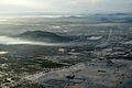 Aerial view of Chennai during floods.jpg 1,500 × 994; 1,020 KB
-
 Amreli flood1.jpg 712 × 534; 11 KB
-
 Amreli flood11.jpg 480 × 294; 19 KB
-
 Chandigarh river.jpg 3,456 × 4,608; 5.99 MB
-
 Flood Affected Areas of Amreli District Gujarat India on 24 June 2015 1.jpg 8,280 × 4,257; 1.62 MB
-
 Flood Affected Areas of Amreli District Gujarat India on 24 June 2015 2.jpg 3,141 × 1,914; 1.22 MB
-
 Flood Affected Areas of Amreli District Gujarat India on 24 June 2015 3.jpg 4,230 × 2,532; 1.5 MB
-
 Flood Affected Areas of Amreli District Gujarat India on 24 June 2015 4.jpg 10,893 × 7,233; 2.15 MB
-
 Flood Affected Areas of Amreli District Gujarat India on 24 June 2015 5.jpg 5,079 × 3,372; 1.24 MB
-
 GandhiSetu1.jpg 3,072 × 2,304; 189 KB
-
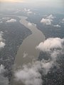
 Ganges - August2016.jpg 4,608 × 3,456; 6.52 MB
-
 HooghlyRiverOverBally gobeirne.jpg 1,944 × 2,592; 1.4 MB
-
 Land From The Sky.jpg 2,304 × 4,096; 2.58 MB
-
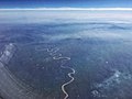 River Dudhi.jpg 3,946 × 2,960; 2.73 MB
-
 Vaigai Dam - August 2016.jpg 4,608 × 3,456; 7.98 MB
-
 Yamuna from air.jpg 2,592 × 1,936; 4.34 MB
-
 Yamuna from air1.jpg 2,592 × 1,936; 4.45 MB
-
 YamunaRiver - August2016 (2).jpg 4,608 × 3,456; 6.29 MB


.jpg)