Category:Aerial photographs of the London Borough of Hammersmith and Fulham
Media in category "Aerial photographs of the London Borough of Hammersmith and Fulham"
The following 44 files are in this category, out of 44 total.
-
 Barnes and Hammersmith from the air - geograph.org.uk - 2246845.jpg 640 × 353; 144 KB
-
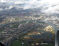 Barnes from the air - geograph.org.uk - 6087184.jpg 1,024 × 806; 648 KB
-
 Bird Eye Pictures of Chelsea's Stamford Bridge stadium 1909.jpg 970 × 654; 140 KB
-
 Brompton Cemetery from the air - geograph.org.uk - 4262017.jpg 480 × 640; 173 KB
-
 Chelsea from the air - geograph.org.uk - 3893238.jpg 640 × 480; 196 KB
-
 Chelsea Harbour from the air - geograph.org.uk - 2246834.jpg 640 × 494; 207 KB
-
 Chiswick and the Thames from the air - geograph.org.uk - 2357237.jpg 640 × 480; 233 KB
-
 Chiswick and the Thames from the air - geograph.org.uk - 2357243.jpg 640 × 480; 238 KB
-

-
 Craven Cottage from the air (geograph 4604541 by Thomas Nugent).jpg 480 × 640; 135 KB
-
 Craven Cottage LH4736.jpg 3,488 × 2,616; 1.31 MB
-
 Fulham and the Thames from the air - geograph.org.uk - 2246841.jpg 568 × 640; 215 KB
-
 Fulham from the air - geograph.org.uk - 3893254.jpg 640 × 480; 196 KB
-
 Fulham from the air - geograph.org.uk - 4604526.jpg 640 × 480; 219 KB
-
 Hammersmith and City Line - geograph.org.uk - 24573.jpg 480 × 640; 110 KB
-
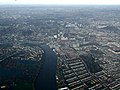
 Hammersmith and Fulham from the air - geograph.org.uk - 5074197.jpg 640 × 480; 222 KB
-
 Hammersmith and Fulham from the air - geograph.org.uk - 6087181.jpg 1,024 × 768; 725 KB
-
 Hammersmith and Fulham from the air - geograph.org.uk - 6087182.jpg 1,024 × 768; 796 KB
-
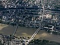
 Hammersmith Bridge - geograph.org.uk - 6021678.jpg 1,024 × 742; 189 KB
-
 Hammersmith Bridge from the air - geograph.org.uk - 5074223.jpg 640 × 480; 209 KB
-
 Hammersmith Cemetery from the air - geograph.org.uk - 5074182.jpg 640 × 480; 223 KB
-
 Hammersmith from the air - geograph.org.uk - 4418621.jpg 640 × 480; 191 KB
-
 Hammersmith from the air - geograph.org.uk - 5074218.jpg 640 × 480; 214 KB
-
 Hammersmith from the air - geograph.org.uk - 6080418.jpg 1,024 × 768; 792 KB
-
 London from the air, 2001 - geograph.org.uk - 5571188.jpg 897 × 587; 135 KB
-
 London Wetland Centre from the air - geograph.org.uk - 3893262.jpg 640 × 480; 183 KB
-
 London Wetland Centre from the air - geograph.org.uk - 4355294.jpg 640 × 480; 140 KB
-

-
 Putney Bridge and Pier from the air - geograph.org.uk - 3011548.jpg 3,264 × 2,448; 2.88 MB
-
 Putney from the air - geograph.org.uk - 4544447.jpg 640 × 482; 182 KB
-
 ShpBushGreen1.jpg 1,072 × 1,424; 516 KB
-
 Stamford Bridge 1930s.JPG 1,081 × 709; 131 KB
-
 Stamford Bridge LH4736.jpg 2,616 × 3,488; 2.4 MB
-
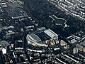 Stamford Bridge stadium from the air - geograph.org.uk - 4262036.jpg 640 × 480; 176 KB
-
 Stamford Bridge stadium from the air - geograph.org.uk - 4351685.jpg 640 × 480; 123 KB
-
 Stamford Bridge stadium from the air - geograph.org.uk - 4418606.jpg 640 × 480; 152 KB
-
 Stamford Bridge, 30 June 2011.jpg 3,072 × 2,304; 850 KB
-
 Stanford Bridge - panoramio.jpg 3,872 × 2,592; 3.34 MB
-
 The Thames at Fulham from the air - geograph.org.uk - 4262066.jpg 640 × 480; 145 KB
-
 Wandsworth from the air - geograph.org.uk - 4544424.jpg 640 × 480; 187 KB
-
 Wandsworth from the air - geograph.org.uk - 4544431.jpg 640 × 480; 196 KB
-
 West Kensington from the air - geograph.org.uk - 2646410.jpg 640 × 431; 193 KB
-
 West Kensington from the air - geograph.org.uk - 4598731.jpg 624 × 640; 337 KB
-


.jpg)


