Category:Aerial views of the Alaskan Way Viaduct

Media in category "Aerial views of the Alaskan Way Viaduct"
The following 31 files are in this category, out of 31 total.
-
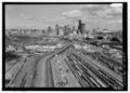
 Aerial of Alaskan Way Viaduct south of Downtown Seattle, 1960 (52474347222) (cropped).jpg 3,402 × 2,681; 4.12 MB
-
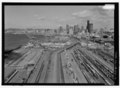
 Aerial of Alaskan Way Viaduct south of Downtown Seattle, 1960 (52474347222).jpg 4,000 × 3,151; 4.87 MB
-
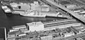 Aerial of Hanford Street Dock and Spokane Street Dock Seattle, 1960.jpg 1,413 × 672; 446 KB
-
 Aerial of Seattle's Central Waterfront, 1974 (52114141197).jpg 4,677 × 4,513; 16.01 MB
-
 Aerial photograph of Downtown Seattle from Elliott Bay, 2001.jpg 1,200 × 800; 300 KB
-

-

-
 Aerial view of Waterfront Park, Seattle.jpg 656 × 363; 83 KB
-

-
-

-
-
 Ferry in Downtown Seattle - Flickr - brewbooks.jpg 3,264 × 2,448; 3.78 MB
-

-

-

-

-
-
-

-
 Pike Market from the RIC - panoramio.jpg 2,048 × 1,152; 1.05 MB
-

-

-
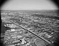
 Seattle - Aerial of downtown and Alaskan Way Viaduct, probably 1970s.jpg 1,200 × 808; 378 KB
-

-
-
-

-

-

-

_(cropped).jpg)
.jpg)

.jpg)


.jpg)
