Category:Afon Llugwy
river in Wales  | |||||
| Upload media | |||||
| Instance of | |||||
|---|---|---|---|---|---|
| Location | Conwy County Borough, Wales | ||||
| Elevation above sea level |
| ||||
| Mouth of the watercourse | |||||
 | |||||
Subcategories
This category has the following 4 subcategories, out of 4 total.
Media in category "Afon Llugwy"
The following 101 files are in this category, out of 101 total.
-
 Afon Llugwy - Flickr - petersrockypics.jpg 4,032 × 2,840; 9.28 MB
-
 Afon Llugwy - geograph.org.uk - 1540221.jpg 640 × 426; 123 KB
-

-
 Afon Llugwy at Capel Curig - geograph.org.uk - 1335203.jpg 600 × 450; 156 KB
-
 Afon Llugwy at Capel Curig - geograph.org.uk - 1340900.jpg 426 × 640; 124 KB
-
 Afon Llugwy from Pont Cyfyng - geograph.org.uk - 1386254.jpg 480 × 640; 185 KB
-
 Afon Llugwy from the Miners Bridge - geograph.org.uk - 181405.jpg 640 × 480; 146 KB
-

-
 Afon Llugwy in flood - geograph.org.uk - 1589233.jpg 462 × 640; 128 KB
-
 Afon Llugwy in flood - geograph.org.uk - 1589797.jpg 640 × 480; 264 KB
-
 Afon Llugwy through the trees - geograph.org.uk - 212052.jpg 640 × 480; 150 KB
-
 An incised meander on Afon Llugwy - geograph.org.uk - 424479.jpg 640 × 480; 117 KB
-
-
 Bettws y Coed.jpeg 900 × 597; 388 KB
-
 Betws-y-coed - panoramio.jpg 2,448 × 1,399; 339 KB
-
 Betws-y-coed falls - panoramio.jpg 3,011 × 1,712; 397 KB
-
 Bridge over the Llugwy - Holyhead Road near Capel Curig (1129655).jpg 1,000 × 734; 224 KB
-
 Bridge over the Llugwy - Holyhead Road near Capel Curig.jpeg 900 × 657; 397 KB
-
 Bridge over the River Llugwy - geograph.org.uk - 785016.jpg 640 × 480; 126 KB
-
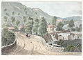
 Capel Curig (1129235).jpg 1,000 × 726; 128 KB
-
 Capel Curig (1131419).jpg 1,000 × 728; 122 KB
-
 Capel-Carig Capel Curig.jpeg 900 × 710; 279 KB
-
 Cataract on the Llugwy (1129789).jpg 1,000 × 705; 104 KB
-
 Cataract on the Llugwy.jpeg 640 × 485; 282 KB
-
 Dam on the upper course of Afon Llugwy - geograph.org.uk - 423764.jpg 640 × 480; 114 KB
-
 David Cox (II) - Junction of the Llugwy and Conway.jpg 1,024 × 736; 392 KB
-
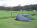 Dol-gam Campsite - geograph.org.uk - 157084.jpg 640 × 485; 58 KB
-
 Down by the River (7561832220).jpg 4,264 × 3,044; 13.88 MB
-

-
 Falls of the Llygwy - Bettws y Coed.jpeg 900 × 656; 284 KB
-
 Footbridge at Helyg - geograph.org.uk - 204175.jpg 640 × 427; 123 KB
-
 Hans Gude--Ved Lugwy River I Wales--1863.jpg 1,798 × 2,326; 1.75 MB
-
 Llugwy from Miner's Bridge (NBY 440328).jpg 2,340 × 3,600; 2.19 MB
-
 North of Capel Curig - geograph.org.uk - 84498.jpg 600 × 450; 274 KB
-
 North Wales Snowdon horseshoe.jpg 1,280 × 841; 696 KB
-
 On the Llugwy, North Wales (NBY 442740).jpg 3,600 × 2,358; 2.17 MB
-
 On The Llugwy, North Wales. (NBY 442950).jpg 3,600 × 2,352; 2.15 MB
-
 On the Llugy, north Wales.jpeg 900 × 621; 321 KB
-
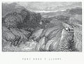 Pont Dros Y Llugwy.jpeg 900 × 693; 420 KB
-
 Pont Y Pair (1133107).jpg 1,000 × 732; 274 KB
-
 Pont Y Pair (1133694).jpg 1,000 × 733; 269 KB
-
 Pont y Pair near Hanrwst, north Wales.jpeg 800 × 684; 216 KB
-

-
 Pont Y Pair, Bettws Y Coed.jpeg 900 × 673; 304 KB
-
 Pont y Pair, Carnarvonshire.jpeg 900 × 723; 328 KB
-
 Pont y Pair, north Wales.jpeg 1,057 × 838; 804 KB
-
 Pont-y-Pair II Bettws-y-Coed Wales.jpg 773 × 993; 129 KB
-
 Rhaiadr-Wenol.jpeg 900 × 741; 410 KB
-
 Rhaiadyr-y-wenol or the Swallow Fall, Caernarvonshire (1129155).jpg 1,000 × 983; 263 KB
-
 Rhaiadyr-y-wenol or the Swallow Fall, Caernarvonshire.jpeg 900 × 818; 526 KB
-
 Rhaidr Y Wenol - Falls Of The Swallow.jpeg 704 × 900; 420 KB
-
 Rhaidr-y Wennel near Llanrwst in the County of Denbigh (1133594).jpg 1,000 × 743; 176 KB
-
 River Bank at Betws-y-Coed - geograph.org.uk - 463190.jpg 640 × 480; 147 KB
-

-
 River near Betws-y-Coed - scan02.jpg 2,024 × 1,432; 2.08 MB
-
 River near Betws-y-Coed - scan03.jpg 2,024 × 1,440; 2.12 MB
-
 River near Betws-y-Coed - scan04.jpg 2,024 × 1,432; 2.18 MB
-
 River near Betws-y-Coed - scan07.jpg 2,040 × 1,432; 1.94 MB
-
 River near Betws-y-Coed - scan08.jpg 2,062 × 1,430; 2.22 MB
-
 River near Betws-y-Coed - scan09.jpg 2,016 × 1,440; 2.13 MB
-
 River near Betws-y-Coed - scan10.jpg 2,016 × 1,432; 2.08 MB
-
 Sheep and River near Betws-y-Coed - scan01.jpg 2,024 × 1,440; 2.18 MB
-
 Snowden and Capel Cerrig north Wales.jpeg 800 × 643; 217 KB
-
 Snowdon From Capel Curig Hotel (1132369).jpg 1,000 × 742; 153 KB
-
 Snowdon From Capel Curig Hotel.jpeg 900 × 673; 331 KB
-
 Swallow Falls - geograph.org.uk - 173769.jpg 426 × 640; 80 KB
-
 Swallow Falls - geograph.org.uk - 173770.jpg 426 × 640; 108 KB
-
 Swallow Falls - geograph.org.uk - 54857.jpg 640 × 480; 56 KB
-
 Swallow Falls - geograph.org.uk - 8518.jpg 480 × 640; 129 KB
-
 Swallow Falls near Betws y Coed - geograph.org.uk - 1735.jpg 640 × 480; 91 KB
-
 The Fairy Glen - geograph.org.uk - 1373306.jpg 480 × 640; 128 KB
-
 The Llugwy At Pont Y Pair.jpeg 900 × 649; 317 KB
-
 The Miner's Bridge - geograph.org.uk - 44289.jpg 640 × 480; 208 KB
-
 The trout stream, Capel Curig, north Wales.jpeg 800 × 678; 206 KB
-
 Trevaen & part of Llyn Ogwen (1132830).jpg 1,000 × 730; 233 KB
-
 Trevaen & part of Llyn Ogwen.jpeg 900 × 657; 383 KB
-
 Vale of the Llugwy.jpeg 900 × 684; 387 KB
-

-
 Waterfall, near Capel Curig (Pont Cyfing).jpeg 900 × 701; 379 KB
-
 Waterfall, near Capel Curig. (Pont Cyfing).jpeg 900 × 700; 399 KB
-
 Waterfalls, Betws-y-Coed, North Wales - geograph.org.uk - 132975.jpg 640 × 409; 94 KB
-
 Afon Conwy from the Sapper's bridge - geograph.org.uk - 556313.jpg 640 × 480; 76 KB
-

-

-
 Afon Llugwy - geograph.org.uk - 1432405.jpg 640 × 480; 121 KB
-
 Afon Llugwy - geograph.org.uk - 1437121.jpg 640 × 426; 200 KB
-
 Afon Llugwy - geograph.org.uk - 1437175.jpg 640 × 427; 218 KB
-
 Afon Llugwy - geograph.org.uk - 1437195.jpg 640 × 425; 194 KB
-
 Afon Llugwy - geograph.org.uk - 747003.jpg 640 × 426; 143 KB
-
 Afon Llugwy at Betws-y-Coed - geograph.org.uk - 463186.jpg 640 × 480; 141 KB
-
 Afon Llugwy from Pont Cynfyng - geograph.org.uk - 1437208.jpg 640 × 425; 226 KB
-
 Afon Llugwy from the A5 - geograph.org.uk - 423054.jpg 640 × 480; 80 KB
-

-

-
 Afon Llugwy valley - geograph.org.uk - 1411086.jpg 640 × 480; 64 KB
-
 Afon Llugwy, Capel Curig - geograph.org.uk - 1476408.jpg 640 × 428; 122 KB
-
 Downstream from Miners Bridge - geograph.org.uk - 181406.jpg 640 × 480; 135 KB
-
 Flowing into Afon Llugwy - geograph.org.uk - 1437182.jpg 640 × 426; 222 KB
-

-
 Waterfall at Betws-y-Coed - geograph.org.uk - 463167.jpg 640 × 480; 149 KB
-
 Waterfall at Betws-y-Coed - geograph.org.uk - 463173.jpg 640 × 480; 146 KB


_-_The_Valley_of_the_Llugwy_-_N01540_-_National_Gallery.jpg)


.jpg)


.jpg)
.jpg)

.jpg)


_-_Junction_of_the_Llugwy_and_Conway.jpg)

.jpg)


.jpg)

.jpg)
.jpg)


.jpg)
.jpg)


.jpg)


.jpg)


.jpg)


.jpg)


.jpeg)
.jpeg)


