Category:Afur
| Object location | | View all coordinates using: OpenStreetMap |
|---|
English: Pictures of Afur, a village belongs to the municipality of Santa Cruz de Tenerife, in the northeastern part of the island of Tenerife one of the islands of the Canary Islands in Spain. Afur is near the road TF-136 and the Anaga Massif and the mountain range Macizo de Anaga
.JPG)  | |||||
| Upload media | |||||
| Instance of |
| ||||
|---|---|---|---|---|---|
| Location | Santa Cruz de Tenerife, Santa Cruz de Tenerife Province, Canary Islands, Spain | ||||
| Population |
| ||||
 | |||||
Subcategories
This category has the following 6 subcategories, out of 6 total.
- Maps of Afur (1 F)
B
- Barranco de Afur (10 F)
P
- Playa de Tamadite (1 F)
R
- Roque Negro (6 F)
- Roque Pai (Anaga) (2 F)
T
- TF-136 (2 F)
Media in category "Afur"
The following 23 files are in this category, out of 23 total.
-
 Afur sendero.jpg 2,048 × 1,536; 1.6 MB
-
 Afur, Macizo de Anaga, Tenerife, Spain 10.jpg 4,496 × 2,615; 9.92 MB
-
 Afur, Macizo de Anaga, Tenerife, Spain 12.jpg 3,456 × 5,184; 11.06 MB
-
 Afur, Macizo de Anaga, Tenerife, Spain 13.jpg 2,928 × 3,120; 6.22 MB
-
 Afur, Macizo de Anaga, Tenerife, Spain 15.jpg 5,184 × 2,921; 10.96 MB
-
 Afur.jpg 1,280 × 960; 559 KB
-
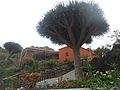
 Afurdrago.jpg 1,024 × 768; 419 KB
-
 Bco. Guardaz. Afur.JPG 3,648 × 2,736; 1.59 MB
-
 Casas de afur 2009.jpg 1,367 × 1,386; 1.63 MB
-
 Casas de Afur.JPG 2,048 × 1,536; 1.38 MB
-
 Caserío de Afur (Anaga).JPG 2,112 × 2,816; 1.48 MB
-
 Choza en Afur (Tenerife).JPG 2,048 × 1,536; 1.31 MB
-
 Drago y casa en Afur.JPG 3,648 × 2,736; 1.52 MB
-
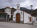 Ermita de Afur.JPG 2,816 × 2,112; 668 KB
-
 Linea de Titsa 076 trayecto Afur.JPG 3,648 × 2,736; 1.52 MB
-
 Macizo de Anaga, Tenerife, Spain 06.jpg 4,756 × 3,303; 13.36 MB
-
 Macizo de Anaga, Tenerife, Spain 07.jpg 3,456 × 5,184; 12.29 MB
-
 Macizo de Anaga, Tenerife, Spain 08.jpg 5,184 × 3,456; 12.58 MB
-
 Poste del sendero PR TF-2.1 camino Afur.JPG 2,048 × 1,536; 1.33 MB
-
 Poste del sendero PR TF-8 y PR TF-9 en la plaza de Afur.JPG 3,648 × 2,736; 1.52 MB
-
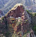
 Rock formation next to Afur, Macizo de Anaga, Tenerife, Spain 16.jpg 5,184 × 3,456; 8.66 MB
-
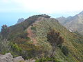 Sendero hacia Afur en lo alto del Bco. Guardaz..JPG 3,648 × 2,736; 1.65 MB
-


.JPG)


