Category:Agricultural machines in the East Riding of Yorkshire
Subcategories
This category has only the following subcategory.
V
Media in category "Agricultural machines in the East Riding of Yorkshire"
The following 96 files are in this category, out of 96 total.
-
 A Crawler Tractor - geograph.org.uk - 219621.jpg 640 × 480; 104 KB
-
 A Harrow - geograph.org.uk - 253389.jpg 638 × 480; 101 KB
-
 Access denied (geograph 4458543).jpg 1,024 × 768; 124 KB
-
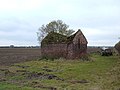
 Angus Farm - Barn - geograph.org.uk - 360588.jpg 640 × 480; 124 KB
-
 Approaching Poplar Farm (geograph 4448549).jpg 1,280 × 954; 1.09 MB
-
 At the entrance of Moat Farm, Welwick (geograph 4987991).jpg 3,888 × 5,184; 5.79 MB
-
 Baling near Skirlaugh - geograph.org.uk - 963277.jpg 640 × 540; 189 KB
-
 Beverley and Barmston Drain, Tophill Low - geograph.org.uk - 1142036.jpg 640 × 478; 191 KB
-
 Bird Scarer at field edge - geograph.org.uk - 1153370.jpg 640 × 480; 120 KB
-
-
 Blocked Track - geograph.org.uk - 191839.jpg 640 × 480; 114 KB
-
 Boyes Lane Showfield, Keyingham - geograph.org.uk - 849356.jpg 640 × 472; 101 KB
-
 Bridleway near Park Hill, Weel Carr (geograph 5954890).jpg 1,600 × 1,064; 674 KB
-
 Catwick Fields being harvested - geograph.org.uk - 1576034.jpg 640 × 480; 173 KB
-
 Cave Wold - geograph.org.uk - 719004.jpg 481 × 640; 175 KB
-
 Common Farm House and Yard - geograph.org.uk - 1219838.jpg 640 × 480; 66 KB
-
 Derelict Farm Building, Weel Carr - geograph.org.uk - 1552138.jpg 640 × 480; 68 KB
-
 Dothams Road, Cess Dale - geograph.org.uk - 524078.jpg 640 × 469; 114 KB
-
 East Growths, Patrington Haven - geograph.org.uk - 323850.jpg 640 × 479; 108 KB
-
 East of Spaldington - geograph.org.uk - 129028.jpg 640 × 480; 99 KB
-
 East of Thwing - geograph.org.uk - 139440.jpg 640 × 480; 90 KB
-
 Eastfield Farm - geograph.org.uk - 1453884.jpg 640 × 480; 67 KB
-
 Farm at Swaythorpe - geograph.org.uk - 1258421.jpg 640 × 480; 59 KB
-
 Farm buildings at Decoy House - geograph.org.uk - 257904.jpg 640 × 462; 86 KB
-

-
 Farm Buildings TA40341758 - geograph.org.uk - 28456.jpg 640 × 480; 97 KB
-
 Farm Buildings, Demming Farm - geograph.org.uk - 1223802.jpg 640 × 481; 73 KB
-
 Farm Junk - geograph.org.uk - 248338.jpg 640 × 426; 365 KB
-
 Farm Machinery At Driffield Show - geograph.org.uk - 205365.jpg 640 × 480; 112 KB
-

-
 Farmland - Bewholme, Seaton Road - geograph.org.uk - 41160.jpg 640 × 480; 127 KB
-
 Farmland near Bewholme - geograph.org.uk - 63637.jpg 640 × 480; 101 KB
-
 Farmland near Hollym - geograph.org.uk - 45970.jpg 640 × 480; 95 KB
-
 Farmland near Welton Wold Farm - geograph.org.uk - 1734770.jpg 800 × 600; 126 KB
-
 Farmland, Goodmanham Wold - geograph.org.uk - 1563900.jpg 640 × 480; 94 KB
-
 Fertilising farmland, near Willerby (geograph 6786274).jpg 1,024 × 785; 1.33 MB
-
 Field Near East Common - geograph.org.uk - 234188.jpg 640 × 426; 144 KB
-
 Fingerpost at Burn Park Farm (geograph 4398763).jpg 1,600 × 1,062; 1.27 MB
-
 Following the reaper YORYM-S79.jpg 1,500 × 1,200; 451 KB
-
 Getting ready for Christmas (geograph 5600717).jpg 5,376 × 3,024; 3.26 MB
-
 Going sowing, south of Routh (geograph 7287938).jpg 1,024 × 683; 960 KB
-
 Grassy Ferguson - geograph.org.uk - 291394.jpg 640 × 428; 112 KB
-
 Harrowing near Bentley, E Yorks (geograph 3902369).jpg 640 × 426; 200 KB
-
 Harvesting near Out Newton - geograph.org.uk - 538813.jpg 640 × 480; 120 KB
-

-
 Health and safety at play - geograph.org.uk - 2155624.jpg 800 × 600; 304 KB
-
 Hedge trimming near Little Wauldby Farm (geograph 6686490).jpg 1,600 × 1,065; 484 KB
-
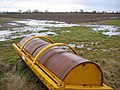
 Idling Rollers - geograph.org.uk - 253261.jpg 640 × 480; 107 KB
-
 Just Leave It Where It Is - geograph.org.uk - 251705.jpg 640 × 480; 104 KB
-
 Kilnwick New Farm near Kilnwick (geograph 5950920).jpg 1,600 × 1,064; 681 KB
-
 Kilnwick New Farm near Kilnwick (geograph 6494871).jpg 5,456 × 3,632; 2.46 MB
-
 Lane Into Easington - geograph.org.uk - 393313.jpg 480 × 640; 155 KB
-
 Laurel Farm, Skeffling - geograph.org.uk - 321723.jpg 478 × 640; 130 KB
-
 Little Newsome Farm - geograph.org.uk - 45977.jpg 640 × 480; 134 KB
-
 Low Fosham - geograph.org.uk - 560850.jpg 640 × 491; 113 KB
-
 Main Street, Roos - geograph.org.uk - 1507530.jpg 467 × 640; 199 KB
-
 Men around the reaping machine YORYM-S84.jpg 1,500 × 1,200; 563 KB
-
 Moat Farm, Welwick - geograph.org.uk - 243945.jpg 640 × 465; 137 KB
-
 Mount Airy Farm - geograph.org.uk - 570917.jpg 469 × 640; 93 KB
-
 Near East Plantation - geograph.org.uk - 743745.jpg 640 × 480; 179 KB
-
 No Entry to the Oaks this way - geograph.org.uk - 1257658.jpg 640 × 480; 50 KB
-
 North Moor, Hotham - geograph.org.uk - 1183951.jpg 640 × 446; 172 KB
-
 Northern Gas Installation - geograph.org.uk - 142953.jpg 640 × 480; 164 KB
-
 Old Barn, Hayton - geograph.org.uk - 133595.jpg 640 × 480; 93 KB
-
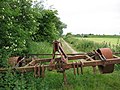
 Old Farm Machinery - geograph.org.uk - 133597.jpg 640 × 480; 130 KB
-
 Old Farm Machinery - geograph.org.uk - 203448.jpg 640 × 480; 225 KB
-
 Old Machinery - geograph.org.uk - 129235.jpg 640 × 480; 146 KB
-
 Old threshing machine, near Hayton - geograph.org.uk - 1568970.jpg 632 × 426; 228 KB
-
 Out Newton harvest - geograph.org.uk - 617393.jpg 640 × 427; 47 KB
-
 Park Lane at Model Farm, East Yorkshire (geograph 4399489).jpg 1,600 × 1,062; 592 KB
-
 Ploughing near Willerby (geograph 6786259).jpg 1,024 × 696; 968 KB
-
 Preparing for the next crop (geograph 5522540).jpg 1,024 × 768; 91 KB
-
 Puzzling Machinery - geograph.org.uk - 174919.jpg 640 × 480; 32 KB
-
 Pylon at Burn Park Farm, East Yorkshire (geograph 4398759).jpg 1,062 × 1,600; 565 KB
-
 Quaker's Farm - geograph.org.uk - 1365149.jpg 640 × 480; 65 KB
-
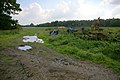
 Redundant Machinery - geograph.org.uk - 133599.jpg 640 × 480; 90 KB
-
 Risby Grange - geograph.org.uk - 1733494.jpg 800 × 600; 80 KB
-
 Row Lane, Welwick - geograph.org.uk - 322561.jpg 640 × 449; 106 KB
-
 Rowton Farm, Skirlaugh - geograph.org.uk - 907966.jpg 640 × 454; 122 KB
-
 Rusting Where It Stands - geograph.org.uk - 251700.jpg 640 × 480; 105 KB
-
 Scurf Dyke Farm (geograph 6516404).jpg 3,648 × 1,744; 2.92 MB
-
 Seed drilling near Kilnwick - geograph.org.uk - 973772.jpg 640 × 438; 175 KB
-
 Spraying the crops near Skeffling (geograph 5562212).jpg 800 × 415; 79 KB
-
 The road to Bishop Burton Wold - geograph.org.uk - 1689214.jpg 1,600 × 1,200; 991 KB
-
 The Turf Crop - geograph.org.uk - 689767.jpg 640 × 480; 89 KB
-
 Threshing at Lockington circa.1910 DDX1862-1 (30561287506).jpg 3,663 × 2,455; 3.17 MB
-
 Towards Low Hunsley Plantation.jpg 640 × 437; 162 KB
-
 Track - Public Footpath - geograph.org.uk - 386106.jpg 480 × 640; 138 KB
-
 Track to Eske Manor - geograph.org.uk - 1552354.jpg 640 × 480; 67 KB
-
 Turf Cutting at Carberry Hall Farm - geograph.org.uk - 735274.jpg 1,280 × 960; 1.05 MB
-
 Turkers - geograph.org.uk - 255292.jpg 640 × 480; 99 KB
-
 Wandales - geograph.org.uk - 1034626.jpg 640 × 345; 157 KB
-
 Weel Carr - geograph.org.uk - 1201438.jpg 640 × 476; 69 KB
-
 Wheel near Weel - geograph.org.uk - 785805.jpg 526 × 640; 223 KB
-
 Whinnyforth Farm - geograph.org.uk - 1453946.jpg 640 × 480; 75 KB
-
 Wold Farm, Nunburnholme - geograph.org.uk - 588910.jpg 640 × 459; 82 KB


.jpg)

.jpg)
.jpg)


.jpg)


.jpg)

.jpg)

.jpg)
.jpg)

.jpg)


.jpg)


.jpg)
.jpg)


.jpg)
.jpg)
.jpg)

.jpg)


.jpg)

.jpg)


.jpg)


