Category:Agriculture in North Yorkshire
Ceremonial counties of England: Bedfordshire · Berkshire · Buckinghamshire · Cambridgeshire · Cheshire · Cornwall · Cumbria · Derbyshire · Devon · Dorset · Durham · East Riding of Yorkshire · East Sussex · Essex · Gloucestershire · Greater London · Greater Manchester · Hampshire · Herefordshire · Hertfordshire · Kent · Lancashire · Leicestershire · Lincolnshire · Merseyside · Norfolk · North Yorkshire · Northamptonshire · Northumberland · Nottinghamshire · Oxfordshire · Rutland · Shropshire · Somerset · South Yorkshire · Staffordshire · Suffolk · Surrey · Tyne and Wear · Warwickshire · West Midlands · West Sussex · West Yorkshire · Wiltshire · Worcestershire
City-counties: Bristol ·
Former historic counties: Huntingdonshire · Yorkshire
Other former counties:
City-counties: Bristol ·
Former historic counties: Huntingdonshire · Yorkshire
Other former counties:
Subcategories
This category has the following 11 subcategories, out of 11 total.
- Forestry in North Yorkshire (17 F)
- Orchards in North Yorkshire (2 F)
Media in category "Agriculture in North Yorkshire"
The following 169 files are in this category, out of 169 total.
-
-
 Anne's Plantation, Skipwith Holmes. - geograph.org.uk - 649188.jpg 640 × 427; 49 KB
-
 Anne's Plantation. - geograph.org.uk - 527248.jpg 640 × 480; 73 KB
-
 Baling silage near Tower Beck - geograph.org.uk - 230684.jpg 640 × 427; 75 KB
-
 Beehives, Warren Moor - geograph.org.uk - 1469935.jpg 640 × 427; 77 KB
-

-
 Carrlow Ridge Plantation - geograph.org.uk - 740591.jpg 640 × 480; 67 KB
-
 Close up of Rape Swather - geograph.org.uk - 892160.jpg 640 × 427; 210 KB
-
 Coldwell Plantation - geograph.org.uk - 261073.jpg 640 × 480; 75 KB
-
 Cross Lane Plantation - geograph.org.uk - 1432854.jpg 640 × 480; 89 KB
-
 Cross Lane Plantation - geograph.org.uk - 461526.jpg 640 × 480; 68 KB
-
 Druid's Plantation - geograph.org.uk - 1403675.jpg 640 × 480; 115 KB
-
 Druid's Plantation - geograph.org.uk - 727026.jpg 640 × 480; 134 KB
-
 East Lane House - geograph.org.uk - 1809870.jpg 2,185 × 3,375; 1.85 MB
-
 East Side Wood - geograph.org.uk - 573704.jpg 640 × 480; 71 KB
-

-
 Farm machinery near Head House - geograph.org.uk - 211412.jpg 640 × 427; 55 KB
-
 Farmland near the A170 - geograph.org.uk - 1355173.jpg 640 × 480; 84 KB
-
 Fields along Colton Lane - geograph.org.uk - 292678.jpg 640 × 479; 44 KB
-
 Fields south of Sherburn-in-Elmet - geograph.org.uk - 253284.jpg 640 × 323; 26 KB
-
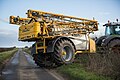 Folded spray boom.jpg 2,048 × 1,365; 855 KB
-
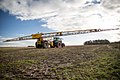 Fully unfolded spray boom.jpg 2,048 × 1,365; 822 KB
-
 Harvest Time, Bank Foot Farm - geograph.org.uk - 1595006.jpg 640 × 457; 72 KB
-
 Helks Wood - geograph.org.uk - 243756.jpg 640 × 480; 100 KB
-
 Henhouse near Ganthorpe - geograph.org.uk - 670026.jpg 640 × 480; 314 KB
-
 Hesston Rape Swather, Browson Bank Farm - geograph.org.uk - 890937.jpg 640 × 427; 203 KB
-
 High Boar Hole - geograph.org.uk - 101224.jpg 640 × 480; 61 KB
-
 Kirby Plantation - geograph.org.uk - 149590.jpg 640 × 480; 116 KB
-
 Logged out - geograph.org.uk - 392921.jpg 640 × 480; 130 KB
-
 Looking over to Ox Close Plantation - geograph.org.uk - 278898.jpg 640 × 480; 98 KB
-
 Low Scargill Plantation - geograph.org.uk - 100918.jpg 640 × 480; 63 KB
-
 Newbiggin - geograph.org.uk - 1285108.jpg 640 × 427; 114 KB
-
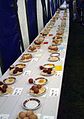 Nidderdale Show 2003 Eggs.JPG 541 × 768; 64 KB
-
 Old Farming Implement, Airyholme Farm - geograph.org.uk - 651409.jpg 640 × 427; 117 KB
-
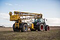 Partially unfolded spray boom.jpg 2,048 × 1,365; 849 KB
-
 Piece of agricultural machinery - geograph.org.uk - 416747.jpg 640 × 480; 116 KB
-
 Plantation by Harkera Gill - geograph.org.uk - 115649.jpg 640 × 480; 72 KB
-
 Plantation by Slape Gill - geograph.org.uk - 115770.jpg 640 × 480; 105 KB
-
 Plantation Corner from Barker's Ridge - geograph.org.uk - 54647.jpg 640 × 480; 77 KB
-
 Plantation on edge of Skipton Moor - geograph.org.uk - 308140.jpg 640 × 480; 86 KB
-
 Rusty hay rake, Broadrake Farm - geograph.org.uk - 1552131.jpg 640 × 480; 176 KB
-
 Silage Clamp, Hilltop Farm - geograph.org.uk - 1756482.jpg 1,024 × 683; 169 KB
-
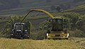 Silage harvesting at Westerdale - geograph.org.uk - 453533.jpg 640 × 374; 62 KB
-
 Skipton Snow Line - geograph.org.uk - 1718030.jpg 4,000 × 3,000; 2.61 MB
-
 Skipton to Addingham Turnpike - geograph.org.uk - 47369.jpg 640 × 480; 95 KB
-
 Sleets Gill Wood. - geograph.org.uk - 98539.jpg 640 × 480; 101 KB
-

-
 Small Plantation near Wildgath End. - geograph.org.uk - 277644.jpg 640 × 480; 230 KB
-

-
 The Womens Land Army in Britain during the First World War HU91979.jpg 2,480 × 1,388; 1.25 MB
-

-
 Towthorpe Plantation - geograph.org.uk - 149560.jpg 640 × 480; 97 KB
-
 Track through High Moor Plantation - geograph.org.uk - 599938.jpg 640 × 480; 102 KB
-
 Turquoise Bales. - geograph.org.uk - 579244.jpg 640 × 329; 208 KB
-
 Wheat harvest - geograph.org.uk - 963571.jpg 640 × 427; 52 KB
-
 Young trees, East Tanfield - geograph.org.uk - 274609.jpg 640 × 480; 124 KB
-
 Young trees, Scawton Moor - geograph.org.uk - 423755.jpg 640 × 480; 139 KB
-
 Approaching Newlands Wood - geograph.org.uk - 88094.jpg 640 × 480; 79 KB
-
 Back Plantation. - geograph.org.uk - 153338.jpg 640 × 480; 116 KB
-
 Battersby Plantation - geograph.org.uk - 784037.jpg 640 × 427; 285 KB
-
 Beech Plantation, Mulgrave Woods - geograph.org.uk - 401829.jpg 426 × 640; 126 KB
-
 Billingside Plantation. - geograph.org.uk - 283882.jpg 640 × 480; 216 KB
-
 Bogs Plantation - geograph.org.uk - 249432.jpg 640 × 480; 61 KB
-
 Broadleaved plantation near Helwith. - geograph.org.uk - 513611.jpg 640 × 359; 118 KB
-
 Bull Park Plantation - geograph.org.uk - 239119.jpg 640 × 480; 70 KB
-
 Burntroots Plantation - geograph.org.uk - 185990.jpg 640 × 480; 80 KB
-
 Burton's Plantation - geograph.org.uk - 297979.jpg 640 × 480; 164 KB
-
 Capplebank Plantation - geograph.org.uk - 288289.jpg 640 × 480; 111 KB
-
 Carr Moor Plantation - geograph.org.uk - 143944.jpg 640 × 480; 178 KB
-
 Catlow Plantation - geograph.org.uk - 155678.jpg 640 × 480; 94 KB
-
 Catlow Plantation - geograph.org.uk - 155680.jpg 640 × 480; 83 KB
-
 Christmas tree nursery, Cawthorn Moor - geograph.org.uk - 349241.jpg 640 × 480; 56 KB
-

-
 Crayke Lodge Plantation - geograph.org.uk - 348413.jpg 640 × 480; 58 KB
-
 Cringle Moor Plantation - geograph.org.uk - 29194.jpg 640 × 480; 95 KB
-
 D Plantation and Skell Gill Plantation. - geograph.org.uk - 295453.jpg 640 × 480; 227 KB
-
 Dialstone Plantation - geograph.org.uk - 583046.jpg 640 × 480; 125 KB
-
 Druid's Plantation - geograph.org.uk - 727003.jpg 480 × 640; 85 KB
-
 Earthquake Plantation - geograph.org.uk - 181149.jpg 640 × 480; 105 KB
-
 Earthquake Plantation - geograph.org.uk - 553787.jpg 640 × 480; 99 KB
-
 Ellington Firth - geograph.org.uk - 107356.jpg 640 × 480; 78 KB
-
 Fatten Hill Plantation - geograph.org.uk - 144037.jpg 640 × 480; 165 KB
-
 Feeder - geograph.org.uk - 214217.jpg 640 × 480; 172 KB
-
 Field and Scally Moor Plantation - geograph.org.uk - 512618.jpg 640 × 480; 112 KB
-
 Footpath through a plantation - geograph.org.uk - 331627.jpg 640 × 480; 136 KB
-
 Footpath through conifers - geograph.org.uk - 491553.jpg 494 × 640; 137 KB
-
 Forty Acre Plantation - geograph.org.uk - 131992.jpg 640 × 480; 139 KB
-
 Foxclose Plantation - geograph.org.uk - 556484.jpg 640 × 480; 91 KB
-
 Gandale Bivouac Site - geograph.org.uk - 171964.jpg 640 × 480; 135 KB
-
 Gillsike Plantation - geograph.org.uk - 549794.jpg 640 × 480; 98 KB
-
 Gillsike Plantation - geograph.org.uk - 549832.jpg 640 × 480; 112 KB
-
 Grange Moor Plantation - geograph.org.uk - 270412.jpg 640 × 480; 81 KB
-

-
 Green Plantation from Airy Hill Lane - geograph.org.uk - 92650.jpg 640 × 482; 108 KB
-
 Greenfield Plantation - geograph.org.uk - 281411.jpg 640 × 480; 80 KB
-
 Grey Yaud Plantation - geograph.org.uk - 308497.jpg 640 × 480; 103 KB
-
 Halton West - geograph.org.uk - 696216.jpg 640 × 427; 52 KB
-
 Heslerton Wold - Plantation - geograph.org.uk - 154170.jpg 640 × 480; 169 KB
-
 High Mowthorpe Plantation - geograph.org.uk - 203370.jpg 640 × 480; 85 KB
-
 High Scar Plantation. - geograph.org.uk - 278115.jpg 640 × 480; 81 KB
-
 Hill Plantation - geograph.org.uk - 640577.jpg 640 × 388; 55 KB
-
 Hollgate Plantation - geograph.org.uk - 154315.jpg 640 × 480; 153 KB
-
 Horse Shoe Plantation - geograph.org.uk - 374963.jpg 640 × 426; 88 KB
-
 In Sheepshaw Plantation - geograph.org.uk - 655409.jpg 640 × 427; 299 KB
-
 Infant plantation on High Pasture - geograph.org.uk - 640702.jpg 640 × 480; 77 KB
-
 Isolated Plantation and Grove Head - geograph.org.uk - 189978.jpg 640 × 480; 68 KB
-
 Jockey Cap Clump. - geograph.org.uk - 176007.jpg 640 × 290; 36 KB
-
 Langhill Plantation - geograph.org.uk - 181174.jpg 640 × 480; 103 KB
-
 Lings Plantation - geograph.org.uk - 640484.jpg 640 × 427; 272 KB
-
 Little Fell Plantation. - geograph.org.uk - 284095.jpg 640 × 480; 228 KB
-

-
 Mixed Plantation - geograph.org.uk - 556414.jpg 640 × 480; 105 KB
-
 Monday Howl Plantation - geograph.org.uk - 615982.jpg 640 × 427; 95 KB
-
 Moons Plantation - geograph.org.uk - 235246.jpg 640 × 480; 77 KB
-
 Morton Carr Belt - geograph.org.uk - 24469.jpg 640 × 480; 51 KB
-
 Mount Plantation - geograph.org.uk - 552413.jpg 480 × 640; 177 KB
-
 New Covert plantation near Thirn. - geograph.org.uk - 330998.jpg 640 × 480; 90 KB
-
 New plantation - geograph.org.uk - 420439.jpg 640 × 480; 109 KB
-
 New Plantation in Strans Gill. - geograph.org.uk - 264765.jpg 640 × 480; 83 KB
-
 Newly-planted Trees on Cotter High Rigg - geograph.org.uk - 480693.jpg 640 × 440; 131 KB
-
 North Plantation - Deep Dale - geograph.org.uk - 158593.jpg 640 × 432; 64 KB
-
 Number 1- The Larch - geograph.org.uk - 556437.jpg 480 × 640; 161 KB
-
 On the edge of Hay Bridge Plantation - geograph.org.uk - 512686.jpg 640 × 480; 132 KB
-
 Part of Galphay Moor - geograph.org.uk - 126736.jpg 640 × 480; 57 KB
-
 Part of Plantation on Nutwith Common - geograph.org.uk - 229257.jpg 640 × 480; 73 KB
-
 Path through conifer plantation - geograph.org.uk - 594715.jpg 640 × 462; 137 KB
-

-
 Pits Hill Plantation - geograph.org.uk - 171389.jpg 640 × 480; 75 KB
-
 Plantation - geograph.org.uk - 154112.jpg 640 × 480; 172 KB
-
 Plantation - Sherburn Wold - geograph.org.uk - 154115.jpg 640 × 480; 91 KB
-
 Plantation above Askrigg - geograph.org.uk - 567070.jpg 640 × 480; 110 KB
-
 Plantation around Picking Gill - geograph.org.uk - 118645.jpg 640 × 480; 122 KB
-
 Plantation at High Moor - geograph.org.uk - 118512.jpg 640 × 480; 65 KB
-
 Plantation by Eller Beck - geograph.org.uk - 604020.jpg 640 × 480; 62 KB
-
 Plantation Gill Farm - geograph.org.uk - 127346.jpg 640 × 480; 112 KB
-
 Plantation Green Hippins - geograph.org.uk - 176783.jpg 640 × 349; 41 KB
-
 Plantation Lanes, Impenetrable Brambles - geograph.org.uk - 350080.jpg 640 × 426; 123 KB
-
 Plantation near Winterley Cobba - geograph.org.uk - 171786.jpg 640 × 480; 56 KB
-
 Plantation of Young Trees - geograph.org.uk - 45178.jpg 640 × 480; 127 KB
-
 Plantation on Back Allotment - geograph.org.uk - 216775.jpg 640 × 480; 70 KB
-
 Plantation on Snaizeholme Pasture - geograph.org.uk - 189942.jpg 640 × 480; 117 KB
-
 Plantation remnants near Winksley - geograph.org.uk - 118563.jpg 640 × 480; 70 KB
-
 Plantation, Crow Wood Farm - geograph.org.uk - 23588.jpg 640 × 480; 67 KB
-
 Plantation, Green Scar - geograph.org.uk - 282577.jpg 640 × 480; 113 KB
-
 Plantation, Howsham Wood - geograph.org.uk - 533641.jpg 359 × 640; 132 KB
-
 Potter Plantation - geograph.org.uk - 677211.jpg 640 × 425; 229 KB
-
 Ranley Gill Plantation - geograph.org.uk - 190258.jpg 640 × 480; 113 KB
-
 Recently planted trees - geograph.org.uk - 143602.jpg 640 × 427; 60 KB
-
 Reforestation - geograph.org.uk - 214193.jpg 640 × 480; 115 KB
-
 Scarnber Wood - geograph.org.uk - 120004.jpg 640 × 480; 62 KB
-
 Sheephouse Plantation - geograph.org.uk - 172714.jpg 480 × 640; 103 KB
-
 Silage Bales near West Green Farm - geograph.org.uk - 309444.jpg 640 × 427; 77 KB
-
 Small Plantation, Howith - geograph.org.uk - 264052.jpg 640 × 480; 53 KB
-
 Snow at Rush Plantation - geograph.org.uk - 132890.jpg 640 × 425; 72 KB
-
 South Plantation - geograph.org.uk - 167093.jpg 640 × 480; 122 KB
-
 Starvation Clump - geograph.org.uk - 24166.jpg 640 × 480; 51 KB
-
 Tree plantation on Harkerside Moor. - geograph.org.uk - 448230.jpg 640 × 480; 111 KB
-
 Tree Planting at Fornah Gill - geograph.org.uk - 238141.jpg 640 × 480; 142 KB
-

-
 Wasters Plantation - geograph.org.uk - 195339.jpg 640 × 480; 175 KB
-

-
 Wenningber Plantation - geograph.org.uk - 170103.jpg 640 × 480; 45 KB
-
 Willow Garth Wood - geograph.org.uk - 396318.jpg 640 × 480; 101 KB
-
 Wolside plantation. - geograph.org.uk - 283886.jpg 640 × 480; 182 KB
-
 Wolside Plantation. - geograph.org.uk - 284099.jpg 640 × 480; 203 KB
-
 Wolside Plantation. - geograph.org.uk - 284304.jpg 640 × 480; 186 KB
-
 Wolside Plantation. - geograph.org.uk - 284305.jpg 640 × 480; 169 KB
-
 Wye Plantation - geograph.org.uk - 193048.jpg 640 × 480; 39 KB
-
 Young trees by Skiplam Road - geograph.org.uk - 180944.jpg 640 × 479; 119 KB


_-_geograph.org.uk_-_606766.jpg)


