Category:Ailsa Craig
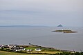
island in the outer Firth of Clyde, South Ayrshire, Scotland, UK  Pohled na ostrov z parníku PS Waverley, plujícího do Ayru | |||||
| Upload media | |||||
| Instance of | |||||
|---|---|---|---|---|---|
| Location |
| ||||
| Located in or next to body of water | |||||
| Width |
| ||||
| Length |
| ||||
| Population |
| ||||
| Area |
| ||||
| Elevation above sea level |
| ||||
 | |||||
Subcategories
This category has the following 4 subcategories, out of 4 total.
A
- Ailsa Craig Castle (4 F)
- Ailsa Craig foghorns (14 F)
- Ailsa Craig Lighthouse (15 F)
- Ailsa Craig summit (4 F)
Media in category "Ailsa Craig"
The following 200 files are in this category, out of 294 total.
(previous page) (next page)-
 20091108 Lomond Ben Vorlich to Inverkip.jpg 2,176 × 1,632; 569 KB
-
 20091108 Lomond Ben Vorlich view south.jpg 3,072 × 2,304; 1.17 MB
-
 A Deceptive Slope on Ailsa Craig - geograph.org.uk - 2992012.jpg 640 × 407; 120 KB
-
 A harrowing time^ - geograph.org.uk - 262882.jpg 640 × 480; 69 KB
-
 Admiralty Chart No 2159 Firth of Clyde, Published 1869.jpg 11,193 × 19,484; 22.08 MB
-
 Admiralty Chart No 2164 Fith of Clyde Bennane Head to Largs Channel, Published 1969.jpg 11,302 × 16,359; 23.06 MB
-
 Admiralty Chart No 2199 North Channel Northern Part, Published 1966.jpg 18,326 × 11,113; 12.45 MB
-
 Admiralty Chart No 46 Ailsa Craig to Bloody Foreland, Published 1861.jpg 20,202 × 11,078; 58.98 MB
-
 Ailsa and Little Ailsa - geograph.org.uk - 2992000.jpg 464 × 640; 134 KB
-
 Ailsa Castle View - geograph.org.uk - 4096884.jpg 640 × 444; 59 KB
-
 Ailsa Craig & Pladda Lighthouse (37114801732).jpg 5,973 × 3,982; 13.99 MB
-

-
 Ailsa Craig - 1829.jpg 3,949 × 2,312; 1.92 MB
-
 Ailsa Craig - geograph.org.uk - 250513.jpg 640 × 479; 44 KB
-
 Ailsa Craig - geograph.org.uk - 4016793.jpg 3,648 × 2,736; 3.26 MB
-
 Ailsa Craig - geograph.org.uk - 4096846.jpg 640 × 425; 82 KB
-
 Ailsa Craig - geograph.org.uk - 4797196.jpg 3,312 × 1,941; 2.15 MB
-
 Ailsa Craig - geograph.org.uk - 4908498.jpg 2,879 × 1,808; 1.82 MB
-
 Ailsa Craig - geograph.org.uk - 5497303.jpg 640 × 426; 69 KB
-
 Ailsa Craig - geograph.org.uk - 56890.jpg 640 × 424; 70 KB
-
 Ailsa Craig - geograph.org.uk - 57378.jpg 640 × 428; 30 KB
-
 Ailsa Craig - geograph.org.uk - 767673.jpg 640 × 480; 42 KB
-
 Ailsa Craig - geograph.org.uk - 767703.jpg 640 × 480; 49 KB
-
 Ailsa Craig - Paddy's Milestone - geograph.org.uk - 2994013.jpg 1,100 × 710; 463 KB
-
 Ailsa Craig 2017-05-17.jpg 7,291 × 3,645; 8.03 MB
-
 Ailsa Craig and Arran - geograph.org.uk - 4908449.jpg 3,504 × 2,336; 3.48 MB
-
 Ailsa Craig and Arran - geograph.org.uk - 4908457.jpg 3,504 × 2,336; 3.93 MB
-
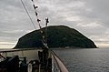
 Ailsa Craig and mv Encounter.jpg 5,000 × 3,327; 9.16 MB
-
 Ailsa Craig and the Loups Path running ot the North Foghorn.JPG 4,457 × 2,303; 3.6 MB
-
-
 Ailsa Craig at Sunset - geograph.org.uk - 52273.jpg 640 × 480; 61 KB
-
 Ailsa Craig at Sunset B.jpg 640 × 480; 45 KB
-
 Ailsa Craig Cliffs - geograph.org.uk - 534691.jpg 458 × 600; 61 KB
-
 Ailsa Craig Cliffs.jpg 640 × 469; 79 KB
-
 Ailsa Craig from Arran - geograph.org.uk - 1036107.jpg 640 × 480; 35 KB
-
 Ailsa Craig from Ballantrae shore, South Ayrshire, Scotland.jpg 1,612 × 759; 277 KB
-
 Ailsa Craig from Ballantrae, South Ayrshire, Scotland.jpg 1,920 × 1,080; 521 KB
-
 Ailsa Craig from Bennane Head, South Ayrshire.jpg 3,876 × 2,008; 1.4 MB
-
 Ailsa Craig From Corsewall Point - geograph.org.uk - 3078476.jpg 3,448 × 4,592; 1.85 MB
-
 Ailsa Craig from Culzean Castle in 1830.jpg 1,804 × 1,134; 843 KB
-
 Ailsa Craig From Culzean Shore - geograph.org.uk - 703238.jpg 640 × 480; 40 KB
-
 Ailsa Craig from HMS Campbeltown - geograph.org.uk - 988480.jpg 640 × 480; 51 KB
-
 Ailsa Craig from HMS Campbeltown - geograph.org.uk - 988485.jpg 640 × 480; 49 KB
-
 Ailsa Craig from HMS Campbeltown - geograph.org.uk - 988488.jpg 640 × 480; 50 KB
-
 Ailsa Craig from Kildonan - geograph.org.uk - 3403193.jpg 1,081 × 1,000; 883 KB
-
 Ailsa Craig from near Girvan - geograph.org.uk - 4932686.jpg 3,648 × 2,736; 2.57 MB
-
 Ailsa Craig from the air - geograph.org.uk - 2174068.jpg 640 × 480; 13 KB
-
 Ailsa Craig from the air - geograph.org.uk - 5985604.jpg 1,024 × 713; 138 KB
-
 Ailsa Craig from the PS Waverley - geograph.org.uk - 1436832.jpg 640 × 454; 79 KB
-
 Ailsa Craig from Waverley.jpg 1,800 × 1,200; 1.25 MB
-
 Ailsa Craig fron Floors Farm, Kilmaurs, East Ayrshire.jpg 4,896 × 2,752; 2.93 MB
-
 Ailsa Craig Gannetry - geograph.org.uk - 1939115.jpg 1,600 × 1,200; 463 KB
-
 Ailsa Craig Gannetry - geograph.org.uk - 4096826.jpg 640 × 480; 108 KB
-
 Ailsa Craig Girvan 01.jpg 6,016 × 2,407; 3.13 MB
-
 Ailsa Craig Girvan 02.jpg 6,016 × 3,010; 4.32 MB
-
 Ailsa Craig Girvan 03.jpg 5,858 × 2,926; 3.52 MB
-
 Ailsa Craig Granite Quarry - geograph.org.uk - 1937654.jpg 1,200 × 1,600; 499 KB
-
 Ailsa Craig in Strathclutha,.jpg 1,481 × 703; 211 KB
-
 Ailsa Craig morning.jpg 4,970 × 3,313; 13.48 MB
-
 Ailsa Craig Nature Reserve - geograph.org.uk - 1363831.jpg 640 × 480; 80 KB
-
 Ailsa Craig off the Scottish coast in May Mist.jpg 1,200 × 800; 125 KB
-
 Ailsa Craig OS OpenData map.png 776 × 695; 39 KB
-
 Ailsa Craig pier - geograph.org.uk - 5061314.jpg 1,024 × 735; 144 KB
-
 Ailsa Craig South Foghorn - geograph.org.uk - 1363628.jpg 640 × 480; 93 KB
-
 Ailsa Craig sunset.jpg 5,072 × 3,282; 11.73 MB
-
 Ailsa Craig Trig Point - geograph.org.uk - 3252404.jpg 1,024 × 768; 211 KB
-
 Ailsa Craig View - geograph.org.uk - 2857630.jpg 411 × 640; 105 KB
-
 Ailsa Craig View - geograph.org.uk - 3621716.jpg 640 × 480; 93 KB
-
 Ailsa Craig View - geograph.org.uk - 911045.jpg 640 × 426; 94 KB
-
 Ailsa Craig with Turnberry Castle.jpg 2,027 × 1,059; 689 KB
-
 Ailsa Craig, a view from Saltcoats - geograph.org.uk - 1540485.jpg 480 × 640; 162 KB
-
 Ailsa Craig, Clyde, 1840s..jpg 2,144 × 1,280; 621 KB
-

-
 Ailsa Craig2.jpg 640 × 480; 46 KB
-
 Ailsa View - geograph.org.uk - 4096903.jpg 640 × 425; 76 KB
-
 Ailsa's Cliffs - geograph.org.uk - 4096853.jpg 640 × 442; 91 KB
-
 Ailsa.jpg 300 × 225; 16 KB
-
 Aisla Craig-touching the clouds - geograph.org.uk - 1555300.jpg 500 × 375; 37 KB
-
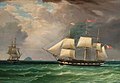
 American Ship Corra Linn in Two Positions.jpg 864 × 715; 125 KB
-
 Approaching Ailsa Craig - geograph.org.uk - 1442958.jpg 640 × 480; 56 KB
-
 Approaching Ailsa Craig - geograph.org.uk - 534686.jpg 445 × 600; 61 KB
-
 Approaching Ailsa Craig - geograph.org.uk - 5494727.jpg 1,600 × 969; 330 KB
-
 Ardrossan Sunset - geograph.org.uk - 660771.jpg 640 × 472; 74 KB
-
 Ardwell Bay View - geograph.org.uk - 1756231.jpg 800 × 522; 170 KB
-
 Arran and Ailsa Craig from Balcreuchan Port, Ballantrae, South Ayrshire.jpg 4,896 × 2,752; 3.42 MB
-

-
 Ayrshire Coast - geograph.org.uk - 3564310.jpg 3,968 × 2,232; 5.79 MB
-
 Ayrshire Dunure Castle 2.jpg 3,968 × 2,976; 8.13 MB
-
 Ballantrae Bay - geograph.org.uk - 2438965.jpg 640 × 469; 55 KB
-
 Ballantrae Boat - geograph.org.uk - 704404.jpg 640 × 479; 42 KB
-
 Basalt columns on Ailsa Craig.jpg 640 × 454; 96 KB
-
 Black Guillemot (Cepphus grylle) - geograph.org.uk - 1937669.jpg 1,200 × 1,600; 364 KB
-
 Black Rocks, Troon - geograph.org.uk - 1601044.jpg 640 × 391; 72 KB
-
 Blacksmith's bellows - geograph.org.uk - 3442109.jpg 1,200 × 1,600; 675 KB
-
 Bloody Slouch - geograph.org.uk - 2941518.jpg 640 × 472; 73 KB
-
 Boats at the pier, Ailsa Craig - geograph.org.uk - 5644719.jpg 1,600 × 1,067; 226 KB
-
 Bulldozer Remains at Ailsa Craig Quarry - geograph.org.uk - 1375407.jpg 640 × 480; 104 KB
-
 By The North Breakwater - geograph.org.uk - 1068562.jpg 640 × 413; 116 KB
-
 Bynehill Cemetery 08.jpg 6,016 × 3,010; 3.89 MB
-
 Bynehill Cemetery 09.jpg 5,929 × 2,965; 3.53 MB
-
 Bynehill Cemetery 10.jpg 5,571 × 3,531; 3.66 MB
-
 Bynehill Cemetery 11.jpg 5,544 × 3,683; 4.46 MB
-
 Bynehill Cemetery 12.jpg 5,642 × 3,747; 4.09 MB
-
 Bynehill Girvan 03.jpg 5,799 × 3,857; 3.85 MB
-
 Bynehill Girvan 04.jpg 6,016 × 4,000; 5.66 MB
-
 Bynehill Girvan 05.jpg 6,016 × 4,000; 6.3 MB
-
 Bynehill Grave Helen Grodynska 01.jpg 2,048 × 1,536; 918 KB
-
 Bynehill Grave Helen Grodynska 09.jpg 6,016 × 4,000; 6.48 MB
-
 Bynehill Grave Helen Grodynska 10.jpg 6,016 × 4,000; 6.37 MB
-
 Bynehill Grave Helen Grodynska 11.jpg 2,775 × 3,699; 2.49 MB
-
 William Clark - The Barque Eldon off Ailsa Craig (1831).jpg 1,200 × 832; 111 KB
-

-
 William Clark - Full-rigged ship Daniel Rankin (1861).jpg 3,200 × 2,157; 2.34 MB
-
 Cliffs above Stranny Point, Ailsa Craig - geograph.org.uk - 5644700.jpg 1,038 × 1,600; 459 KB
-
 Cliffs At Eagle's Seat - geograph.org.uk - 1939110.jpg 1,600 × 1,200; 656 KB
-
 Clyde View - geograph.org.uk - 808101.jpg 450 × 600; 59 KB
-
 Clyde View - geograph.org.uk - 808141.jpg 640 × 444; 78 KB
-
 Coastline near Lendalfoot - geograph.org.uk - 3055181.jpg 2,244 × 1,672; 396 KB
-
 Crop at Dowhill - geograph.org.uk - 776336.jpg 640 × 480; 49 KB
-
 Dowhill - geograph.org.uk - 250504.jpg 640 × 479; 42 KB
-
 Down In The Glen - geograph.org.uk - 807973.jpg 450 × 600; 90 KB
-
 Down The Glen - geograph.org.uk - 807965.jpg 452 × 600; 74 KB
-
 Down The Path - geograph.org.uk - 807947.jpg 640 × 423; 79 KB
-
 Dunure Castle, Ayrshire, 1840.jpg 3,056 × 1,968; 1.09 MB
-
 Eagle's Seat - geograph.org.uk - 41035.jpg 496 × 640; 54 KB
-
 Eagle's Seat, Ailsa Craig.jpg 480 × 640; 65 KB
-
 Eider And Duckling (Somateria mollissima) - geograph.org.uk - 1937694.jpg 1,600 × 1,200; 278 KB
-
 Eider Ducks - geograph.org.uk - 3441868.jpg 1,600 × 900; 378 KB
-
 Explosives Container - geograph.org.uk - 1363654.jpg 480 × 640; 129 KB
-
 Ferry passing Ailsa Craig - geograph.org.uk - 5551826.jpg 640 × 270; 151 KB
-
 First View Of Castle - geograph.org.uk - 3252421.jpg 1,024 × 768; 270 KB
-

-
 Foreshore - geograph.org.uk - 1476867.jpg 640 × 457; 240 KB
-
 Former Gasworks, Ailsa Craig - geograph.org.uk - 1363669.jpg 640 × 480; 98 KB
-
 From The Hill Path - geograph.org.uk - 807922.jpg 450 × 600; 64 KB
-
 From the west.jpg 2,448 × 980; 696 KB
-
 Garraloo, Ailsa Craig - geograph.org.uk - 1363783.jpg 640 × 480; 68 KB
-
 Gas Tanks on Ailsa Craig - geograph.org.uk - 1375623.jpg 640 × 480; 72 KB
-
 Gasometer Remains, Ailsa Craig - geograph.org.uk - 1363702.jpg 640 × 480; 93 KB
-
 General view, Ailsa Craig, Scotland-LCCN2001703575.jpg 3,636 × 2,728; 2.72 MB
-
 Girvan beach - geograph.org.uk - 1473676.jpg 640 × 457; 210 KB
-
 Girvan Lifeboat At Ailsa Craig Jetty - geograph.org.uk - 1937704.jpg 1,200 × 1,600; 737 KB
-
 Goodbye Ailsa - geograph.org.uk - 4096786.jpg 640 × 433; 48 KB
-
 Gormley Land Ailsa.jpg 4,000 × 3,000; 4.65 MB
-
 Guillemots at Ailsa Craig - geograph.org.uk - 2992037.jpg 640 × 404; 95 KB
-
 Holy Isle - geograph.org.uk - 240029.jpg 640 × 427; 105 KB
-
 Horse Isle and Ailsa Craig.JPG 1,607 × 1,141; 566 KB
-
 John Livingstone - The paddle steamer 'Europa'.jpg 944 × 550; 59 KB
-
 Joint Warrior Exercise at Ailsa Craig (21662159294).jpg 4,118 × 1,717; 1.39 MB
-
 Kildonan (38227722665).jpg 4,563 × 3,044; 1.58 MB
-
-
 Kildonan, Pladda & Ailsa Craig from the air.jpg 640 × 424; 52 KB
-
 Land Here At Your Own Risk - geograph.org.uk - 2993885.jpg 640 × 458; 88 KB
-
 Landing Pier, Ailsa Craig - geograph.org.uk - 3288780.jpg 800 × 545; 212 KB
-
 Leaving Ailsa Craig - geograph.org.uk - 4096794.jpg 640 × 431; 59 KB
-
 Lendalfoot View - geograph.org.uk - 1199346.jpg 640 × 377; 62 KB
-
 Lghthousewithseals.jpg 640 × 398; 105 KB
-
 Lighthouse and associated buildings, Ailsa Craig - geograph.org.uk - 5644192.jpg 1,600 × 559; 125 KB
-
 Lighthouse and pier - geograph.org.uk - 3441881.jpg 1,600 × 1,199; 821 KB
-
 Little Ailsa - geograph.org.uk - 1375386.jpg 480 × 640; 107 KB
-
 Little Ailsa - geograph.org.uk - 2991991.jpg 640 × 469; 142 KB
-
 Little Ailsa Islet and Basalt Columns.JPG 3,074 × 2,304; 2.94 MB
-
 Little Ailsa Islet, Ailsa Craig.JPG 2,306 × 3,074; 2.74 MB
-
 Location map Ailsa Craig.png 451 × 600; 130 KB
-
 Lochan on Ailsa Craig - geograph.org.uk - 1444894.jpg 640 × 480; 149 KB
-
 Lonely Cloud, Lonely Boat - geograph.org.uk - 4663147.jpg 1,920 × 1,280; 815 KB
-
 Looking towards Ailsa Craig - geograph.org.uk - 3515848.jpg 3,978 × 2,970; 2.32 MB
-
 Looking towards Ailsa Craig - geograph.org.uk - 3583380.jpg 3,942 × 2,922; 1.84 MB
-
 Looking towards Bennane Head and Ailsa Craig - geograph.org.uk - 3583375.jpg 3,968 × 2,956; 2.01 MB
-
 Low Tide at Port Cardloch - geograph.org.uk - 3128671.jpg 640 × 417; 85 KB
-
 MacNall's Cave and Little Ailsa, Ailsa Craig.JPG 3,696 × 2,569; 3.52 MB
-

-
 Milton Burn At Turnberry - geograph.org.uk - 1068515.jpg 640 × 410; 104 KB
-
 Mineral Railway embankment, Kennedy's Nags, Ailsa Craig.JPG 2,642 × 1,488; 2 MB
-
 Nesting site on Ailsa Craig - geograph.org.uk - 1436865.jpg 640 × 475; 86 KB
-
 North end of Ailsa Craig.jpg 640 × 480; 64 KB
-

-
 North Quarry, Ailsa Craig.jpg 640 × 480; 89 KB
-
 Old Tea Room on Ailsa Craig - geograph.org.uk - 2993902.jpg 640 × 473; 119 KB
-
 One of Ailsa Craig's Slow Worms - geograph.org.uk - 2993921.jpg 640 × 480; 80 KB
-
 Ordnance Survey One-Inch Sheet 72 Girvan, Published 1955.jpg 8,360 × 9,944; 7.81 MB
-
 Ordnance Survey One-Inch Sheet 72 Girvan, Published 1965.jpg 8,617 × 10,682; 8.3 MB
-
 Ordnance Survey One-Inch Sheet 82 Ailsa Craig & Girvan, Published 1925.jpg 8,691 × 12,855; 8.44 MB
-

-
 Passing Ship - geograph.org.uk - 2941689.jpg 640 × 471; 77 KB
-
 Pasture at Kinniegar - geograph.org.uk - 710033.jpg 640 × 479; 61 KB
-
 Pladaighadeas.jpg 640 × 426; 92 KB
-
 Pladda and Ailsa Craig - geograph.org.uk - 1719038.jpg 800 × 513; 84 KB
-
 Pladda from Dippen - geograph.org.uk - 1036109.jpg 640 × 365; 35 KB
-
 Pladda Island and Ailsa Craig - geograph.org.uk - 44619.jpg 640 × 480; 88 KB
-
 Puffin On Ailsa Craig - geograph.org.uk - 1401543.jpg 640 × 480; 51 KB
-
 Quarry path, Ailsa Craig.jpg 640 × 480; 109 KB
-
 Redundant railway line on Ailsa Craig - geograph.org.uk - 1444559.jpg 480 × 640; 124 KB
-
 Roadstone Quarry and mineral railway remnants, Ailsa Craig.JPG 2,534 × 1,535; 1.72 MB
-
 Roadstone Quarry at Kennedy's Nag, Ailsa Craig.JPG 3,074 × 2,304; 3.38 MB
-
 Rocks at Kennedy's Pass - geograph.org.uk - 5397067.jpg 2,592 × 1,728; 2.01 MB
-
 Rocks at Lendalfoot - geograph.org.uk - 4859113.jpg 1,890 × 1,251; 422 KB
-
 Rocks Below Egg Knock - geograph.org.uk - 1308225.jpg 640 × 480; 139 KB
-
 Rocks with a View - geograph.org.uk - 5512746.jpg 2,592 × 1,728; 2.82 MB
-
 Rotten Nick, Ailsa Craig - geograph.org.uk - 1375658.jpg 480 × 640; 119 KB


.jpg)
_-_geograph.org.uk_-_605729.jpg)


_-_geograph.org.uk_-_1937669.jpg)


.jpg)

.jpg)


_-_geograph.org.uk_-_1937694.jpg)


.jpg)
.jpg)


