Category:Aldborough, Norfolk
English: Aldborough is a village in the civil parish of Aldborough & Thurgarton in the English county of Norfolk. It is situated about eight miles (13 km) south of Cromer.
village in Norfolk, England, UK  | |||||
| Upload media | |||||
| Instance of |
| ||||
|---|---|---|---|---|---|
| Location | Aldborough & Thurgarton, North Norfolk, Norfolk, East of England, England | ||||
| Area |
| ||||
 | |||||
Subcategories
This category has the following 6 subcategories, out of 6 total.
B
N
P
S
Media in category "Aldborough, Norfolk"
The following 19 files are in this category, out of 19 total.
-
 Aldborough Watermill.JPG 2,560 × 1,920; 1.17 MB
-
 Chapel Road approaches Aldborough - geograph.org.uk - 2370269.jpg 1,280 × 960; 352 KB
-
 Common northeast of Aldborough - geograph.org.uk - 2370271.jpg 1,280 × 768; 317 KB
-
 Common south of Aldborough - geograph.org.uk - 2368552.jpg 1,280 × 853; 371 KB
-
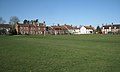
 East corner of the Green, Aldborough - geograph.org.uk - 2370237.jpg 1,280 × 768; 342 KB
-
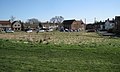
 Grassland east of Aldborough Mill - geograph.org.uk - 2368572.jpg 1,280 × 960; 381 KB
-

-
 Methodist Chapel - geograph.org.uk - 521097.jpg 480 × 640; 67 KB
-
 Old House (rear) on edge of Aldborough - geograph.org.uk - 506791.jpg 640 × 469; 102 KB
-
 Older houses on the Green, Aldborough - geograph.org.uk - 2370241.jpg 1,280 × 768; 342 KB
-
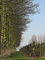
 Orchard southwest of Aldborough - geograph.org.uk - 2368487.jpg 1,280 × 853; 430 KB
-
 Orchard southwest of Aldborough - geograph.org.uk - 2370256.jpg 1,280 × 960; 652 KB
-
 South corner of the Green, Aldborough - geograph.org.uk - 2370260.jpg 1,280 × 960; 430 KB
-

-
 Thwaite Road approaching Aldborough - geograph.org.uk - 2368545.jpg 1,280 × 960; 457 KB
-
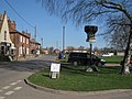
 Villagers chat at Aldborough Mill - geograph.org.uk - 2368589.jpg 1,280 × 853; 294 KB
-
 West side of the Green, Aldborough - geograph.org.uk - 2370215.jpg 1,280 × 768; 270 KB
-
 Chapel Road - geograph.org.uk - 521103.jpg 640 × 480; 95 KB
-
 Fruit trees - geograph.org.uk - 452242.jpg 480 × 640; 169 KB


_on_edge_of_Aldborough_-_geograph.org.uk_-_506791.jpg)


