Category:Aldwincle
English: Aldwincle is a village in the east of the county of Northamptonshire, England. It is on a bend of the River Nene not far from Thrapston.
village in Northamptonshire, United Kingdom  | |||||
| Upload media | |||||
| Instance of | |||||
|---|---|---|---|---|---|
| Location | Aldwincle | ||||
 | |||||
Subcategories
This category has the following 4 subcategories, out of 4 total.
A
- All Saints' church, Aldwincle (14 F)
L
- Lyveden New Bield (45 F)
- Lyveden Old Bield (1 F)
P
- St Peter's church, Aldwincle (8 F)
Media in category "Aldwincle"
The following 91 files are in this category, out of 91 total.
-
 5 Cross Lane, Aldwincle (geograph 6670403).jpg 1,024 × 768; 237 KB
-
 Aldwincle Lodge - geograph.org.uk - 49324.jpg 640 × 480; 126 KB
-
 Aldwincle Road - geograph.org.uk - 4169403.jpg 1,024 × 683; 359 KB
-
 Aldwincle side road - geograph.org.uk - 4499302.jpg 480 × 640; 92 KB
-
 Aldwincle, south-west from All Saints' Church - geograph.org.uk - 3063598.jpg 1,024 × 757; 1.1 MB
-
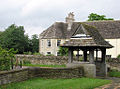 Aldwincle- lychgate and Old Rectory (geograph 3063601).jpg 1,024 × 762; 1.1 MB
-
 At the A6116 junction to Aldwincle - geograph.org.uk - 2510314.jpg 2,048 × 1,536; 1.49 MB
-
 Baptist Church, Aldwincle (geograph 6669485).jpg 1,024 × 768; 164 KB
-
 Baulks Lane, Aldwincle - geograph.org.uk - 1377975.jpg 640 × 480; 116 KB
-
 Bridge over stream - geograph.org.uk - 4499332.jpg 480 × 640; 120 KB
-
 Bridle Way - geograph.org.uk - 4499313.jpg 480 × 640; 91 KB
-
 Bridle Way - geograph.org.uk - 4499315.jpg 480 × 640; 77 KB
-
 Bridle Way - geograph.org.uk - 4499319.jpg 480 × 640; 103 KB
-
 Bridle Way signs - geograph.org.uk - 4499325.jpg 480 × 640; 76 KB
-
 Bridleway and woodland edge - geograph.org.uk - 6250138.jpg 1,024 × 768; 269 KB
-
 Bridleway to Lyveden - geograph.org.uk - 6250116.jpg 1,024 × 768; 176 KB
-
 Byway Heading Towards Aldwincle - geograph.org.uk - 1024045.jpg 640 × 480; 78 KB
-
 Byway to Islip - geograph.org.uk - 6250178.jpg 1,024 × 768; 199 KB
-
 Byway west of Aldwincle - geograph.org.uk - 3271573.jpg 2,592 × 1,944; 2.13 MB
-
 Cattle - geograph.org.uk - 4499305.jpg 640 × 480; 64 KB
-
 Cattle a bit close^ - geograph.org.uk - 4499308.jpg 640 × 480; 90 KB
-
 Cross Lane near Aldwincle - geograph.org.uk - 6250149.jpg 1,024 × 768; 296 KB
-
 Dryden House (geograph 4169343).jpg 1,024 × 683; 255 KB
-
 Dryden House, Aldwincle (geograph 6250175).jpg 1,024 × 768; 201 KB
-
 Entering Aldwincle from the north - geograph.org.uk - 2510265.jpg 2,048 × 1,536; 1.46 MB
-
 Field view - geograph.org.uk - 4499309.jpg 640 × 480; 95 KB
-
 Field view - geograph.org.uk - 4499310.jpg 480 × 640; 96 KB
-
 Field view - geograph.org.uk - 4499314.jpg 640 × 480; 57 KB
-
 Field view - geograph.org.uk - 4499321.jpg 640 × 480; 75 KB
-
 Field view - geograph.org.uk - 4499324.jpg 480 × 640; 103 KB
-
 Field view - geograph.org.uk - 4499329.jpg 640 × 480; 101 KB
-
 Field view - geograph.org.uk - 4499331.jpg 640 × 480; 84 KB
-
 Field view - geograph.org.uk - 4499333.jpg 480 × 640; 102 KB
-
 Fields north of Islip - geograph.org.uk - 3271555.jpg 2,592 × 1,944; 1.86 MB
-
 Fishing Lake near Islip - geograph.org.uk - 1377977.jpg 640 × 480; 66 KB
-
 Footpath alongside Lady Wood - geograph.org.uk - 6250121.jpg 1,024 × 768; 175 KB
-
 Ford at Thorpe Waterville - geograph.org.uk - 3019861.jpg 3,264 × 2,448; 3.23 MB
-
 Garden Earthworks – Lyvendon New Bield - geograph.org.uk - 3752540.jpg 640 × 427; 265 KB
-
 Geese near Islip - geograph.org.uk - 1377978.jpg 640 × 480; 56 KB
-
 Hawthorn in full flower - geograph.org.uk - 3752520.jpg 640 × 427; 158 KB
-
 Heading downhill near Lowick - geograph.org.uk - 2510306.jpg 2,048 × 1,536; 1.25 MB
-
 Leaving Aldwincle for Islip - geograph.org.uk - 2510278.jpg 2,048 × 1,536; 1.59 MB
-
 Lyveden Cottage, Harley Way, Brigstock - geograph.org.uk - 5529550.jpg 5,184 × 3,456; 6.34 MB
-
 Lyveden New Bield , Part of the moat - geograph.org.uk - 2000268.jpg 640 × 480; 101 KB
-
 Lyveden New Bield - geograph.org.uk - 2000280.jpg 640 × 480; 98 KB
-
 Lyveden New Bield - geograph.org.uk - 3703946.jpg 640 × 427; 145 KB
-
 Lyveden New Bield - geograph.org.uk - 6290331.jpg 4,000 × 3,000; 4.71 MB
-
 Lyveden New Bield - geograph.org.uk - 6290336.jpg 4,000 × 3,000; 4.57 MB
-
 Lyveden New Bield - geograph.org.uk - 6290341.jpg 4,000 × 3,000; 4.63 MB
-
 Lyveden New Bield across the moat - geograph.org.uk - 2028524.jpg 1,280 × 960; 627 KB
-
 Lyveden New Bield moat - geograph.org.uk - 6290346.jpg 4,000 × 3,000; 6.33 MB
-
 Lyveden New Bield moat - geograph.org.uk - 6290352.jpg 4,000 × 3,000; 7.54 MB
-
 Lyveden New Bield moat - geograph.org.uk - 6290365.jpg 4,000 × 3,000; 7.68 MB
-
 Lyveden New Bield moat - geograph.org.uk - 6290371.jpg 4,000 × 3,000; 4.57 MB
-
 Lyveden New Bield moat and snail mound - geograph.org.uk - 6290459.jpg 4,000 × 3,000; 6.85 MB
-
 Lyveden New Bield – the gardens - geograph.org.uk - 3752529.jpg 640 × 427; 213 KB
-
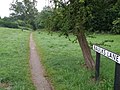
 Lyveden Way - geograph.org.uk - 4499318.jpg 480 × 640; 133 KB
-
 Marvellous chimneys - geograph.org.uk - 4499304.jpg 480 × 640; 66 KB
-
 Moat and viewing mount at Lyveden - geograph.org.uk - 2028513.jpg 1,280 × 960; 657 KB
-
 Moat and viewing mount at Lyveden New Bield - geograph.org.uk - 2028533.jpg 1,280 × 960; 636 KB
-
 Moat and viewing mount at Lyveden New Bield - geograph.org.uk - 2029903.jpg 1,280 × 960; 615 KB
-
 Moat at Lyveden New Bield - geograph.org.uk - 2028540.jpg 1,280 × 960; 649 KB
-
 Moat at Lyveden New Bield - geograph.org.uk - 3703935.jpg 640 × 427; 208 KB
-
 North-west from Lyveden New Bield - geograph.org.uk - 4302203.jpg 1,024 × 768; 1.39 MB
-
 Northern moat at Lyveden - geograph.org.uk - 2028549.jpg 1,280 × 960; 654 KB
-
 Path near Aldwincle - geograph.org.uk - 4499334.jpg 480 × 640; 145 KB
-
 Random Bench - geograph.org.uk - 4499326.jpg 480 × 640; 67 KB
-
 Random Bench - geograph.org.uk - 4499328.jpg 640 × 480; 104 KB
-
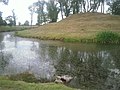
 Reflections at Lyveden - geograph.org.uk - 2029895.jpg 1,280 × 960; 656 KB
-
 River Nene - geograph.org.uk - 4169399.jpg 1,024 × 683; 205 KB
-
 River Nene sweeps round a bend - geograph.org.uk - 312909.jpg 640 × 480; 150 KB
-
 Sharp bend ahead on the lane from Aldwincle - geograph.org.uk - 2510301.jpg 2,048 × 1,536; 1.34 MB
-
 Sign Post in Aldwincle - geograph.org.uk - 1377973.jpg 640 × 480; 131 KB
-
 Spring Flowers, Venue Lyveden New Bield - geograph.org.uk - 1886622.jpg 4,288 × 2,848; 5.72 MB
-
 Straw bales at Aldwincle - geograph.org.uk - 6250160.jpg 1,024 × 768; 183 KB
-
 The lane to Islip - geograph.org.uk - 2510284.jpg 2,048 × 1,536; 1.53 MB
-
 The Manse, Aldwincle (geograph 6670373).jpg 1,024 × 768; 141 KB
-
 The moat at Lyveden New Bield - geograph.org.uk - 5020810.jpg 1,920 × 1,080; 686 KB
-
 The orchard at Lyveden New Beild - geograph.org.uk - 3501947.jpg 800 × 533; 151 KB
-
 The River Nene East of Aldwincle - geograph.org.uk - 322073.jpg 640 × 480; 131 KB
-
 The road to Aldwincle - geograph.org.uk - 3271561.jpg 2,592 × 1,944; 1.36 MB
-
 The road to Aldwincle - geograph.org.uk - 3271588.jpg 2,592 × 1,944; 1.82 MB
-
 The road to Islip - geograph.org.uk - 3271578.jpg 2,592 × 1,944; 1.36 MB
-
 Trains Passed This Way - geograph.org.uk - 1024029.jpg 640 × 480; 126 KB
-
 Tree - geograph.org.uk - 4499311.jpg 480 × 640; 141 KB
-
 UK Aldwincle.jpg 671 × 1,715; 280 KB
-
 Valley of the strawstacks near Aldwincle - geograph.org.uk - 6250154.jpg 1,024 × 768; 185 KB
-
 View toward Aldwincle church - geograph.org.uk - 386900.jpg 640 × 480; 82 KB
-
 View towards Lyveden Manor - geograph.org.uk - 2445597.jpg 640 × 480; 61 KB
-
 Young rams grazing in Aldwincle - geograph.org.uk - 1377974.jpg 640 × 480; 106 KB
-
 The Drift Road - geograph.org.uk - 49323.jpg 640 × 480; 144 KB
.jpg)


.jpg)

.jpg)


.jpg)
.jpg)


.jpg)


