Category:All Saints' church, Feering
| Object location | | View all coordinates using: OpenStreetMap |
|---|
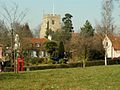
Grade I listed church in Feering, Essex, England, UK  | |||||
| Upload media | |||||
| Instance of | |||||
|---|---|---|---|---|---|
| Dedicated to | |||||
| Location | Feering, Braintree, Essex, East of England, England | ||||
| Diocese | |||||
| Heritage designation |
| ||||
| Inception |
| ||||
| Religion or worldview | |||||
 | |||||
Media in category "All Saints' church, Feering"
The following 3 files are in this category, out of 3 total.
-
 All Saints Church, Feering, Essex (geograph 2010349).jpg 640 × 452; 98 KB
-
 All Saints' church, Feering - geograph.org.uk - 4613522.jpg 4,320 × 3,240; 3.88 MB
-
 Feering, Essex - geograph.org.uk - 137313.jpg 640 × 480; 102 KB
.jpg)
