Category:All Saints Church, St Paul's Walden
| Object location | | View all coordinates using: OpenStreetMap |
|---|
church in St Paul's Walden, Hertfordshire .jpg) | |||||
| Upload media | |||||
| Instance of | |||||
|---|---|---|---|---|---|
| Dedicated to | |||||
| Location | St Paul's Walden, North Hertfordshire, Hertfordshire, East of England, England | ||||
| Diocese | |||||
| Heritage designation |
| ||||
| Inception |
| ||||
| Religion or worldview | |||||
 | |||||
Subcategories
This category has only the following subcategory.
I
Media in category "All Saints Church, St Paul's Walden"
The following 16 files are in this category, out of 16 total.
-
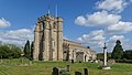
 All Saints, St Paul's Walden, Herts - geograph.org.uk - 443328.jpg 640 × 426; 95 KB
-
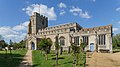
 All Saints, St Paul's Walden 2017-04-23 1.jpg 5,512 × 3,101; 6.62 MB
-
 All Saints, St Paul's Walden 2017-04-23 2.jpg 5,857 × 3,295; 8.42 MB
-
 Church of All Saints, St Paul's Walden (8792516019).jpg 4,288 × 3,216; 4.26 MB
-
 Church of All Saints, St Paul's Walden (8803093376).jpg 4,288 × 3,216; 4.47 MB
-
 GOC St Paul's Walden 065 Church of All Saints, St Paul's Walden (8753596171).jpg 4,288 × 3,216; 3.65 MB
-
 GOC St Paul's Walden 066 Church of All Saints, St Paul's Walden (8756344187).jpg 4,288 × 3,216; 4.49 MB
-
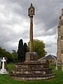 GOC St Paul's Walden 067 Memorial at All Saints Church, St Paul's Walden (8756344677).jpg 2,880 × 3,842; 2.56 MB
-

-

-

-
 GOC St Paul's Walden 086 Church of All Saints, St Paul's Walden (8775755313).jpg 4,288 × 3,216; 4.32 MB
-
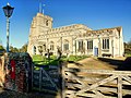 All Saints St Pauls Walden - geograph.org.uk - 1576195.jpg 640 × 480; 112 KB
-
 All Saints, St Paul's Walden, Herts - geograph.org.uk - 433353.jpg 416 × 640; 88 KB
-

-


.jpg)
.jpg)
.jpg)
.jpg)
.jpg)
.jpg)
.jpg)
.jpg)


