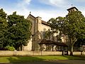
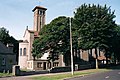
Category:All Souls' Church, Springwood
| Camera location | | View all coordinates using: OpenStreetMap |
|---|
church building in Springwood, Liverpool, Merseyside, England, UK .jpg) | |||||
| Upload media | |||||
| Instance of | |||||
|---|---|---|---|---|---|
| Dedicated to | |||||
| Location | Liverpool, Merseyside, North West England, England | ||||
| Diocese | |||||
| Heritage designation |
| ||||
| Religion or worldview | |||||
 | |||||
Media in category "All Souls' Church, Springwood"
The following 9 files are in this category, out of 9 total.
-
 All Souls Church tower, Springwood 2016.jpg 3,306 × 3,643; 9.07 MB
-
 All Souls Church, Mather Avenue, Allerton (geograph 3147376).jpg 1,024 × 683; 85 KB
-
 All Souls Church, Springwood 2016(1).jpg 4,095 × 2,819; 7.38 MB
-
 All Souls Church, Springwood 2016(2).jpg 4,137 × 3,101; 8.49 MB
-
 All Souls, Springwood - geograph.org.uk - 48765.jpg 427 × 640; 82 KB
-
 All Souls, Springwood - geograph.org.uk - 48768.jpg 640 × 427; 91 KB
-
 Benchmark at All Souls Springwood.jpg 4,340 × 2,855; 9.17 MB
-
 Church hall, All Souls Springwood.jpg 4,795 × 3,134; 10.71 MB
-
 Foundation stone of All Souls Springwood.jpg 4,470 × 3,138; 11.92 MB

.jpg)
.jpg)


