Category:Almora district
district of Uttarakhand, India  .svg) | |||||
| Upload media | |||||
| Instance of | |||||
|---|---|---|---|---|---|
| Location |
| ||||
| Capital | |||||
| Population |
| ||||
| Area |
| ||||
| Elevation above sea level |
| ||||
| official website | |||||
 | |||||
Subcategories
This category has the following 7 subcategories, out of 7 total.
B
- Binsar Wildlife Sanctuary (17 F)
D
L
- Lakhudiyar Caves (14 F)
P
S
- Sun Temple, Katarmal (22 F)
Y
- Yudh Abhyas 2007 (6 F)
- Yudh Abhyas 2018 (5 F)
Media in category "Almora district"
The following 44 files are in this category, out of 44 total.
-
 A House in the hand of Earth.jpg 4,608 × 2,592; 4.78 MB
-
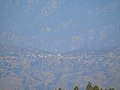
 A view of a village near Almora district of Uttarakhand, north India.jpg 1,944 × 2,592; 1.08 MB
-
 Almora district history.png 3,833 × 1,439; 204 KB
-
 Almora population.png 1,287 × 710; 106 KB
-
 Bhumiya tample Almora uttarakhand.jpg 1,024 × 768; 195 KB
-
 Chaukhutia bridge.JPG 2,592 × 1,944; 1.04 MB
-
 Chaukhutia valley.JPG 1,600 × 1,200; 691 KB
-
 Chauna1983A.jpg 1,016 × 764; 93 KB
-
 Chauna1983B.jpg 1,016 × 692; 84 KB
-
 Child in Uttarakhand District, India (3386099895).jpg 4,288 × 2,848; 7.84 MB
-
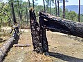
 Chir pine trees felled by fire .jpg 3,200 × 2,400; 5.11 MB
-
 Chir pine trees felled by fire 2.jpg 3,200 × 2,400; 5 MB
-
 Chir pine trees felled by forest fires .jpg 3,200 × 2,400; 3.16 MB
-
 Corbett 13.jpg 2,592 × 1,456; 1.22 MB
-
 Dhukane, Uttarakhand 263135, India - panoramio.jpg 3,264 × 2,448; 3.14 MB
-

-

-
 GIC Jaurasi.jpg 4,208 × 2,368; 3.54 MB
-
 Gwalbina.jpg 1,280 × 960; 124 KB
-
 Hawal Bagh, near Almora.jpg 976 × 690; 217 KB
-
 Himalaya (69086465).jpeg 2,048 × 814; 399 KB
-
 Kaphal (काफल) Myrica esculenta, fruit being sold near Almora.jpeg 3,200 × 2,400; 2.67 MB
-
 Kosi River valley near Almora, Uttarakhand, India.jpg 3,393 × 2,023; 4.84 MB
-
 Mahtgaon - panoramio.jpg 1,600 × 1,200; 508 KB
-
 Malla Lamkot village of Almora district.jpg 1,600 × 1,200; 587 KB
-
 Mountain Ranges (65436733).jpeg 2,048 × 1,152; 650 KB
-
 Nagchula.jpg 5,152 × 3,864; 6.16 MB
-
 NAROLA- Mahtgaon - panoramio.jpg 1,600 × 1,200; 269 KB
-
 NATURE IS A ALL BEAUTY MOTHER.jpg 590 × 1,280; 204 KB
-
 New Basti Bridge - panoramio.jpg 1,200 × 1,600; 547 KB
-
 P05-01-15 10-26-2 almora.jpg 640 × 480; 110 KB
-
 Pandukholi View.jpg 720 × 407; 24 KB
-
 Pandukholi.jpg 720 × 407; 25 KB
-

-
 Seen - panoramio.jpg 1,600 × 1,200; 464 KB
-
 Sunset At Danya (133534269).jpeg 2,048 × 1,529; 788 KB
-
 UTC bus.jpg 1,691 × 873; 551 KB
-
 ValleyView.jpg 4,640 × 3,480; 4.85 MB
-
 View from Asur Garhi.jpg 1,280 × 928; 104 KB
-
 View of Jaurasi.jpg 4,208 × 2,368; 2.22 MB
-
 Village Malli Kiroli.jpg 960 × 541; 130 KB
-
 Women Washing Cloths (52946544).jpeg 2,048 × 1,308; 794 KB
-
 Yudh Abhyas 2018 1.jpg 3,773 × 2,515; 1.47 MB
-
 महादेव.jpg 1,208 × 1,076; 349 KB


.jpg)


_(page_1_crop).jpg)


_Myrica_esculenta,_fruit_being_sold_near_Almora.jpeg)


.jpeg)


.jpg)

.jpeg)


.jpeg)


.jpeg)