Category:Alnmouth
coastal village in Northumberland, England, UK  | |||||
| Upload media | |||||
| Instance of | |||||
|---|---|---|---|---|---|
| Location | Northumberland, North East England, England | ||||
| Said to be the same as | Alnmouth | ||||
 | |||||
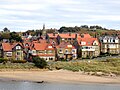
English: Alnmouth ( south-east of Alnwick.
Italiano: Alnmouth è un piccolo centro urbano della regione di Northumberland, nel nord dell'Inghilterra. Affianca la strada principale A1068 per Ashington, circa 4 miglia, quasi 6.5 km, a sud-est di Alnwick.
Nederlands: Alnmouth is een dorp en civil parish in het graafschap Northumberland in het noordoosten van Engeland aan de mond van de rivier de Aln. Het ligt ongeveer zeven kilometer ten zuidoosten van Alnwick. In het verleden is het een belangrijke handelsplaats geweest, vooral voor de export van graan. Het dorp is tegenwoordig een populaire toeristische bestemming en maakt deel uit van de beschermde kust van Northumberland, een gebied van grote natuurlijke schoonheid.
Subcategories
This category has the following 13 subcategories, out of 13 total.
2
A
- Alnmouth beach (42 F)
- Alnmouth harbour (10 F)
- Alnmouth Methodist Church (8 F)
- Alnmouth Post Office (4 F)
- Alnmouth railway station (88 F)
- Alnmouth War Memorial (6 F)
D
- Duchess Bridge, Alnmouth (15 F)
H
- Hindmarsh Hall, Alnmouth (4 F)
J
P
- Pubs in Alnmouth (15 F)
S
- Schooner Hotel (3 F)
Media in category "Alnmouth"
The following 200 files are in this category, out of 658 total.
(previous page) (next page)-
 ... tide coming in, better move. - Flickr - BazzaDaRambler.jpg 4,932 × 1,100; 675 KB
-
 1-4 Victoria Place with Attached Wall to North West.jpg 5,568 × 3,712; 16.06 MB
-
 14, Northumberland Street.jpg 5,568 × 3,712; 15.27 MB
-
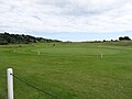 18th Green, Alnmouth Village Golf Course - geograph.org.uk - 5148252.jpg 1,066 × 800; 176 KB
-
 7 And 7A, Northumberland Street.jpg 4,736 × 3,157; 9.66 MB
-
 A Bend in the River - geograph.org.uk - 185191.jpg 640 × 480; 82 KB
-
 A cloud of Painted Lady (Vanessa cardui) butterflies - geograph.org.uk - 6225294.jpg 1,600 × 1,004; 368 KB
-
 A field of oilseed rape - geograph.org.uk - 3499429.jpg 3,872 × 2,592; 4.17 MB
-
 A grand modern house at Alnmouth - geograph.org.uk - 5083261.jpg 480 × 640; 175 KB
-
 A grey day in Alnmouth Bay - geograph.org.uk - 4335822.jpg 1,600 × 1,198; 324 KB
-
 A hardy soul on the river - geograph.org.uk - 4335935.jpg 1,600 × 1,164; 189 KB
-
 A view over the golf links, Alnmouth - geograph.org.uk - 5083562.jpg 640 × 480; 213 KB
-

-
 A1068 at High Buston turn - geograph.org.uk - 5836032.jpg 1,024 × 696; 70 KB
-
 A1068 heading north towards Alnmouth - geograph.org.uk - 3049839.jpg 640 × 480; 79 KB
-
 A1068 heading south - geograph.org.uk - 3067635.jpg 640 × 480; 60 KB
-
 A1068 southbound - geograph.org.uk - 3903852.jpg 640 × 480; 53 KB
-
 Abandoned boat at Alnmouth - geograph.org.uk - 1423706.jpg 640 × 480; 114 KB
-
 Above the Aln - geograph.org.uk - 6308258.jpg 1,024 × 683; 505 KB
-

-
 Across the Aln - geograph.org.uk - 6227278.jpg 2,560 × 1,440; 1.83 MB
-
 Across the Aln Mouth - geograph.org.uk - 5065141.jpg 640 × 390; 92 KB
-
 Across the river - geograph.org.uk - 2455838.jpg 4,288 × 3,216; 1.36 MB
-
 Across to Alnmouth - geograph.org.uk - 5065122.jpg 640 × 427; 99 KB
-
 Afternoon snow scene. Follow this path - panoramio.jpg 4,320 × 3,240; 5.07 MB
-
 Alm House.jpg 2,780 × 3,707; 7.27 MB
-
 Almouth Common with paragliders - geograph.org.uk - 5083543.jpg 480 × 640; 154 KB
-
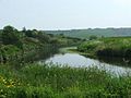
 Aln estuary - geograph.org.uk - 1518677.jpg 640 × 427; 197 KB
-
 Aln Estuary - geograph.org.uk - 1860626.jpg 640 × 480; 64 KB
-
 Aln Estuary - geograph.org.uk - 4153937.jpg 640 × 428; 71 KB
-
 Aln estuary - geograph.org.uk - 4153967.jpg 640 × 428; 79 KB
-
 Aln estuary - geograph.org.uk - 4153983.jpg 640 × 428; 65 KB
-
 Aln Estuary and Church Hill, Alnmouth - geograph.org.uk - 5340545.jpg 4,320 × 2,880; 5.37 MB
-
 Aln Estuary Saltmarsh - geograph.org.uk - 5340553.jpg 4,320 × 2,880; 5.34 MB
-
 Aln Estuary, Alnmouth - geograph.org.uk - 5821562.jpg 1,600 × 1,067; 438 KB
-
 Alnmouth (2021-05-25) 05.jpg 5,568 × 3,712; 17.1 MB
-
 Alnmouth (2021-05-25) 07.jpg 5,568 × 3,712; 16.07 MB
-
 Alnmouth (2021-05-25) 08.jpg 5,568 × 3,712; 15.42 MB
-
 Alnmouth (2021-05-25) 09.jpg 5,568 × 3,712; 12.99 MB
-
 Alnmouth (2021-05-25) 10.jpg 5,568 × 3,712; 16.98 MB
-
 Alnmouth (2021-05-25) 11.jpg 3,712 × 5,568; 15.84 MB
-
 Alnmouth (2021-05-25) 12.jpg 5,568 × 3,712; 14.87 MB
-
 Alnmouth (2021-05-25) 13.jpg 5,568 × 3,712; 13.64 MB
-
 Alnmouth (2021-05-25) 14.jpg 5,568 × 3,712; 13.35 MB
-
 Alnmouth (2021-05-25) 15.jpg 5,568 × 3,712; 15.03 MB
-
 Alnmouth (2021-05-25) 16.jpg 5,568 × 3,712; 14.61 MB
-
 Alnmouth (2021-05-25) 17.jpg 3,712 × 5,568; 15.81 MB
-
 Alnmouth (2021-05-25) 18.jpg 3,712 × 5,568; 16.43 MB
-
 Alnmouth (2021-05-25) 19.jpg 5,568 × 3,712; 15.3 MB
-
 Alnmouth (2021-05-25) 20.jpg 5,568 × 3,712; 15.72 MB
-
 Alnmouth (2021-05-25) 21.jpg 3,712 × 5,568; 15.67 MB
-
 Alnmouth (2021-05-25) 22.jpg 3,712 × 5,568; 14.98 MB
-
 Alnmouth (2021-05-25) 25.jpg 5,568 × 3,712; 16.39 MB
-
 Alnmouth (2021-05-25) 26.jpg 5,568 × 3,712; 13.86 MB
-
 Alnmouth (2021-05-25) 27.jpg 5,568 × 3,712; 15.34 MB
-
 Alnmouth (2021-05-25) 28.jpg 5,568 × 3,712; 13.56 MB
-
 Alnmouth (View from the old ferry hut over to Church Hill.) - panoramio.jpg 4,320 × 3,240; 5.63 MB
-
 Alnmouth (view from the top of Bracken Hill) - panoramio.jpg 3,240 × 4,320; 5.02 MB
-
 Alnmouth (view of Church Hill beside the little beach) - panoramio.jpg 4,320 × 3,240; 4.96 MB
-
 Alnmouth - 1981 - geograph.org.uk - 2244796.jpg 2,272 × 1,521; 619 KB
-
 Alnmouth - 1981 - geograph.org.uk - 2244801.jpg 2,272 × 1,521; 428 KB
-
 Alnmouth - 1981 - geograph.org.uk - 2244803.jpg 2,272 × 1,515; 555 KB
-
 Alnmouth - 1983 - geograph.org.uk - 2733183.jpg 2,272 × 1,515; 560 KB
-
 Alnmouth - 1986 - geograph.org.uk - 2258555.jpg 2,272 × 1,515; 233 KB
-
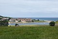
 Alnmouth - geograph.org.uk - 138041.jpg 640 × 419; 71 KB
-
 Alnmouth - geograph.org.uk - 5082686.jpg 640 × 480; 190 KB
-
 Alnmouth - geograph.org.uk - 5266565.jpg 640 × 427; 421 KB
-
 Alnmouth - geograph.org.uk - 5831092.jpg 5,472 × 3,648; 5.09 MB
-
 Alnmouth - geograph.org.uk - 62231.jpg 640 × 481; 82 KB
-
 Alnmouth - geograph.org.uk - 924161.jpg 640 × 274; 41 KB
-
 Alnmouth - Northumberland - 2005-06-25.jpg 1,449 × 401; 123 KB
-
 Alnmouth 19th century photograph 1.jpg 3,173 × 2,085; 951 KB
-
 Alnmouth 19th century photograph 2.jpg 3,228 × 2,124; 942 KB
-
 Alnmouth 19th century photograph 3.jpg 3,224 × 2,126; 949 KB
-
 Alnmouth 21st century.jpg 3,172 × 2,084; 1.69 MB
-
 Alnmouth across the River Aln - geograph.org.uk - 1511901.jpg 640 × 426; 193 KB
-
 Alnmouth and Church Hill - geograph.org.uk - 2982146.jpg 3,200 × 2,400; 2.49 MB
-
 Alnmouth and Church Hill - geograph.org.uk - 4441016.jpg 1,600 × 997; 211 KB
-
 Alnmouth and mouth of the River Aln - geograph.org.uk - 3331554.jpg 1,600 × 1,190; 405 KB
-
 Alnmouth and the Aln Estuary - geograph.org.uk - 4441007.jpg 1,600 × 1,145; 269 KB
-
 Alnmouth and the Aln estuary - geograph.org.uk - 6324420.jpg 3,264 × 2,448; 2.32 MB
-
 Alnmouth and the Aln Estuary - geograph.org.uk - 889333.jpg 640 × 480; 46 KB
-
 Alnmouth and Village Golf Course - geograph.org.uk - 2981348.jpg 1,600 × 1,200; 414 KB
-
 Alnmouth Battery - geograph.org.uk - 5083594.jpg 640 × 480; 230 KB
-
 Alnmouth Bay - geograph.org.uk - 1515029.jpg 640 × 427; 183 KB
-
 Alnmouth Bay - geograph.org.uk - 1515045.jpg 640 × 427; 160 KB
-
 Alnmouth Bay - geograph.org.uk - 17602.jpg 640 × 480; 100 KB
-
 Alnmouth Bay - geograph.org.uk - 2880271.jpg 3,648 × 2,736; 1.99 MB
-
 Alnmouth Bay - geograph.org.uk - 4153942.jpg 640 × 428; 61 KB
-
 Alnmouth bay - geograph.org.uk - 4153954.jpg 640 × 428; 76 KB
-
 Alnmouth Bay and Estuary - geograph.org.uk - 4288260.jpg 1,066 × 800; 107 KB
-
 Alnmouth Bay at low tide - geograph.org.uk - 5824596.jpg 4,000 × 3,000; 2.95 MB
-
 Alnmouth Bay with the tide out - geograph.org.uk - 2848181.jpg 1,600 × 1,200; 296 KB
-
 Alnmouth Camping Huts - geograph.org.uk - 6067603.jpg 1,600 × 1,011; 297 KB
-
 Alnmouth Camping Huts - Shoreside - geograph.org.uk - 6067595.jpg 1,600 × 947; 310 KB
-
 Alnmouth Cemetery - geograph.org.uk - 3501445.jpg 3,872 × 2,592; 4.2 MB
-
 Alnmouth Cemetery - geograph.org.uk - 4156967.jpg 2,048 × 1,536; 751 KB
-
 Alnmouth Debating society - geograph.org.uk - 875796.jpg 640 × 400; 77 KB
-
 Alnmouth Dunes and salt marsh - geograph.org.uk - 2985415.jpg 1,600 × 1,203; 345 KB
-
 Alnmouth Estuary - geograph.org.uk - 943472.jpg 640 × 471; 93 KB
-
 Alnmouth from a train - geograph.org.uk - 5435031.jpg 640 × 341; 95 KB
-
 Alnmouth from a train - geograph.org.uk - 5435034.jpg 640 × 366; 115 KB
-
 Alnmouth from Chapel Hill - geograph.org.uk - 1856267.jpg 2,835 × 963; 434 KB
-
 Alnmouth from Church Hill - geograph.org.uk - 6226975.jpg 2,450 × 1,379; 1.6 MB
-
 Alnmouth from Church Hill - geograph.org.uk - 6347403.jpg 1,024 × 768; 393 KB
-
 Alnmouth from Church Hill - geograph.org.uk - 6347469.jpg 1,024 × 768; 258 KB
-

-

-
 Alnmouth from the west - geograph.org.uk - 4845795.jpg 1,024 × 678; 112 KB
-
 Alnmouth golf club - geograph.org.uk - 4153977.jpg 640 × 428; 57 KB
-
 Alnmouth Golf Course - geograph.org.uk - 3814176.jpg 2,482 × 1,917; 662 KB
-
 Alnmouth Golf Course - geograph.org.uk - 5182156.jpg 640 × 480; 51 KB
-
 Alnmouth Golf Course - geograph.org.uk - 5266572.jpg 640 × 426; 392 KB
-
 Alnmouth Golf Course - geograph.org.uk - 5267254.jpg 640 × 426; 294 KB
-
 Alnmouth Golf Course - geograph.org.uk - 5780504.jpg 2,592 × 1,944; 1.39 MB
-
 Alnmouth Golf Course and Beach - geograph.org.uk - 5148265.jpg 1,813 × 800; 185 KB
-
 Alnmouth in evening sunshine - geograph.org.uk - 5082682.jpg 640 × 480; 198 KB
-
 Alnmouth links - geograph.org.uk - 4932937.jpg 3,072 × 1,728; 994 KB
-
 Alnmouth Links - geograph.org.uk - 6234987.jpg 1,024 × 683; 417 KB
-
 Alnmouth MMB 01.jpg 4,662 × 2,595; 2.87 MB
-
 Alnmouth on a sunny morning - geograph.org.uk - 3530380.jpg 3,900 × 2,110; 2.74 MB
-
 Alnmouth panorama - Flickr - BazzaDaRambler.jpg 2,696 × 1,090; 403 KB
-
 Alnmouth Pant - geograph.org.uk - 3823649.jpg 900 × 1,200; 269 KB
-
 Alnmouth parking - geograph.org.uk - 3814184.jpg 3,264 × 2,448; 4.23 MB
-
 Alnmouth tideline - geograph.org.uk - 4220582.jpg 4,280 × 2,551; 1.52 MB
-
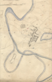 Alnmouth Tithe Map 1843.png 954 × 1,494; 2.54 MB
-
 Alnmouth view - geograph.org.uk - 2455850.jpg 4,288 × 3,216; 1.65 MB
-
 Alnmouth viewed across the River Aln - geograph.org.uk - 4835862.jpg 1,600 × 1,111; 271 KB
-

-
 Alnmouth village - geograph.org.uk - 5964255.jpg 1,600 × 1,067; 357 KB
-
 Alnmouth Village Golf Club - geograph.org.uk - 4148057.jpg 640 × 480; 68 KB
-

-
 Alnmouth Village Golf Course - geograph.org.uk - 1898269.jpg 640 × 480; 79 KB
-
 Alnmouth Village Golf Course - geograph.org.uk - 4281412.jpg 1,600 × 1,243; 377 KB
-
 Alnmouth WV Banner.jpg 2,658 × 380; 793 KB
-
 Alnmouth, across the estuary - geograph.org.uk - 1716302.jpg 800 × 600; 170 KB
-
 Alnmouth, across the mouth of the Aln - geograph.org.uk - 1716278.jpg 800 × 600; 135 KB
-
 Alnmouth, boats on the Aln estuary - geograph.org.uk - 1716294.jpg 800 × 600; 107 KB
-
 Alnmouth, Northumberland ... 50 - Flickr - BazzaDaRambler.jpg 4,340 × 3,260; 1.82 MB
-
 Alnmouth, Northumberland ... a little autumnal calm. - Flickr - BazzaDaRambler.jpg 4,280 × 3,183; 1.49 MB
-
 Alnmouth, Northumberland ... arch. - Flickr - BazzaDaRambler.jpg 4,340 × 3,260; 1.75 MB
-
 Alnmouth, Northumberland ... birdlife. - Flickr - BazzaDaRambler.jpg 4,340 × 3,260; 1.99 MB
-
 Alnmouth, Northumberland ... cloud-sun. - Flickr - BazzaDaRambler.jpg 4,340 × 3,260; 1.27 MB
-
 Alnmouth, Northumberland ... CUTHBERT 684 A.D. - Flickr - BazzaDaRambler.jpg 4,340 × 3,260; 3.29 MB
-
 Alnmouth, Northumberland ... cycle route - Flickr - BazzaDaRambler.jpg 4,340 × 3,260; 1.85 MB
-
 Alnmouth, Northumberland ... dunes. - Flickr - BazzaDaRambler.jpg 4,932 × 1,100; 723 KB
-
 Alnmouth, Northumberland ... evening sun with sheep. - Flickr - BazzaDaRambler.jpg 4,340 × 3,260; 1.21 MB
-
 Alnmouth, Northumberland ... ferry house. - Flickr - BazzaDaRambler.jpg 4,340 × 3,260; 2.05 MB
-
 Alnmouth, Northumberland ... heading for Scotland. - Flickr - BazzaDaRambler.jpg 4,340 × 3,260; 1.16 MB
-
 Alnmouth, Northumberland ... memorial seat. - Flickr - BazzaDaRambler.jpg 4,340 × 3,260; 3.28 MB
-
 Alnmouth, Northumberland ... National Cycle Route 1. - Flickr - BazzaDaRambler.jpg 2,705 × 4,055; 1.91 MB
-
 Alnmouth, Northumberland ... on National Cycle Route 1. - Flickr - BazzaDaRambler.jpg 3,793 × 3,258; 2.43 MB
-
 Alnmouth, Northumberland ... over there. - Flickr - BazzaDaRambler.jpg 4,340 × 3,260; 1.87 MB
-
 Alnmouth, Northumberland ... ripples. - Flickr - BazzaDaRambler.jpg 3,260 × 4,340; 1.65 MB
-
 Alnmouth, Northumberland ... saltmarsh. - Flickr - BazzaDaRambler.jpg 4,340 × 3,260; 2.06 MB
-
 Alnmouth, Northumberland ... scenic mud. - Flickr - BazzaDaRambler.jpg 4,340 × 3,260; 1.78 MB
-
 Alnmouth, Northumberland ... sea coal - Flickr - BazzaDaRambler.jpg 4,340 × 3,260; 4.07 MB
-
 Alnmouth, Northumberland ... SLOW. - Flickr - BazzaDaRambler.jpg 3,150 × 2,550; 1.76 MB
-
 Alnmouth, Northumberland ... the last of summer, probably. - Flickr - BazzaDaRambler.jpg 4,340 × 3,260; 2.4 MB
-
 Alnmouth, Northumberland ... tide's out. - Flickr - BazzaDaRambler.jpg 4,340 × 3,260; 1.31 MB
-

-
 Alnmouth, Northumberland ... water feature. - Flickr - BazzaDaRambler.jpg 4,340 × 3,260; 2.73 MB
-
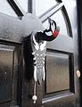 Alnmouth, Northumberland ... woodpecker knocker. - Flickr - BazzaDaRambler.jpg 2,491 × 3,245; 1.48 MB
-
 Alnmouth, Northumberland ... wracked. - Flickr - BazzaDaRambler.jpg 3,260 × 4,340; 2.06 MB
-

-
 Alnmouth, Northumberland from across the river.jpg 2,355 × 1,403; 379 KB
-
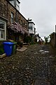
 Alnmouth, Northumberland Street - geograph.org.uk - 1716284.jpg 800 × 600; 138 KB
-
 Alnmouth, Northumberland, UK - panoramio.jpg 320 × 240; 31 KB
-
 Alnmouth, the Aln meets the sea - geograph.org.uk - 1716314.jpg 800 × 588; 106 KB
-
 Alnmouth, the mouth of the Aln - geograph.org.uk - 1716311.jpg 800 × 600; 151 KB
-
 Alnmouth.JPG 1,024 × 678; 206 KB
-
 Alnmoutth Board School - geograph.org.uk - 5083490.jpg 640 × 480; 217 KB
-
 Along Alnmouth Bay - geograph.org.uk - 4153959.jpg 640 × 428; 65 KB
-
 Anti tank defences on Alnmouth bay - geograph.org.uk - 4117192.jpg 2,048 × 1,152; 408 KB
-
 Anti-tank blocks and seat near Alnmouth - geograph.org.uk - 6014083.jpg 800 × 516; 170 KB
-
 Arable field - geograph.org.uk - 6016166.jpg 2,000 × 1,333; 337 KB
-
 Archway to mortuary chapel - geograph.org.uk - 2985146.jpg 750 × 1,000; 220 KB
-
 Armada Beacon, Alnmouth - geograph.org.uk - 1146585.jpg 640 × 480; 38 KB
-
 Barndale Cottage Barndale House.jpg 5,568 × 3,712; 14.59 MB
-
 Battery in the dunes - geograph.org.uk - 4150222.jpg 2,048 × 1,536; 948 KB
-
 Beach Blocks - geograph.org.uk - 6231572.jpg 5,016 × 3,344; 3.51 MB
-
 Beach defence in need of restoration - geograph.org.uk - 6057301.jpg 3,156 × 2,042; 2.21 MB
-
 Beach near Seaton Point - geograph.org.uk - 3210572.jpg 4,320 × 3,240; 2.02 MB
-
 Beach shelter, Alnmouth - geograph.org.uk - 4148051.jpg 640 × 480; 82 KB
-
 Beach south of Alnmouth Bay - geograph.org.uk - 2880760.jpg 2,772 × 2,024; 805 KB
-
 Beach, Buston Links - geograph.org.uk - 4288258.jpg 1,066 × 800; 117 KB
-
 Beacon and bench on Alnmouth Common - geograph.org.uk - 4150226.jpg 2,048 × 1,536; 808 KB
-

-
 Beacon on the common - geograph.org.uk - 5083557.jpg 480 × 640; 197 KB
-
 Bends in the River Aln - geograph.org.uk - 4156963.jpg 2,048 × 1,152; 369 KB
-
 Boat in Alnmouth bay - geograph.org.uk - 4153974.jpg 640 × 428; 66 KB
-
 Boats beside the Aln estuary - geograph.org.uk - 5503905.jpg 640 × 427; 99 KB
-
 Boats on the shore, Alnmouth - geograph.org.uk - 4117201.jpg 2,048 × 1,536; 610 KB
-
 Boggy land inland from the coastal path - geograph.org.uk - 3499733.jpg 3,604 × 2,403; 2.69 MB
-
 Boy on windswept beach - geograph.org.uk - 3639167.jpg 1,000 × 753; 99 KB
-
 Bracken Hill in Winter - panoramio.jpg 4,320 × 3,240; 5.33 MB
-
 Bridleway to A.1068 - geograph.org.uk - 1201500.jpg 640 × 480; 104 KB
-
 Building site, Alnmouth - geograph.org.uk - 4156960.jpg 2,048 × 1,536; 742 KB
-
 Bulldozer in field - geograph.org.uk - 5868154.jpg 640 × 480; 281 KB
-
 Bus stop, Buston - geograph.org.uk - 4553272.jpg 800 × 533; 203 KB


_butterflies_-_geograph.org.uk_-_6225294.jpg)


_05.jpg)
_07.jpg)
_08.jpg)
_09.jpg)
_10.jpg)
_11.jpg)
_12.jpg)
_13.jpg)
_14.jpg)
_15.jpg)
_16.jpg)
_17.jpg)
_18.jpg)
_19.jpg)
_20.jpg)
_21.jpg)
_22.jpg)
_25.jpg)
_26.jpg)
_27.jpg)
_28.jpg)
_-_panoramio.jpg)
_-_panoramio.jpg)
_-_panoramio.jpg)


