Category:Alte Kirche Härkingen
| Object location | | View all coordinates using: OpenStreetMap |
|---|
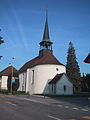
church building in Härkingen in the canton of Solothurn, Switzerland  | |||||
| Upload media | |||||
| Instance of | |||||
|---|---|---|---|---|---|
| Part of | |||||
| Location | Härkingen, Gäu District, Thal-Gäu, Solothurn, Switzerland | ||||
| Street address |
| ||||
| Heritage designation | |||||
 | |||||
Media in category "Alte Kirche Härkingen"
The following 8 files are in this category, out of 8 total.
-
 Haerkingen old church.jpg 320 × 213; 11 KB
-
 Haerkingen preghejoj 159.jpg 2,592 × 3,872; 3.53 MB
-
 HärkingenaKirche.JPG 1,200 × 1,600; 460 KB
-
 Malnova preĝejo Härkingen 167.jpg 3,872 × 2,592; 4.16 MB
-
 Malnova preĝejo Härkingen 173.jpg 3,872 × 2,592; 3.67 MB
-
 Malnova preĝejo Härkingen 179.jpg 2,592 × 3,872; 4.75 MB
-
 Malnova preĝejo Härkingen 180.jpg 3,872 × 2,592; 4.7 MB
-
 Malnova preĝejo kaj fromaghejo Härkingen 148.jpg 3,872 × 2,592; 3.85 MB


