Category:Altläufe der Glatt (Schutzgebiet)
Deutsch: Das Gebiet Altläufe der Glatt ist ein 1970 errichtetes kantonales Naturschutzgebiet an der Glatt im Kanton Zürich.
| Object location | | View all coordinates using: OpenStreetMap |
|---|
nature reserve in Switzerland | |||||
| Upload media | |||||
| Location | Canton of Zürich, Switzerland | ||||
|---|---|---|---|---|---|
 | |||||
Media in category "Altläufe der Glatt (Schutzgebiet)"
The following 42 files are in this category, out of 42 total.
-
 Amphibienlaichgebiet Glattaltlaufgebiet, Rümlang ZH 20170915-jag9889.jpg 3,916 × 2,937; 10.33 MB
-
 Amphibienlaichgebiet im Naturreservat Altläufe der Glatt.jpg 3,558 × 2,592; 4.01 MB
-
 Beobachtungsstand «Naturfenster» im Naturschutzgebiet Altläufe der Glatt.jpg 3,484 × 2,440; 3.43 MB
-
 Bulten im Auwald - Naturschutzgebiet Altläufe der Glatt.jpg 3,444 × 2,614; 3.94 MB
-
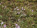 Colchicum autumnale Giessen nature reserve, Oberglatt.jpg 2,530 × 1,920; 2.4 MB
-
 Dipsacus laciniatus, Alpen, Rümlang.jpg 3,354 × 2,568; 2.15 MB
-
 ETH-BIB-Flughafen Zürich-Kloten-LBS H1-015483.tif 6,634 × 4,589; 87.27 MB
-
 ETH-BIB-Rümlang, Glatt-Altwasser (Reservat)-Dia 247-09751.tif 3,714 × 2,872; 30.62 MB
-
 Euonymus europaeus, Solachten nature reserve, Oberglatt.jpg 1,844 × 1,402; 520 KB
-
 Glatt - Rümlang IMG 6880.jpg 2,448 × 3,264; 2.5 MB
-
 Glattkanal bei Rümlang 2023.jpg 3,126 × 2,282; 2.69 MB
-
 Glattkanal im Naturschutzgebiet Altläufe der Glatt 2023.jpg 3,024 × 2,346; 2.39 MB
-
 Glattkanal mit Uferbefestigung bei Oberglatt 2023.jpg 3,560 × 2,664; 4.56 MB
-
 Glattkanal Naturschutzgebiet Flugzeug.jpg 3,316 × 2,414; 2.67 MB
-
 Glattkanal Rümlang Drainagerohr Alpen.jpg 3,038 × 2,324; 2.76 MB
-
 Glattkanal, Station Erdgas Ostschweiz, Eberhard AG, Rümlang.jpg 3,402 × 2,582; 3.88 MB
-
 Kantonales Naturschutzgebiet Giessen Solachten.jpg 2,135 × 1,818; 890 KB
-
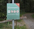
 Kein Durchgang - Fachstelle Naturschutz Zürich.jpg 3,560 × 2,428; 2.15 MB
-
 Langensegen Revitalisierung Baudirektion Flughafen.jpg 3,330 × 2,231; 1.38 MB
-
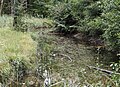
 Moor im Naturschutzgebiet Altläufe der Glatt 01.jpg 3,504 × 2,528; 3.45 MB
-
 Moor im Naturschutzgebiet Altläufe der Glatt 02.jpg 3,112 × 2,348; 3.11 MB
-
 Naturschutzgebiet Altläufe der Glatt 01.jpg 3,330 × 2,518; 2.17 MB
-
 Naturschutzgebiet Altläufe der Glatt 02.jpg 3,400 × 2,526; 3.41 MB
-
 Naturschutzgebiet Altläufe der Glatt 03.jpg 3,376 × 2,512; 4.13 MB
-
 Naturschutzgebiet Altläufe der Glatt 04.jpg 3,206 × 2,428; 3.23 MB
-
 Naturschutzgebiet Püntenwisen Rümlang Flugzeugstart.jpg 2,880 × 2,040; 2.21 MB
-
 Oberglatt Flurname Giessen im Naturschutzgebiet an der Glatt.jpg 3,416 × 2,594; 2.36 MB
-
 Oberglatterallmend-Glattkanal.jpg 2,412 × 2,106; 2.95 MB
-
 OberglattZH02.jpg 1,600 × 1,200; 631 KB
-
 Prunus laurocerasus Solacht nature reserve Rümlang.jpg 1,876 × 1,404; 774 KB
-
 Rümlangstrasse Oberglatt.jpg 3,446 × 2,356; 2.53 MB
-
 Schorenweg Brücke 20170915-jag9889.jpg 4,608 × 3,456; 13.29 MB
-
 Silberweiden im Naturschutzgebiet Altläufe der Glatt bei Rümlang.jpg 3,416 × 2,382; 3.3 MB
-
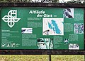
 Tafel im Naturschutzgebiet Altläufe der Glatt.jpg 3,430 × 2,612; 1.4 MB
-
 Tafel Naturschutzgebiet Altläufe der Glatt 01.jpg 3,252 × 2,348; 2.4 MB
-
 Tafel Naturschutzgebiet Altläufe der Glatt 02.jpg 2,914 × 2,343; 1.69 MB
-
 Tümpel im Naturschutzgebiet Altläufe der Glatt.jpg 3,350 × 2,518; 4.24 MB
-
 Waldreservat Solacht 01.jpg 2,784 × 2,276; 2.96 MB
-
 Waldreservat Solachten 02.jpg 2,688 × 2,018; 1.99 MB
-
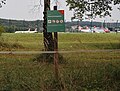
 Wegweiser Glatt-Uferweg bei Oberglatt.jpg 3,204 × 2,510; 794 KB
-
 Wiesen-Flockenblume (Centaurea jacea) an der Glatt bei Rümlang.jpg 2,784 × 2,234; 1.37 MB
-
 Zurich airport img 3324.jpg 4,416 × 2,944; 2.96 MB


_an_der_Glatt_bei_R%C3%BCmlang.jpg)
