Category:Ambachtstraat 2, Utrecht
| Object location | | View all coordinates using: OpenStreetMap |
|---|
 | |||||
| Upload media | |||||
| Instance of |
| ||||
|---|---|---|---|---|---|
| Location | Utrecht, Netherlands | ||||
| Heritage designation |
| ||||
 | |||||
|
This is a category about rijksmonument number 36009
|
| Address |
|
Media in category "Ambachtstraat 2, Utrecht"
The following 3 files are in this category, out of 3 total.
-
 Aanzicht, voor- en zijgevel - Utrecht - 20235428 - RCE.jpg 808 × 1,200; 173 KB
-
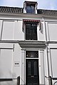 Ambachtstraat 2 - Utrecht - entree.JPG 2,848 × 4,288; 4.1 MB
-
 Ambachtstraat 2 - Utrecht.JPG 4,288 × 2,848; 4.64 MB

