Category:Amselflue
| Object location | | View all coordinates using: OpenStreetMap |
|---|
mountain  | |||||
| Upload media | |||||
| Instance of | |||||
|---|---|---|---|---|---|
| Location | Grisons, Switzerland | ||||
| Mountain range | |||||
| Topographic prominence |
| ||||
| Topographic isolation |
| ||||
| Elevation above sea level |
| ||||
| Parent peak | |||||
 | |||||
Media in category "Amselflue"
The following 13 files are in this category, out of 13 total.
-
 Amselflue 2.jpg 5,443 × 3,317; 6.95 MB
-
 Amselflue 2020.jpg 5,192 × 2,083; 4.01 MB
-
 Amselflue and bench.jpg 5,472 × 3,398; 6.24 MB
-
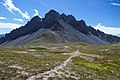 Amselflue and trail.jpg 5,472 × 3,648; 5.27 MB
-
 Amselflue BlickVonRinerhorn.jpg 4,608 × 3,456; 3.97 MB
-
 Amselflue DavosFrauenkirch.JPG 4,608 × 3,456; 4.14 MB
-
 Amselflue.jpg 2,391 × 739; 568 KB
-
 ETH-BIB-Berge-LBS H1-018095.tif 6,616 × 4,670; 88.52 MB
-
 Furggahorn - Amselflue.jpg 5,513 × 1,037; 1.49 MB
-
 Kirchner - Stafelalp mit Amselfluh, 1918, 5950915.jpg 1,696 × 1,950; 889 KB
-
 Maienfelder Furgga Amselflue.jpg 2,048 × 1,536; 883 KB
-
 Plessur Range in Switzerland.jpg 16,020 × 2,979; 11.23 MB
-
 Trail and Amselflue.jpg 5,472 × 3,648; 6.95 MB


