Category:Ancien Prieuré de Grandgourt, Montignez
| Object location | | View all coordinates using: OpenStreetMap |
|---|
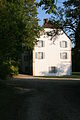
former church building in Montignez in the canton of Jura, Switzerland  | |||||
| Upload media | |||||
| Instance of | |||||
|---|---|---|---|---|---|
| Part of | |||||
| Location | Montignez, Basse-Allaine, Porrentruy District, Jura, Switzerland | ||||
| Street address |
| ||||
| Heritage designation | |||||
 | |||||
Media in category "Ancien Prieuré de Grandgourt, Montignez"
The following 2 files are in this category, out of 2 total.
-
 Ancien Prieuré de Grandgourt - Façade ouest.jpg 2,336 × 3,504; 3.7 MB
-
 Ancien Prieuré de Grandgourt - Façade sud.jpg 3,504 × 2,336; 4.35 MB
