Category:Ancien bâtiment douanier et port franc (Lausanne)
| Object location | | View all coordinates using: OpenStreetMap |
|---|
building in Switzerland  | |||||
| Upload media | |||||
| Instance of | |||||
|---|---|---|---|---|---|
| Part of | |||||
| Location |
| ||||
| Street address |
| ||||
| Heritage designation | |||||
 | |||||
Media in category "Ancien bâtiment douanier et port franc (Lausanne)"
The following 12 files are in this category, out of 12 total.
-
 Ancien bâtiment douanier et port franc Lausanne.JPG 4,320 × 2,432; 3.52 MB
-
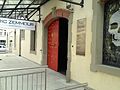
 Entrepôt de Port Franc porte E.jpg 3,264 × 2,448; 2.23 MB
-
 Entrepôt de Port Franc toiture.jpg 3,264 × 2,448; 1.89 MB
-
 Entrepôt de Port Franc vue cour intérieure.jpg 3,264 × 2,448; 2.04 MB
-
 Entrepôt de Port Franc, coin NE.jpg 3,264 × 2,448; 1.91 MB
-
 Entrepôt de Port Franc, coin SE.jpg 3,264 × 2,448; 2.13 MB
-
 Entrepôt de Port Franc, coin SO.jpg 3,264 × 2,448; 1.87 MB
-
 Entrepôt de Port Franc, entrée O détails.jpg 3,264 × 2,448; 1.99 MB
-
 Entrepôt de Port Franc, entrée O.jpg 3,264 × 2,448; 2.07 MB
-
 Entrepôt de Port Franc, intérieur porte O.jpg 3,264 × 2,448; 1.16 MB
-
 Entrepôt de Port Franc, porte E détails.jpg 2,448 × 3,264; 2.06 MB
-
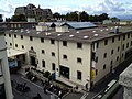 Entrepôt de Port Franc.jpg 3,264 × 2,448; 2.22 MB


