Category:Anerley Road, London
Street in the London Borough of Bromley  | |||||
| Upload media | |||||
| Instance of | |||||
|---|---|---|---|---|---|
| Part of | |||||
| Named after | |||||
| Location | Anerley, London Borough of Bromley, Greater London, London, England | ||||
| Connects with | |||||
 | |||||
Subcategories
This category has the following 2 subcategories, out of 2 total.
A
- Anerley Town Hall (5 F)
B
- Betts Park (11 F)
Media in category "Anerley Road, London"
The following 41 files are in this category, out of 41 total.
-
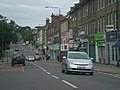
 Anerley Rd - geograph.org.uk - 2400434.jpg 640 × 430; 68 KB
-
 Anerley Rd - geograph.org.uk - 2400436.jpg 640 × 430; 68 KB
-
 Anerley Rd - geograph.org.uk - 2474985.jpg 640 × 430; 66 KB
-
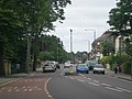
 Anerley Road - geograph.org.uk - 3655734.jpg 1,600 × 1,041; 647 KB
-
 Anerley Road - geograph.org.uk - 3674438.jpg 640 × 449; 198 KB
-
 Anerley Road - geograph.org.uk - 5663519.jpg 2,763 × 2,065; 997 KB
-
 Anerley Road 2010.JPG 3,072 × 2,304; 2.02 MB
-
 Anerley Road II 2010.JPG 3,072 × 2,304; 1.85 MB
-
 Anerley Road III 2010.JPG 3,072 × 2,304; 2.02 MB
-
 Anerley Road, Anerley - geograph.org.uk - 4607365.jpg 2,272 × 1,704; 773 KB
-
 Anerley Road, Penge - geograph.org.uk - 2429440.jpg 640 × 480; 75 KB
-
 Anerley station - geograph.org.uk - 2741187.jpg 768 × 1,024; 142 KB
-
 Anerley, Anerley Road - geograph.org.uk - 1745779.jpg 3,456 × 2,304; 5 MB
-
 AnerleyHill2.jpg 592 × 919; 116 KB
-
 Block of flats, Anerley Rd - geograph.org.uk - 2402344.jpg 640 × 430; 92 KB
-
 Broken down bus, Anerley Road - geograph.org.uk - 4333139.jpg 640 × 480; 146 KB
-
 Capital Ring sign, Anerley Road - geograph.org.uk - 1929063.jpg 640 × 430; 144 KB
-
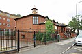
 Christ Church, Anerley Road, London SE20 8ER - geograph.org.uk - 2002118.jpg 1,000 × 554; 139 KB
-
 Christ Church, Anerley Road, London SE20 8ER - geograph.org.uk - 2002120.jpg 1,000 × 543; 135 KB
-
 Christ Church, Anerley Road, London SE20 8ER - geograph.org.uk - 2002124.jpg 1,000 × 666; 167 KB
-
 Christ Church, Anerley Road, London SE20 8ER - geograph.org.uk - 2002125.jpg 1,000 × 660; 164 KB
-
 Christ Church, Anerley Road, London SE20 8ER - geograph.org.uk - 2002132.jpg 1,000 × 571; 142 KB
-

-

-
 Faded sign, Anerley SE20.jpg 3,072 × 2,304; 1.47 MB
-
 Flats above shops, Anerley Road - geograph.org.uk - 2223881.jpg 1,024 × 768; 257 KB
-
 Ghost-sign, Anerley Road - geograph.org.uk - 2002604.jpg 640 × 269; 52 KB
-
 Ghost-sign, Anerley Road - geograph.org.uk - 2002609.jpg 640 × 480; 113 KB
-
 Incident on Anerley Road - geograph.org.uk - 2518960.jpg 640 × 480; 113 KB
-
 Jerk Centre, Anerley Road - geograph.org.uk - 2692993.jpg 3,216 × 4,288; 5.06 MB
-
 JXC designs Street art in Anerley London (49966108861).jpg 4,002 × 2,809; 5.7 MB
-
 Panorama from Anerley Hill - geograph.org.uk - 2505389.jpg 2,048 × 1,536; 503 KB
-
 Panorama from Anerley Road ^3 - geograph.org.uk - 2505405.jpg 2,048 × 1,536; 622 KB
-
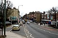
 Shops on Anerley Road, Crystal Palace - geograph.org.uk - 3168213.jpg 2,048 × 1,536; 1.51 MB
-
 Shops, Anerley Rd - geograph.org.uk - 2474984.jpg 640 × 423; 95 KB
-
 The Co-operative,Anerley SE20 - 33080293171.jpg 3,072 × 2,304; 1.4 MB
-
 The Co-operative,Anerley SE20.jpg 2,304 × 3,072; 1.2 MB
-
 The Paxton Arms Hotel, Anerley Road - geograph.org.uk - 1929056.jpg 640 × 449; 97 KB
-

-
 Thicket Tavern, Anerley, SE20 (3311905525).jpg 2,848 × 2,136; 2.4 MB
-
 Traffic jam on Anerley Road - geograph.org.uk - 4333125.jpg 640 × 480; 134 KB


.jpg)


.jpg)
