Category:Animated maps of the United States
Media in category "Animated maps of the United States"
The following 51 files are in this category, out of 51 total.
-
 % of Total Houses by US county, Built By Time Period, US Census.gif 1,554 × 902; 1.77 MB
-
-
 15animation.gif 640 × 480; 8.51 MB
-
 2006 800x506 us senate by party nov-2006 election.gif 800 × 506; 23 KB
-
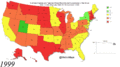
 2008 Democratic Primary Process Map Color Blindness Simulation.gif 431 × 247; 29 KB
-
 Airqualityasian 2022 01.gif 720 × 545; 634 KB
-
 AKsizemap.gif 396 × 180; 180 KB
-
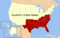 American south animated map.gif 566 × 365; 32 KB
-
 Animation Relief USA 2.gif 510 × 369; 325 KB
-
 Animation relief USA.gif 171 × 151; 66 KB
-
 CSA states evolution.gif 1,000 × 677; 245 KB
-
 Dcmapanimated.gif 456 × 480; 23 KB
-
Derecho 08May09 mesonet 640x480.ogv 38 s, 640 × 480; 28.09 MB
-
 Development of the United States, 1789 to 1959.gif 1,000 × 677; 4.75 MB
-
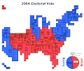 Electoral Vote Cartogram - 2004-2008 Swing.gif 895 × 762; 101 KB
-
Evolution of United States standard time zone boundaries.webm 29 s, 3,507 × 2,480; 4.58 MB
-
 Exapnsion of Delta Upsilon.gif 1,144 × 707; 772 KB
-
 January 2007 western US freeze.gif 303 × 420; 57 KB
-
 January 4, 2022 0100 UTC outlook activity loop.gif 582 × 408; 128 KB
-
 Kentucky Congressional Districts (1935-2021).gif 837 × 387; 30.63 MB
-
Loveland, Ohio, 1975 to 2024 in OpenHistoricalMap.webm 22 s, 3,456 × 2,158; 2.15 MB
-
 Ma code history.gif 450 × 420; 40 KB
-
 Map of NATO chronological.gif 743 × 284; 135 KB
-
 Marriage amendment animation.gif 840 × 575; 103 KB
-
 PercentOfUSPopInEachState.gif 1,513 × 983; 710 KB
-
 PSKGrowth1910.gif 1,513 × 983; 2.83 MB
-
 Q913672.gif 864 × 864; 832 KB
-
 Rainbow Growth.gif 954 × 589; 298 KB
-
 US states by date of statehood.gif 795 × 595; 108 KB
-
 US states by date of statehood3.gif 795 × 595; 236 KB
-
Territorial evolution of San Jose, California, 1850–2022 in OpenHistoricalMap.webm 17 s, 2,880 × 1,800; 1,015 KB
-
Territorial evolution of San Jose, California, 1950–1969 in OpenHistoricalMap.webm 23 s, 2,880 × 1,800; 1.74 MB
-
 Timeline of the Brown Tree Snake's Travel Across Guam.gif 428 × 500; 119 KB
-
 Unemployment rate map of the united states.gif 757 × 403; 35.53 MB
-
 United States 1860-1870.gif 787 × 483; 49 KB
-
 United States evolution small.gif 747 × 479; 3.96 MB
-
 United States evolution.gif 1,000 × 641; 5.1 MB
-
 United States governors.gif 1,600 × 989; 613 KB
-
 United States installed wind power capacity animation 561px.gif 561 × 421; 1.44 MB
-
 US house membership 1854-1898.gif 570 × 370; 91 KB
-
 US house membership 1900-1948.gif 570 × 370; 88 KB
-
 US house membership 1950-2006.gif 570 × 370; 112 KB
-
 US LGBT civil rights animation.gif 1,239 × 680; 1.39 MB
-
 US Presidential Elections Dem GOP 1952-2004.gif 580 × 340; 55 KB
-
 US Presidential Elections Dem GOP.gif 506 × 313; 111 KB
-
 US Slave Free 1789-1861.gif 774 × 468; 100 KB
-
 US states by date of statehood.svg 959 × 593; 123 KB
-
 US states by date of statehood2.gif 800 × 650; 129 KB
-
 USA Territorial Growth small.gif 431 × 287; 456 KB
-
 USA territorial growth.gif 921 × 573; 2.01 MB
-
 Utah Territory evolution animation - August 2011.gif 1,000 × 786; 158 KB


.gif)


