Category:Antennenturm (Wilhelmshaven)
| Object location | | View all coordinates using: OpenStreetMap |
|---|
tower in Wilhelmshaven, Germany  | |||||
| Upload media | |||||
| Instance of | |||||
|---|---|---|---|---|---|
| Made from material | |||||
| Location | Wilhelmshaven, Lower Saxony, Germany | ||||
| Inception |
| ||||
 | |||||
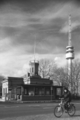
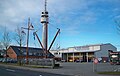
English: Antenna tower of the Wilhelmshaven Port Authority (Wasser- und Schifffahrtsamt (WSA) Wilhelmshaven).
Deutsch: Antennenturm des Wasser- und Schifffahrtsamts Wilhelmshaven (WSA Wilhelmshaven).
Media in category "Antennenturm (Wilhelmshaven)"
The following 25 files are in this category, out of 25 total.
-
 2012-05-28 Fotoflug Cuxhaven Wilhelmshaven DSCF9448.jpg 4,256 × 2,848; 7.57 MB
-
 2012-05-28 Fotoflug Cuxhaven Wilhelmshaven DSCF9759.jpg 4,256 × 2,848; 7.83 MB
-
 20180329wasserstrassenUndSchiffahrtsamtWilhelmshaven2.png 3,750 × 5,633; 13.71 MB
-
 Erste Einfahrt 7263.jpg 2,925 × 2,025; 1.62 MB
-
 Flug Wilhelmshaven 2010 179.JPG 4,272 × 2,848; 4.07 MB
-
 Flug Wilhelmshaven 2010 181.JPG 4,272 × 2,848; 4.14 MB
-
 Flug Wilhelmshaven 2010 183.JPG 4,272 × 2,848; 3.75 MB
-
 Flug Wilhelmshaven 2010 189.JPG 4,272 × 2,848; 3.65 MB
-
 Jade-Dienst 0940.jpg 2,048 × 1,291; 583 KB
-
 Luftaufnahmen Nordseekueste 2012 05 D90 by-RaBoe 123.jpg 2,900 × 1,926; 4.7 MB
-
 Luftaufnahmen Nordseekueste 2012 05 D90 by-RaBoe 124.jpg 2,900 × 1,926; 4.85 MB
-
 Luftaufnahmen Nordseekueste 2012 05 D90 by-RaBoe 129.jpg 2,900 × 1,926; 4.69 MB
-
 Luftaufnahmen Nordseekueste 2012 05 D90 by-RaBoe 130.jpg 2,900 × 1,926; 4.65 MB
-
 Marinemuseum Wilhelmshaven - Flickr - Axel Schwenke (66).jpg 3,008 × 2,000; 2.68 MB
-
 Maritime Meile.JPG 1,042 × 473; 42 KB
-
 Nassaubruecke 0043.jpg 3,008 × 2,000; 901 KB
-
 SchleuseninseI (Wilhelmshaven), Antennenturm mit Erster Einfahrt.jpg 3,000 × 4,000; 2.41 MB
-
 SchleuseninseI (Wilhelmshaven), Antennenturm, Erste Einfahrt und ICBM Wilhelmshaven.jpg 4,000 × 3,000; 2.51 MB
-
 ST ANNASTRAND 1059.jpg 5,501 × 3,668; 2.8 MB
-
 Turm WSA Wilhelmshaven.jpg 1,205 × 1,680; 145 KB
-
 Verbindungshafen (Wilhelmshaven), Schwimmdock 3 und Zerstörer D186 Mölders (2).jpg 4,000 × 3,000; 2.32 MB
-
 Verbindungshafen (Wilhelmshaven), Schwimmdock 3 und Zerstörer D186 Mölders.jpg 4,000 × 3,000; 4.28 MB
-
 Verbindungshafen 123257.jpg 2,507 × 1,736; 1.05 MB
-
 Wilhelmshaven Schleusenmole 5794.jpg 3,262 × 2,258; 1.32 MB
-
 Wilhlemshaven Lotsenstation.jpg 2,000 × 3,008; 1.29 MB


.jpg)


,_Antennenturm_mit_Erster_Einfahrt.jpg)
,_Antennenturm,_Erste_Einfahrt_und_ICBM_Wilhelmshaven.jpg)

,_Schwimmdock_3_und_Zerst%C3%B6rer_D186_M%C3%B6lders_(2).jpg)
,_Schwimmdock_3_und_Zerst%C3%B6rer_D186_M%C3%B6lders.jpg)


