Category:April 2005 in Kent
Ceremonial counties of England: Berkshire · Buckinghamshire · Cambridgeshire · Cheshire · Cornwall · Cumbria · Derbyshire · Devon · Dorset · Durham · East Riding of Yorkshire · East Sussex · Essex · Gloucestershire · Greater London · Greater Manchester · Hampshire · Herefordshire · Hertfordshire · Isle of Wight · Kent · Lancashire · Leicestershire · Lincolnshire · Merseyside · Norfolk · North Yorkshire · Northamptonshire · Northumberland · Nottinghamshire · Oxfordshire · Shropshire · Somerset · South Yorkshire · Staffordshire · Suffolk · Surrey · Tyne and Wear · Warwickshire · West Midlands · West Sussex · West Yorkshire · Wiltshire · Worcestershire
City-counties: Bristol ·
Former historic counties:
Other former counties:
City-counties: Bristol ·
Former historic counties:
Other former counties:
Deutsch: Bilder, die im April 2005 in Kent aufgenommen worden sind. Bitte beachten Sie, dass dies weder das Datum des Uploads noch das Datum des Scannens eines Fotos ist.
English: Images/pictures taken in Kent during April 2005. Note this is not the date of the upload, nor the date a photo was scanned.
Español: Fotografías o imágenes tomadas en Kent durante abril 2005. No es la fecha de subida ni escaneo, sino la fecha en que las fotografías o imágenes se crearon.
Esperanto: Bildoj faritaj en Kent en aprilo 2005. Tio ne estas la dato, kiam la bildoj estis alŝutitaj aŭ skanitaj.
Français : Photographies ou images prises en Kent durant avril 2005. Ce n'est pas la date du téléchargement ou du scan.
Galego: Fotografías ou imaxes tomadas en Kent durante abril 2005. Non é a data de subida nin escaneamento, senón a data na que se crearon as fotografías ou imaxes.
Italiano: Fotografie o immagini scattate a Kent nel aprile 2005. Nota bene: la data non si riferisce né a quella di upload né a quella in cui la foto è stata digitalizzata.
Norsk bokmål: Bilder tatt i Kent i løpet av april 2005. Merk at dette ikke er datoen for opplasting, eller når et bilde har blitt skannet.
Norsk nynorsk: Bilete teke i Kent i løpet av april 2005. Merk at dette ikkje er datoen for opplasting, eller når eit bilete har vorte skanna.
Русский: Изображения, сделанные в Kent в течение апрель 2005 (не дата загрузки изображения).
Українська: Зображення, зроблені в Kent протягом квітень 2005. Зауважте, що це не дата завантаження чи дата сканування фотографії.
| April 2004 | ← | April 2005 | → | April 2006 | |||||||
| Jan | Feb | Mar | Apr | May | Jun | Jul | Aug | Sep | Oct | Nov | Dec |
| 6 | 6 | 4 | 39 | 20 | 23 | 24 | 80 | 34 | 25 | 24 | 17 |
|---|---|---|---|---|---|---|---|---|---|---|---|
Media in category "April 2005 in Kent"
The following 39 files are in this category, out of 39 total.
-
 14806 Canterbury - Flickr - megabus13601 (1).jpg 1,600 × 1,200; 266 KB
-
 14811 Canterbury - Flickr - megabus13601.jpg 1,600 × 1,200; 242 KB
-
 14813 Folkestone - Flickr - megabus13601.jpg 1,600 × 1,200; 234 KB
-
 14821 Folkestone - Flickr - megabus13601.jpg 1,600 × 1,200; 246 KB
-
 14978 Canterbury - Flickr - megabus13601 (2).jpg 1,600 × 1,200; 213 KB
-
 14980 Canterbury - Flickr - megabus13601.jpg 1,600 × 1,200; 206 KB
-
 WealdfromDowns.JPG 640 × 480; 29 KB
-
 A Canterbury street (10858877).jpg 640 × 480; 55 KB
-
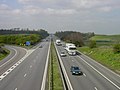
 A249 road Kent, England 004167.jpg 640 × 357; 34 KB
-
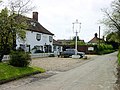 Blacksmiths Arms, Wormshill - geograph.org.uk - 6189.jpg 640 × 480; 95 KB
-
 Boat full of flowers - geograph.org.uk - 4309.jpg 640 × 480; 83 KB
-
 Canterbury East railway station - geograph.org.uk - 210648.jpg 640 × 480; 105 KB
-
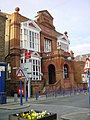 Conservative Club, Sheerness - geograph.org.uk - 4304.jpg 480 × 640; 66 KB
-
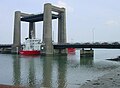 Kingsferry Bridge - geograph.org.uk - 4251.jpg 640 × 471; 55 KB
-
 M2 motorway junction 5.jpg 640 × 480; 44 KB
-
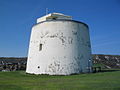 Martello Tower 3 - geograph.org.uk - 356269.jpg 640 × 480; 57 KB
-
 Milton recreation ground - geograph.org.uk - 4961.jpg 640 × 480; 79 KB
-

-
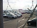 New Cars - geograph.org.uk - 4313.jpg 640 × 480; 62 KB
-
 Rodmersham Cricket Club - geograph.org.uk - 4870.jpg 640 × 480; 134 KB
-
 Romney Sands Station. - geograph.org.uk - 4141.jpg 640 × 480; 124 KB
-
 Rose Street, Sheerness - geograph.org.uk - 4306.jpg 480 × 640; 79 KB
-
 Sheerness Clock Tower.jpg 640 × 480; 79 KB
-
 Sheerness Steel Mill - geograph.org.uk - 4297.jpg 640 × 480; 55 KB
-
 The Guildhall, Queenborough - geograph.org.uk - 4284.jpg 640 × 480; 81 KB
-
 The Hard, Queenborough - geograph.org.uk - 4287.jpg 640 × 480; 86 KB
-
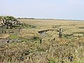
 Chetney Marshes - geograph.org.uk - 4330.jpg 639 × 288; 33 KB
-
 Elmley Ferry - geograph.org.uk - 6598.jpg 640 × 480; 52 KB
-
 First and last roundabout on Sheppey - geograph.org.uk - 4226.jpg 640 × 480; 57 KB
-
 Funton Creek - geograph.org.uk - 4336.jpg 640 × 480; 130 KB
-
 Ham Street Bridge, Hamstreet, Kent - geograph.org.uk - 4536.jpg 640 × 480; 129 KB
-
 Little Murston Nature Reserve - geograph.org.uk - 6548.jpg 640 × 480; 76 KB
-
 Milton Creek joins the Swale - geograph.org.uk - 6553.jpg 640 × 168; 23 KB
-
 Neatscourt Marshes - geograph.org.uk - 4229.jpg 640 × 334; 29 KB
-
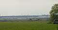
 Ridham Dock - geograph.org.uk - 4258.jpg 640 × 480; 45 KB
-
 Rushenden Hill - geograph.org.uk - 4326.jpg 640 × 259; 16 KB
-
 Saxon Shore Way, Elmley Ferry - geograph.org.uk - 6596.jpg 640 × 359; 77 KB
-
 Sewage Works, Lydd, Romney Marsh, Kent. - geograph.org.uk - 4800.jpg 640 × 480; 52 KB
-
 Track to Elmley Ferry - geograph.org.uk - 6561.jpg 640 × 480; 73 KB
.jpg)


.jpg)


.jpg)


