Category:April 2007 in Northern Ireland
English: Images taken in Northern Ireland in this month of 2007 (not the date of the upload).
| Jan | Feb | Mar | Apr | May | Jun | Jul | Aug | Sep | Oct | Nov | Dec | ||
| ← | 73 | 112 | 113 | 154 | 75 | 192 | 191 | 201 | 164 | 162 | 207 | 164 | → |
|---|
Subcategories
This category has the following 8 subcategories, out of 8 total.
A
- April 2007 in County Antrim (53 F)
- April 2007 in Ards (1 F)
- April 2007 in County Armagh (2 F)
B
- April 2007 in Belfast (31 F)
D
L
- April 2007 in County Londonderry (37 F)
M
- April 2007 in Moyle (1 F)
T
- April 2007 in County Tyrone (103 F)
Media in category "April 2007 in Northern Ireland"
The following 146 files are in this category, out of 146 total.
-
 "Glenoe" or "Gleno"^ - geograph.org.uk - 402906.jpg 640 × 426; 165 KB
-
 Approaching Portaferry - geograph.org.uk - 640973.jpg 640 × 480; 69 KB
-
 Access to Slieve Croob, Locked x 5 - geograph.org.uk - 390962.jpg 640 × 480; 177 KB
-
 Barley Hill - geograph.org.uk - 407609.jpg 640 × 479; 71 KB
-
 Drumnamalra Townland - geograph.org.uk - 411395.jpg 640 × 479; 66 KB
-
 Drumnmalra Townland - geograph.org.uk - 411385.jpg 640 × 290; 31 KB
-
 Drumowen Townland - geograph.org.uk - 411306.jpg 640 × 479; 51 KB
-
 Easter weekend in Omagh's town centre - geograph.org.uk - 391632.jpg 640 × 315; 48 KB
-
 Foggyhill Road - geograph.org.uk - 390145.jpg 640 × 479; 72 KB
-

-
 Fort Road, Magherangeeragh - geograph.org.uk - 390278.jpg 640 × 479; 72 KB
-
 Franklin Street, Belfast - geograph.org.uk - 384091.jpg 640 × 426; 131 KB
-
 Garvagh Blane Road - geograph.org.uk - 391257.jpg 640 × 479; 89 KB
-
 Garvagh pullans - geograph.org.uk - 407746.jpg 640 × 479; 69 KB
-
 Golf Course in Limavady - geograph.org.uk - 396552.jpg 640 × 480; 169 KB
-
 Grazing land near Slievenaboley - geograph.org.uk - 393825.jpg 640 × 480; 189 KB
-
 Harbour Cafe, Portstewart - geograph.org.uk - 386401.jpg 640 × 480; 68 KB
-
 Hill Street, Belfast - geograph.org.uk - 412458.jpg 640 × 426; 142 KB
-
 Kilclean - geograph.org.uk - 406998.jpg 640 × 280; 25 KB
-
 Kilclean - geograph.org.uk - 407592.jpg 640 × 312; 53 KB
-
 Killen - geograph.org.uk - 390066.jpg 640 × 479; 73 KB
-
 Killen, County Tyrone - geograph.org.uk - 390093.jpg 640 × 291; 27 KB
-
 KillenTownland. - geograph.org.uk - 390141.jpg 640 × 479; 61 KB
-
 KIllenTownland. - geograph.org.uk - 390142.jpg 640 × 479; 67 KB
-
 Killeter Bridge - geograph.org.uk - 390225.jpg 640 × 282; 30 KB
-
 Killeter Presbyterian Church - geograph.org.uk - 390268.jpg 640 × 479; 59 KB
-
 Knockbrack Road - geograph.org.uk - 391290.jpg 640 × 280; 32 KB
-
 Learmore Hill - geograph.org.uk - 390088.jpg 640 × 479; 65 KB
-
 Legatoneagan Townland - geograph.org.uk - 390426.jpg 640 × 479; 60 KB
-
 Lisburn Square - geograph.org.uk - 409038.jpg 640 × 480; 75 KB
-
 Lisleen Townland - geograph.org.uk - 390046.jpg 640 × 479; 71 KB
-
 Lisleen Townland - geograph.org.uk - 390056.jpg 640 × 301; 33 KB
-
 Lisnacloon - geograph.org.uk - 390453.jpg 640 × 479; 72 KB
-
 Lisnacloon Townland - geograph.org.uk - 390462.jpg 640 × 479; 98 KB
-
 Lisnacloon Townland - geograph.org.uk - 391280.jpg 640 × 312; 29 KB
-
 Listymore - geograph.org.uk - 406962.jpg 640 × 479; 45 KB
-
 Listymore Townland - geograph.org.uk - 406960.jpg 640 × 304; 26 KB
-
 Magherangeeragh - geograph.org.uk - 390252.jpg 640 × 479; 68 KB
-
 Magherangeeragh - geograph.org.uk - 390258.jpg 640 × 479; 72 KB
-
 Magherangeeragh - geograph.org.uk - 390404.jpg 640 × 479; 86 KB
-
 Magherangeeragh Townland - geograph.org.uk - 390395.jpg 640 × 321; 42 KB
-
 Meencargagh Townland - geograph.org.uk - 390016.jpg 640 × 479; 75 KB
-
 Muckle Hill - geograph.org.uk - 407607.jpg 640 × 292; 32 KB
-
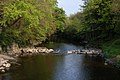
 Muff River - geograph.org.uk - 414010.jpg 640 × 480; 180 KB
-
 Mullanabreen Townland - geograph.org.uk - 390416.jpg 640 × 479; 76 KB
-
 Munie Road - geograph.org.uk - 390044.jpg 640 × 276; 34 KB
-
 Narrow Water Tower, Warrenpoint - geograph.org.uk - 399224.jpg 640 × 426; 129 KB
-
 Ness Wood - geograph.org.uk - 415640.jpg 640 × 316; 41 KB
-
 Nettles and Dandelions, Omagh - geograph.org.uk - 417015.jpg 640 × 480; 106 KB
-
 Old Boat - geograph.org.uk - 392532.jpg 640 × 426; 123 KB
-
 Old Cottage Ballylumford - geograph.org.uk - 383883.jpg 640 × 426; 143 KB
-
 Outhouse at Lisleen - geograph.org.uk - 390051.jpg 640 × 479; 64 KB
-
 Path by the River Quoile - geograph.org.uk - 405041.jpg 640 × 426; 162 KB
-
 Portfad - geograph.org.uk - 410426.jpg 640 × 480; 104 KB
-
 Priestsessagh Townland - geograph.org.uk - 406956.jpg 640 × 479; 67 KB
-
 Priestsessagh Townland - geograph.org.uk - 406957.jpg 640 × 479; 68 KB
-

-
 Pruglish Townland - geograph.org.uk - 411327.jpg 640 × 479; 55 KB
-
 Pruglish Townland - geograph.org.uk - 411328.jpg 640 × 479; 74 KB
-
 Pullyernan Hill - geograph.org.uk - 407016.jpg 640 × 295; 26 KB
-

-
 Queen's Square, Belfast - geograph.org.uk - 412542.jpg 640 × 426; 141 KB
-
 Queen's University, Belfast (detail) - geograph.org.uk - 395106.jpg 640 × 426; 154 KB
-

-
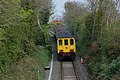 Railway near Larne - geograph.org.uk - 407129.jpg 640 × 426; 175 KB
-
 Ramore Head, Portrush - geograph.org.uk - 386445.jpg 640 × 480; 43 KB
-
 Ravenhillstadium.jpg 2,417 × 1,694; 754 KB
-
 Reflections at Newcastle - geograph.org.uk - 418577.jpg 640 × 426; 104 KB
-
 Retail car-park, Sedan Avenue, Omagh - geograph.org.uk - 418329.jpg 640 × 480; 66 KB
-
 River Bann and Spelga Pass - geograph.org.uk - 403262.jpg 426 × 640; 158 KB
-
 River Bann, Dunbar's Bridge (4) - geograph.org.uk - 417006.jpg 640 × 426; 156 KB
-
 River Faughan - geograph.org.uk - 388569.jpg 640 × 480; 176 KB
-
 River Faughan - geograph.org.uk - 414778.jpg 640 × 479; 63 KB
-
 River Strule, Omagh - geograph.org.uk - 418337.jpg 640 × 480; 63 KB
-
 Road at Barley Hill - geograph.org.uk - 407611.jpg 640 × 479; 57 KB
-
 Road at Carnoughter - geograph.org.uk - 391279.jpg 640 × 479; 71 KB
-
 Road at Creevy - geograph.org.uk - 406970.jpg 640 × 283; 29 KB
-
 Road at Learmore Hill - geograph.org.uk - 390086.jpg 640 × 287; 31 KB
-
 Road at Lisleen - geograph.org.uk - 390048.jpg 640 × 273; 29 KB
-
 Road at Lisleen - geograph.org.uk - 390104.jpg 640 × 479; 83 KB
-
 Road at Oughtad - geograph.org.uk - 415643.jpg 640 × 297; 35 KB
-
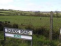
 Road at Shanog - geograph.org.uk - 390127.jpg 640 × 273; 39 KB
-
 Roadside Well at Golan Spout - geograph.org.uk - 391293.jpg 640 × 304; 46 KB
-
 Rock at Ramore Head, Portrush - geograph.org.uk - 386455.jpg 640 × 480; 54 KB
-
 Rock pool at Ramore Head, Portrush - geograph.org.uk - 386449.jpg 640 × 480; 42 KB
-
 Rostrevor Obelisk - geograph.org.uk - 399228.jpg 640 × 426; 139 KB
-
 Round tower near Maghera, Co Down - geograph.org.uk - 418722.jpg 640 × 426; 194 KB
-
 Ruined buildings near Sloughan Glen - geograph.org.uk - 411400.jpg 640 × 289; 37 KB
-
 Rushpark roundabout, Whiteabbey - geograph.org.uk - 384108.jpg 640 × 426; 122 KB
-
 Shanmullagh - geograph.org.uk - 390038.jpg 640 × 278; 23 KB
-
 Shanmullagh Townland - geograph.org.uk - 390040.jpg 640 × 479; 100 KB
-
 Shanog Road - geograph.org.uk - 390058.jpg 640 × 479; 65 KB
-
 Shanog Townland - geograph.org.uk - 390107.jpg 640 × 479; 53 KB
-
 Shanog Townland - geograph.org.uk - 390132.jpg 640 × 479; 90 KB
-
 Sheep at Garvagh - geograph.org.uk - 391255.jpg 640 × 479; 87 KB
-
 Shore Road, Whiteabbey - geograph.org.uk - 389309.jpg 640 × 426; 105 KB
-
 Signs, the Quay Brae, Ardglass - geograph.org.uk - 405160.jpg 600 × 400; 136 KB
-
 Sloughan - geograph.org.uk - 411402.jpg 640 × 479; 102 KB
-
 Sloughan Glen - geograph.org.uk - 411407.jpg 640 × 540; 110 KB
-
 Sloughan Townland - geograph.org.uk - 411515.jpg 640 × 479; 72 KB
-
 Spelga Dam - geograph.org.uk - 403286.jpg 640 × 426; 114 KB
-
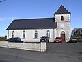 St Andrew's Church of Ireland - geograph.org.uk - 390019.jpg 640 × 479; 42 KB
-
 St Nicholas's, Carrickfergus (detail) (1) - geograph.org.uk - 402828.jpg 640 × 426; 137 KB
-
 St Nicholas's, Carrickfergus (detail) (4) - geograph.org.uk - 402844.jpg 640 × 426; 143 KB
-
 Standing stone at Garvagh Pullans - geograph.org.uk - 407738.jpg 640 × 315; 32 KB
-
 Statue, Custom House Square, Belfast (1) - geograph.org.uk - 412523.jpg 640 × 426; 144 KB
-
 Statue, Custom House Square, Belfast (2) - geograph.org.uk - 412529.jpg 640 × 426; 135 KB
-
 Stone wall at Creevy Lower - geograph.org.uk - 406948.jpg 640 × 479; 100 KB
-
 Stony ground at Garvagh - geograph.org.uk - 391259.jpg 640 × 479; 79 KB
-
 Summit view from Slieve Meelbeg - geograph.org.uk - 387250.jpg 640 × 480; 44 KB
-
 Templemoyle - geograph.org.uk - 414884.jpg 640 × 479; 67 KB
-
 The "Golden Fleece" at Ballylumford - geograph.org.uk - 388957.jpg 640 × 426; 159 KB
-
 The Beltoy Road near Carrickfergus - geograph.org.uk - 398485.jpg 640 × 426; 163 KB
-
 The Holywood Road, Newtownards - geograph.org.uk - 411335.jpg 640 × 426; 149 KB
-
 The Lagan Weir, Lisburn (3) - geograph.org.uk - 394568.jpg 640 × 426; 149 KB
-
 The Man of War - geograph.org.uk - 386003.jpg 640 × 480; 64 KB
-
 The Mournes - a distant view - geograph.org.uk - 418626.jpg 640 × 427; 82 KB
-
 The North Gate, Carrickfergus - geograph.org.uk - 386741.jpg 640 × 426; 133 KB
-
 The PortstewART Galleries - geograph.org.uk - 386393.jpg 640 × 480; 60 KB
-

-
 The River Strule - geograph.org.uk - 384126.jpg 640 × 480; 61 KB
-
 The Square, Strangford - geograph.org.uk - 405258.jpg 640 × 426; 139 KB
-
 The Union Theological College, Belfast - geograph.org.uk - 395032.jpg 640 × 426; 157 KB
-
 The White Rocks, Portrush - geograph.org.uk - 386479.jpg 640 × 286; 34 KB
-
 The Whitings, Glenarm - geograph.org.uk - 408059.jpg 640 × 426; 135 KB
-
 Thompson Dock Belfast.JPG 1,712 × 2,288; 730 KB
-
 Tomb at Garvagh Pullans - geograph.org.uk - 391264.jpg 640 × 479; 82 KB
-
 Town wall, Carrickfergus (4) - geograph.org.uk - 402861.jpg 640 × 426; 143 KB
-
 Town wall, Carrickfergus (5) - geograph.org.uk - 407100.jpg 640 × 426; 180 KB
-

-

-

-
 Ulster Hall lamppost, Belfast (detail) - geograph.org.uk - 383840.jpg 640 × 426; 141 KB
-
 Upper Crescent, Belfast - geograph.org.uk - 394717.jpg 640 × 426; 135 KB
-
 Vacant premises, Omagh - geograph.org.uk - 418350.jpg 640 × 480; 65 KB
-
 Victoria channel, Belfast.JPG 2,288 × 1,712; 783 KB
-
 Ward Park, Bangor (1) - geograph.org.uk - 405810.jpg 640 × 426; 158 KB
-
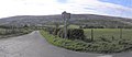
 Welcome to Killen - geograph.org.uk - 390081.jpg 640 × 295; 38 KB
-
 White Rocks carpark - geograph.org.uk - 386484.jpg 640 × 480; 40 KB
-
 Willmount - geograph.org.uk - 411467.jpg 640 × 479; 54 KB
-
 Willmount - geograph.org.uk - 411475.jpg 640 × 479; 69 KB
-
 Willmount Primary School - geograph.org.uk - 411471.jpg 640 × 479; 84 KB
-
 Willmount Townland - geograph.org.uk - 411425.jpg 640 × 479; 90 KB
-
 Willmount Townland - geograph.org.uk - 411511.jpg 640 × 306; 32 KB
-
 Woodside - geograph.org.uk - 390214.jpg 640 × 479; 74 KB
-


_-_geograph.org.uk_-_386796.jpg)


_-_geograph.org.uk_-_395106.jpg)


_-_geograph.org.uk_-_417006.jpg)


_(1)_-_geograph.org.uk_-_402828.jpg)
_(4)_-_geograph.org.uk_-_402844.jpg)

_-_geograph.org.uk_-_412523.jpg)
_-_geograph.org.uk_-_412529.jpg)


_-_geograph.org.uk_-_394568.jpg)


_-_geograph.org.uk_-_417002.jpg)


_-_geograph.org.uk_-_402861.jpg)
_-_geograph.org.uk_-_407100.jpg)


_-_geograph.org.uk_-_383840.jpg)


_-_geograph.org.uk_-_405810.jpg)


_-_geograph.org.uk_-_402851.jpg)