Category:April 2010 in York
Deutsch: Bilder, die im April 2010 in York aufgenommen worden sind. Bitte beachten Sie, dass dies weder das Datum des Uploads noch das Datum des Scannens eines Fotos ist.
English: Images/pictures taken in York during April 2010. Note this is not the date of the upload, nor the date a photo was scanned.
Español: Fotografías o imágenes tomadas en York durante abril 2010. No es la fecha de subida ni escaneo, sino la fecha en que las fotografías o imágenes se crearon.
Esperanto: Bildoj faritaj en York en aprilo 2010. Tio ne estas la dato, kiam la bildoj estis alŝutitaj aŭ skanitaj.
Français : Photographies ou images prises en York durant avril 2010. Ce n'est pas la date du téléchargement ou du scan.
Galego: Fotografías ou imaxes tomadas en York durante abril 2010. Non é a data de subida nin escaneamento, senón a data na que se crearon as fotografías ou imaxes.
Italiano: Fotografie o immagini scattate a York nel aprile 2010. Nota bene: la data non si riferisce né a quella di upload né a quella in cui la foto è stata digitalizzata.
Norsk bokmål: Bilder tatt i York i løpet av april 2010. Merk at dette ikke er datoen for opplasting, eller når et bilde har blitt skannet.
Norsk nynorsk: Bilete teke i York i løpet av april 2010. Merk at dette ikkje er datoen for opplasting, eller når eit bilete har vorte skanna.
Русский: Изображения, сделанные в York в течение апрель 2010 (не дата загрузки изображения).
Українська: Зображення, зроблені в York протягом квітень 2010. Зауважте, що це не дата завантаження чи дата сканування фотографії.
| April 2009 | ← | April 2010 | → | April 2011 | |||||||
| Jan | Feb | Mar | Apr | May | Jun | Jul | Aug | Sep | Oct | Nov | Dec |
| 32 | 231 | 295 | 129 | 284 | 39 | 153 | 189 | 252 | 138 | 121 | 108 |
|---|---|---|---|---|---|---|---|---|---|---|---|
Media in category "April 2010 in York"
The following 129 files are in this category, out of 129 total.
-
 60-62 Marygate - geograph.org.uk - 1837434.jpg 2,375 × 2,443; 1.39 MB
-
 Acaster Lane, looking towards Acaster Malbis - geograph.org.uk - 1819041.jpg 1,024 × 683; 131 KB
-
 Acaster Lane, looking towards Bishopthorpe - geograph.org.uk - 1819032.jpg 1,024 × 683; 118 KB
-
 Access path to the Trans-pennine Trail - geograph.org.uk - 1819014.jpg 1,600 × 1,067; 744 KB
-
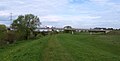
 Across the Ings towards Cottingwith - geograph.org.uk - 1830687.jpg 640 × 435; 217 KB
-
 Along the hedge - geograph.org.uk - 1826334.jpg 640 × 480; 115 KB
-
 Approach road to Acaster Malbis (Hauling Lane) - geograph.org.uk - 1818930.jpg 1,600 × 1,067; 296 KB
-
 Approaching Kexby - geograph.org.uk - 1824814.jpg 640 × 480; 158 KB
-
 Approaching Millfield Wood - geograph.org.uk - 1824508.jpg 640 × 480; 169 KB
-
 Approaching the ring road bridge - geograph.org.uk - 1837500.jpg 3,225 × 1,632; 1,008 KB
-
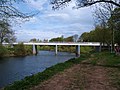
 Bridge over the Ouse - geograph.org.uk - 1837501.jpg 3,264 × 2,448; 1.63 MB
-
 Bridleway between the fields - geograph.org.uk - 1824785.jpg 640 × 480; 144 KB
-
 Bridleway near Heslington - geograph.org.uk - 1826309.jpg 640 × 480; 131 KB
-
 Bridleway near Londesborough Lodge - geograph.org.uk - 1824436.jpg 640 × 480; 139 KB
-
 Bridleway switches fields - geograph.org.uk - 1826306.jpg 480 × 640; 176 KB
-
 Bridleway to Crockey Hill - geograph.org.uk - 1826405.jpg 640 × 480; 139 KB
-
 Bridleway to Kexby - geograph.org.uk - 1824710.jpg 640 × 480; 128 KB
-
 Bridleway to Tillmire Farm - geograph.org.uk - 1826395.jpg 480 × 640; 215 KB
-
 Bridleway to White House Farm - geograph.org.uk - 1826365.jpg 640 × 480; 155 KB
-
 Bridleway towards Coronation Plantation - geograph.org.uk - 1826329.jpg 640 × 480; 117 KB
-
 Carrbank Lane - geograph.org.uk - 1802011.jpg 2,816 × 2,112; 2.21 MB
-
 City walls and Micklegate bar, York - geograph.org.uk - 2851007.jpg 4,000 × 2,672; 2.75 MB
-
 Clifton Bridge, York - geograph.org.uk - 1837466.jpg 3,264 × 2,448; 2.06 MB
-
 Clifton Long Reach - geograph.org.uk - 1837454.jpg 3,264 × 2,448; 2.17 MB
-
 Construction of Dean's Acre access road - geograph.org.uk - 1826203.jpg 640 × 480; 123 KB
-
 Coronation Plantation - geograph.org.uk - 1826323.jpg 640 × 480; 140 KB
-
 Country between Stockton and Warthill - geograph.org.uk - 1804211.jpg 2,816 × 2,112; 2.03 MB
-
 Cows near Kexby - geograph.org.uk - 1824800.jpg 640 × 480; 127 KB
-
 Cross Lane - geograph.org.uk - 1826438.jpg 640 × 480; 110 KB
-
 Daffodils in Heslington - geograph.org.uk - 1826793.jpg 640 × 480; 160 KB
-
 Drain on the Ings - geograph.org.uk - 1830683.jpg 640 × 457; 217 KB
-
 Entering Murton - geograph.org.uk - 1825096.jpg 640 × 480; 113 KB
-
 Fields along the Kexby bridleway - geograph.org.uk - 1824735.jpg 640 × 480; 142 KB
-
 Fighters on display - geograph.org.uk - 3479311.jpg 4,000 × 2,672; 2.42 MB
-
 Flood bank, Clifton Ings - geograph.org.uk - 1837473.jpg 3,264 × 2,448; 1.96 MB
-
 Flood Defences - York - geograph.org.uk - 2177000.jpg 640 × 480; 131 KB
-
 Footpath between Stockton and Carlton Farm - geograph.org.uk - 1802004.jpg 2,816 × 2,112; 2.26 MB
-
 Footpath on Heslington Common - geograph.org.uk - 1826471.jpg 480 × 640; 216 KB
-
 Forest Lane - geograph.org.uk - 1826372.jpg 480 × 640; 167 KB
-
 Fulford turnoff - geograph.org.uk - 1826423.jpg 640 × 480; 108 KB
-
 Golf course road - geograph.org.uk - 1826477.jpg 480 × 640; 191 KB
-
 Hagg Wood - geograph.org.uk - 1824302.jpg 640 × 480; 144 KB
-
 Hardware Shop Foxwood Lane - geograph.org.uk - 1827702.jpg 1,000 × 750; 413 KB
-
 Heslington Village - geograph.org.uk - 1826799.jpg 480 × 640; 153 KB
-
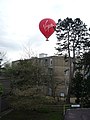 Hot air balloon over Derwent A Block - geograph.org.uk - 1826669.jpg 480 × 640; 146 KB
-
 Hot air balloon over the Quiet Place - geograph.org.uk - 1826693.jpg 640 × 480; 120 KB
-

-
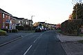
 Houses on York Street - geograph.org.uk - 1824223.jpg 640 × 480; 127 KB
-
 Intake Lane - geograph.org.uk - 1824285.jpg 480 × 640; 183 KB
-

-
 Junction on Cross Lane - geograph.org.uk - 1826452.jpg 640 × 480; 123 KB
-

-
 Looking down the Derwent - geograph.org.uk - 1824993.jpg 640 × 480; 113 KB
-
 Looking towards part of Fulford - geograph.org.uk - 1826455.jpg 640 × 480; 113 KB
-
 Low Petergate, York Geograph-1790092-by-David-Dixon.jpg 2,112 × 2,816; 996 KB
-
 Market Place, York - geograph.org.uk - 2851000.jpg 4,000 × 3,000; 2.89 MB
-
 Millfield Wood - geograph.org.uk - 1824675.jpg 480 × 640; 191 KB
-
 Misfit Building - York - geograph.org.uk - 2134893.jpg 640 × 480; 68 KB
-
 Monk Bar - geograph.org.uk - 1807418.jpg 2,606 × 2,105; 1.65 MB
-
 Museum Street Bridge - York - geograph.org.uk - 2134856.jpg 640 × 480; 89 KB
-
 National Centre for Early Music - geograph.org.uk - 1801250.jpg 2,560 × 1,920; 1.17 MB
-
 Near Londesborough Lodge - geograph.org.uk - 1824431.jpg 640 × 480; 131 KB
-

-
 Nimrod MR2 XV250 at Yorkshire Air Museum - geograph.org.uk - 3479315.jpg 3,964 × 1,928; 965 KB
-
 NRM Depot 13079.jpg 1,024 × 768; 234 KB
-
 NRM Yard 69621.jpg 1,024 × 768; 192 KB
-
 On Carrbank Lane - geograph.org.uk - 1802022.jpg 2,816 × 2,112; 2.08 MB
-
 Osbaldwick Beck - geograph.org.uk - 1825103.jpg 640 × 480; 116 KB
-
 Osbaldwick Beck - geograph.org.uk - 1835908.jpg 640 × 480; 166 KB
-
 Osbaldwick Beck ^ Church - geograph.org.uk - 1825109.jpg 640 × 480; 141 KB
-
 Ouse bank repairs - geograph.org.uk - 1837447.jpg 3,264 × 2,448; 2.22 MB
-
 Path in St Nick's Fields - geograph.org.uk - 1835907.jpg 480 × 640; 173 KB
-
 Path in St Nicks - geograph.org.uk - 1835915.jpg 640 × 480; 112 KB
-
 Path near the stone circle - geograph.org.uk - 1835903.jpg 640 × 480; 156 KB
-
 Paths near Rawdon Avenue - geograph.org.uk - 1835912.jpg 640 × 480; 130 KB
-
 Ploughed field - geograph.org.uk - 1826411.jpg 640 × 480; 140 KB
-
 Queen's Staith - York - geograph.org.uk - 2134821.jpg 640 × 480; 68 KB
-
 River Ouse at Acaster Malbis - geograph.org.uk - 1818950.jpg 1,600 × 1,067; 363 KB
-
 River Ouse at Lendal Bridge, York - geograph.org.uk - 2850983.jpg 4,000 × 2,672; 2.88 MB
-
 River Ouse near Acaster Malbis - geograph.org.uk - 1818944.jpg 1,600 × 1,067; 328 KB
-
 River Ouse near Naburn Marina - geograph.org.uk - 1818910.jpg 5,616 × 3,744; 4.03 MB
-
 River Ouse near the Yorkshire Ouse Sailing Club - geograph.org.uk - 1818920.jpg 1,600 × 1,067; 407 KB
-
 Skelton railway bridges - geograph.org.uk - 1837514.jpg 3,264 × 2,448; 1.76 MB
-
 Sluice gates, Rawcliffe - geograph.org.uk - 1837504.jpg 3,264 × 2,448; 2.04 MB
-
 South Farm - geograph.org.uk - 1824501.jpg 640 × 480; 190 KB
-
 Spitfire Mark I gate guard at Yorkshire Air Museum - geograph.org.uk - 3479332.jpg 4,000 × 2,672; 2.73 MB
-
 St Paul's Church - geograph.org.uk - 1826798.jpg 640 × 480; 123 KB
-
 St Philip and St James Church-geograph-1789212-by-David-Dixon.jpg 2,112 × 2,816; 1.26 MB
-
 St Thomas' Church, York.jpg 1,814 × 2,411; 976 KB
-
 STANTON wagon National Railway Museum.jpg 3,008 × 2,000; 1.36 MB
-
 Stone Circle - geograph.org.uk - 1835898.jpg 640 × 480; 137 KB
-
 The Bay Horse, Marygate (geograph 1837440).jpg 2,881 × 2,184; 1.16 MB
-
 The edge of Millfield wood - geograph.org.uk - 1824662.jpg 640 × 480; 144 KB
-
 The Old Railway Bridge, Bishopthorpe - geograph.org.uk - 1819020.jpg 1,600 × 1,067; 479 KB
-
 The Ouse above York - geograph.org.uk - 1837495.jpg 3,167 × 1,762; 1.04 MB
-
 The Pool, Wheldrake Ings - geograph.org.uk - 1830693.jpg 640 × 457; 219 KB
-
 The Shambles, York (4525456245).jpg 3,776 × 2,520; 3.11 MB
-
 Tillmire Farm - geograph.org.uk - 1826415.jpg 640 × 480; 135 KB
-
 Towards Carr Goit Bridge - geograph.org.uk - 1825092.jpg 640 × 480; 117 KB
-
 Towards Coronation Plantation - geograph.org.uk - 1826302.jpg 640 × 480; 119 KB
-
 Towards Lime Field Farm - geograph.org.uk - 1824294.jpg 640 × 480; 129 KB
-
 Towards Lodge Farm - geograph.org.uk - 1826445.jpg 640 × 480; 111 KB
-
 Towards Londesborough Lodge - geograph.org.uk - 1824423.jpg 640 × 480; 132 KB
-
 Towards Waite's Plantation - geograph.org.uk - 1826294.jpg 640 × 480; 110 KB
-
 Track to White House Farm - geograph.org.uk - 1826388.jpg 480 × 640; 226 KB
-
 Track towards Kexby - geograph.org.uk - 1824793.jpg 640 × 480; 139 KB
-
 Tree on a bridleway - geograph.org.uk - 1826359.jpg 640 × 480; 114 KB
-
 Tree on Germany Lane - geograph.org.uk - 1826459.jpg 640 × 480; 106 KB
-
 Tree on the Kexby bridleway - geograph.org.uk - 1824747.jpg 480 × 640; 165 KB
-
 Trees near the A64 - geograph.org.uk - 1826345.jpg 640 × 480; 116 KB
-
 Twin bridges - geograph.org.uk - 1837513.jpg 3,264 × 2,448; 1.32 MB
-
 View from York Minster's Tower (4525466383).jpg 3,776 × 2,520; 3.33 MB
-
 View from York Minster's Tower (4526100424).jpg 3,776 × 2,520; 3.21 MB
-

-
 View towards the Ship Inn Acaster Malbis - geograph.org.uk - 1818961.jpg 1,600 × 1,067; 389 KB
-
 Wetland area, Clifton Ings - geograph.org.uk - 1837488.jpg 3,201 × 1,933; 1.89 MB
-
 Wheldrake Ings - geograph.org.uk - 1830681.jpg 640 × 457; 209 KB
-
 Windmill Lane remodelling - geograph.org.uk - 4514807.jpg 640 × 480; 112 KB
-
 Windpump on the Ings - geograph.org.uk - 1830667.jpg 640 × 457; 203 KB
-
 Woodpile next to the bridleway - geograph.org.uk - 1826312.jpg 480 × 640; 153 KB
-
 York City before Luton playoff - geograph.org.uk - 1831727.jpg 640 × 411; 61 KB
-
 York City Wall from the NCEM - geograph.org.uk - 1801256.jpg 2,560 × 1,920; 983 KB
-
 York Minster (4526081914).jpg 3,776 × 2,520; 3.11 MB
-
 York Minster - geograph.org.uk - 2851043.jpg 3,207 × 2,644; 1.56 MB
-
 York Minster Buttress (4526098102).jpg 3,776 × 2,520; 3.13 MB
-
 York Minster Glass (4525461881).jpg 3,776 × 2,520; 3.95 MB
-
 York Minster Towers.jpg 4,000 × 3,000; 2.92 MB
-
 York Minster, Chapter House Roof (4526088574).jpg 3,776 × 2,520; 3.4 MB
-
 York Street (4525454079).jpg 3,776 × 2,520; 2.8 MB


_-_geograph.org.uk_-_1818930.jpg)


_-_geograph.org.uk_-_1819002.jpg)


.jpg)


.jpg)


.jpg)
.jpg)


.jpg)

.jpg)
.jpg)

.jpg)
.jpg)