Category:April 2011 in Norfolk, England

Deutsch: Bilder, die im April 2011 in Norfolk, England aufgenommen worden sind. Bitte beachten Sie, dass dies weder das Datum des Uploads noch das Datum des Scannens eines Fotos ist.
English: Images/pictures taken in Norfolk, England during April 2011. Note this is not the date of the upload, nor the date a photo was scanned.
Español: Fotografías o imágenes tomadas en Norfolk, England durante abril 2011. No es la fecha de subida ni escaneo, sino la fecha en que las fotografías o imágenes se crearon.
Esperanto: Bildoj faritaj en Norfolk, England en aprilo 2011. Tio ne estas la dato, kiam la bildoj estis alŝutitaj aŭ skanitaj.
Français : Photographies ou images prises en Norfolk, England durant avril 2011. Ce n'est pas la date du téléchargement ou du scan.
Galego: Fotografías ou imaxes tomadas en Norfolk, England durante abril 2011. Non é a data de subida nin escaneamento, senón a data na que se crearon as fotografías ou imaxes.
Italiano: Fotografie o immagini scattate a Norfolk, England nel aprile 2011. Nota bene: la data non si riferisce né a quella di upload né a quella in cui la foto è stata digitalizzata.
Norsk bokmål: Bilder tatt i Norfolk, England i løpet av april 2011. Merk at dette ikke er datoen for opplasting, eller når et bilde har blitt skannet.
Norsk nynorsk: Bilete teke i Norfolk, England i løpet av april 2011. Merk at dette ikkje er datoen for opplasting, eller når eit bilete har vorte skanna.
Русский: Изображения, сделанные в Norfolk, England в течение апрель 2011 (не дата загрузки изображения).
Українська: Зображення, зроблені в Norfolk, England протягом квітень 2011. Зауважте, що це не дата завантаження чи дата сканування фотографії.
| April 2010 | ← | April 2011 | → | April 2012 | |||||||
| Jan | Feb | Mar | Apr | May | Jun | Jul | Aug | Sep | Oct | Nov | Dec |
| 23 | 166 | 133 | 212 | 48 | 96 | 38 | 56 | 61 | 38 | 37 | 33 |
|---|---|---|---|---|---|---|---|---|---|---|---|
Subcategories
This category has the following 2 subcategories, out of 2 total.
Media in category "April 2011 in Norfolk, England"
The following 200 files are in this category, out of 210 total.
(previous page) (next page)-
 3 St Nicholas Place - geograph.org.uk - 3349842.jpg 640 × 483; 60 KB
-
 A140 Norwich Road - geograph.org.uk - 2365300.jpg 3,072 × 2,304; 1.25 MB
-
 -2011-04-23 Scarrow Beck, Ringbank Lane, Hanworth.jpg 1,280 × 960; 575 KB
-
 Apartment Block and Fitness Centre, Cobholm, Great Yarmouth - geograph.org.uk - 2405592.jpg 3,888 × 2,592; 2.92 MB
-
 ASDA superstore and car park, Vauxhall, Great Yarmouth - geograph.org.uk - 2406832.jpg 3,888 × 2,592; 3.97 MB
-
 Barneys Newsagents - geograph.org.uk - 3349843.jpg 640 × 542; 83 KB
-
 Bathing huts at Sheringham - geograph.org.uk - 3349865.jpg 640 × 472; 84 KB
-

-
 Bretts Hill Railway Bridge sign, Thorpe Road, Southrepps - geograph.org.uk - 2364410.jpg 3,072 × 2,304; 1.4 MB
-
 Bretts Hill Railway Bridge, Thorpe Road - geograph.org.uk - 2364404.jpg 3,072 × 2,304; 1.48 MB
-
 Breydon Water, Great Yarmouth - geograph.org.uk - 2372846.jpg 640 × 480; 217 KB
-
 Cattle grazing in Acle Marshes - geograph.org.uk - 2372871.jpg 640 × 470; 172 KB
-
 Cattle pasture in Acle Marshes - geograph.org.uk - 2372867.jpg 640 × 480; 170 KB
-
 Cattle pasture in Acle Marshes - geograph.org.uk - 2372868.jpg 480 × 640; 191 KB
-
 Cattle pens in Acle Marshes - geograph.org.uk - 2372839.jpg 640 × 480; 191 KB
-
 Chapel Street, Southrepps - geograph.org.uk - 2364627.jpg 3,072 × 2,304; 1.33 MB
-
 Church Street-Whitegate Street sign - geograph.org.uk - 2364617.jpg 3,072 × 2,304; 1.63 MB
-
 Clipped Hedge Lane, Southrepps - geograph.org.uk - 2364576.jpg 2,304 × 3,072; 1.36 MB
-
 Confluence of the Rivers Bure and Yare - geograph.org.uk - 2406803.jpg 3,888 × 2,592; 3.12 MB
-
 Confluence of the Rivers Bure and Yare, Great Yarmouth - geograph.org.uk - 2406810.jpg 3,888 × 2,592; 3.14 MB
-
 Confluence of the Rivers Bure and Yare, Great Yarmouth - geograph.org.uk - 2406827.jpg 3,888 × 2,592; 3.21 MB
-
 Cows and their reflections, Acle Marshes - geograph.org.uk - 2372870.jpg 640 × 615; 234 KB
-
 Disused wharf and silos, Great Yarmouth - geograph.org.uk - 2406825.jpg 3,888 × 2,592; 3.72 MB
-
 Disused wharf on the River Bure, Great Yarmouth - geograph.org.uk - 2406804.jpg 3,888 × 2,592; 3.56 MB
-
 DMU heading for Norwich - geograph.org.uk - 2372836.jpg 640 × 462; 147 KB
-
 DMU on its way from Gt Yarmouth to Acle - geograph.org.uk - 2372801.jpg 640 × 480; 176 KB
-
 Down the slipway - geograph.org.uk - 3349869.jpg 640 × 475; 57 KB
-
 Dr Geebers The Pebbleman - geograph.org.uk - 3349844.jpg 640 × 471; 73 KB
-
 Drain and marsh pasture, Acle Marshes - geograph.org.uk - 2372854.jpg 640 × 497; 179 KB
-
 Drain in Acle Marshes, Great Yarmouth - geograph.org.uk - 2372835.jpg 640 × 480; 221 KB
-

-

-
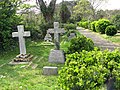
 Earlham Road Cemetery - geograph.org.uk - 2339300.jpg 535 × 640; 303 KB
-
 Earlham Road Cemetery - geograph.org.uk - 2339302.jpg 640 × 567; 214 KB
-
 Earlham Road Cemetery - geograph.org.uk - 2339306.jpg 640 × 526; 232 KB
-
 Earlham Road Cemetery - geograph.org.uk - 2339316.jpg 640 × 522; 176 KB
-
 Earlham Road Cemetery - geograph.org.uk - 2339320.jpg 640 × 480; 265 KB
-
 Earlham Road Cemetery - geograph.org.uk - 2339322.jpg 640 × 480; 243 KB
-
 Earlham Road Cemetery - geograph.org.uk - 2339325.jpg 640 × 480; 259 KB
-
 Earlham Road Cemetery - geograph.org.uk - 2339326.jpg 488 × 640; 289 KB
-
 Earlham Road Cemetery - geograph.org.uk - 2339329.jpg 640 × 474; 239 KB
-
 Earlham Road Cemetery - geograph.org.uk - 2339333.jpg 640 × 480; 274 KB
-
 Earlham Road Cemetery - geograph.org.uk - 2339339.jpg 640 × 414; 251 KB
-
 Earlham Road Cemetery - geograph.org.uk - 2339342.jpg 480 × 640; 298 KB
-
 Earlham Road Cemetery - geograph.org.uk - 2339347.jpg 640 × 480; 236 KB
-
 Earlham Road Cemetery - geograph.org.uk - 2339348.jpg 640 × 480; 260 KB
-
 Earlham Road Cemetery - geograph.org.uk - 2339351.jpg 640 × 480; 269 KB
-
 Earlham Road Cemetery - geograph.org.uk - 2339354.jpg 640 × 526; 192 KB
-
 Earlham Road Cemetery - geograph.org.uk - 2339356.jpg 640 × 540; 288 KB
-
 Earlham Road Cemetery - geograph.org.uk - 2339357.jpg 480 × 640; 244 KB
-
 Earlham Road Cemetery - geograph.org.uk - 2339359.jpg 640 × 480; 242 KB
-
 Earlham Road Cemetery - geograph.org.uk - 2339360.jpg 640 × 585; 311 KB
-
 Earlham Road Cemetery - geograph.org.uk - 2339363.jpg 640 × 575; 285 KB
-
 Earlham Road Cemetery - geograph.org.uk - 2339365.jpg 480 × 640; 284 KB
-
 Earlham Road Cemetery - geograph.org.uk - 2339366.jpg 640 × 480; 284 KB
-
 Earlham Road Cemetery - geograph.org.uk - 2339368.jpg 640 × 480; 250 KB
-
 Earlham Road Cemetery - geograph.org.uk - 2339370.jpg 640 × 480; 263 KB
-
 Earlham Road Cemetery - geograph.org.uk - 2339371.jpg 640 × 480; 256 KB
-
 Earlham Road Cemetery - geograph.org.uk - 2339372.jpg 640 × 483; 208 KB
-
 Earlham Road Cemetery - geograph.org.uk - 2339384.jpg 600 × 583; 306 KB
-
 Earlham Road Cemetery - geograph.org.uk - 2339388.jpg 640 × 439; 244 KB
-
 Earlham Road Cemetery - geograph.org.uk - 2339389.jpg 640 × 480; 290 KB
-
 Earlham Road Cemetery - geograph.org.uk - 2339390.jpg 520 × 640; 286 KB
-
 Earlham Road Cemetery - geograph.org.uk - 2339392.jpg 480 × 566; 199 KB
-
 Earlham Road Cemetery - geograph.org.uk - 2339394.jpg 640 × 443; 280 KB
-
 Earlham Road Cemetery - geograph.org.uk - 2697495.jpg 640 × 430; 125 KB
-
 Earlham Road Cemetery - geograph.org.uk - 2697497.jpg 430 × 640; 118 KB
-
 Earlham Road Cemetery - memorial gardens - geograph.org.uk - 2339297.jpg 539 × 640; 311 KB
-
 Earlham Road Cemetery - the crematorium - geograph.org.uk - 2339281.jpg 640 × 480; 238 KB
-
 Earlham Road Cemetery - the crematorium - geograph.org.uk - 2339286.jpg 525 × 640; 134 KB
-
 Earlham Road Cemetery - the crematorium - geograph.org.uk - 2339289.jpg 640 × 528; 241 KB
-
 Earlham Road Cemetery - the crematorium - geograph.org.uk - 2339293.jpg 640 × 440; 194 KB
-
 East promenade - geograph.org.uk - 3349864.jpg 640 × 474; 51 KB
-
 Eastwards from the car park - geograph.org.uk - 3349866.jpg 640 × 485; 42 KB
-
 Farm track in Acle Marshes - geograph.org.uk - 2372857.jpg 640 × 480; 173 KB
-
 Fishermans Heritage Museum - geograph.org.uk - 3349845.jpg 640 × 476; 60 KB
-
 Fishing boats - geograph.org.uk - 3349846.jpg 640 × 476; 63 KB
-
 Flats overlooking the car park - geograph.org.uk - 3349867.jpg 640 × 543; 55 KB
-
 Footpath to Vauxhall Station, Great Yarmouth - geograph.org.uk - 2405647.jpg 3,888 × 2,592; 3.83 MB
-
 Friary ruins, Great Yarmouth - geograph.org.uk - 2364058.jpg 480 × 640; 258 KB
-
 Friary ruins, Great Yarmouth - geograph.org.uk - 2364062.jpg 640 × 480; 297 KB
-
 Friary ruins, Great Yarmouth - geograph.org.uk - 2364065.jpg 480 × 640; 284 KB
-
 Friary ruins, Great Yarmouth - geograph.org.uk - 2364071.jpg 640 × 480; 270 KB
-
 Friary ruins, Great Yarmouth - geograph.org.uk - 2364076.jpg 480 × 640; 216 KB
-
 Gables Avenue, Southrepps - geograph.org.uk - 2364605.jpg 3,072 × 2,304; 1.36 MB
-
 Gables Avenue, Southrepps - geograph.org.uk - 2364609.jpg 3,072 × 2,304; 1.3 MB
-
 Gables Avenue, Southrepps sign - geograph.org.uk - 2364607.jpg 3,072 × 2,304; 1.62 MB
-
 Gate into friary ruins, Great Yarmouth - geograph.org.uk - 2364046.jpg 480 × 640; 212 KB
-
 Gate on the Weavers Way, Breydon Water - geograph.org.uk - 2372861.jpg 640 × 524; 199 KB
-
 Gate on the Weavers Way, Breydon Water - geograph.org.uk - 2372865.jpg 640 × 480; 179 KB
-
 Gate on the Weavers Way, Great Yarmouth - geograph.org.uk - 2372820.jpg 640 × 480; 190 KB
-
 George II cannon on South Quay, Gt Yarmouth - geograph.org.uk - 2363736.jpg 3,456 × 2,592; 3.81 MB
-
 Golden Lion and Town Hall.jpg 4,288 × 2,416; 2.63 MB
-
 Great Yarmouth Power Station - geograph.org.uk - 2416056.jpg 3,888 × 2,592; 3.21 MB
-
 Great Yarmouth Town Hall - geograph.org.uk - 2405218.jpg 3,888 × 2,592; 4.14 MB
-
 Great Yarmouth Town Hall - geograph.org.uk - 2405260.jpg 3,888 × 2,592; 3.88 MB
-
 Grey Squirrel in Gt Yarmouth cemetery - geograph.org.uk - 2363767.jpg 3,456 × 2,592; 3.94 MB
-
 Greyfriar's House, Great Yarmouth - geograph.org.uk - 2364096.jpg 480 × 640; 165 KB
-
 Greyfriar's House, Great Yarmouth - geograph.org.uk - 2364101.jpg 480 × 640; 168 KB
-
 Greyfriar's House, Great Yarmouth - geograph.org.uk - 2364109.jpg 640 × 480; 206 KB
-
 Greyfriar's House, Great Yarmouth - geograph.org.uk - 2364115.jpg 640 × 480; 201 KB
-
 Greyfriar's House, Great Yarmouth - geograph.org.uk - 2364123.jpg 640 × 480; 199 KB
-
 Greyfriar's House, Great Yarmouth - geograph.org.uk - 2364128.jpg 640 × 480; 212 KB
-
 Greyfriars Cloisters - geograph.org.uk - 1018609.jpg 640 × 480; 124 KB
-
 Hats at Barneys Newsagents - geograph.org.uk - 3349847.jpg 556 × 640; 69 KB
-
 Haven Bridge, Great Yarmouth - geograph.org.uk - 2405268.jpg 3,888 × 2,592; 2.98 MB
-
 Havenbridge House, Stonecutters Quay, Great Yarmouth - geograph.org.uk - 2405590.jpg 2,592 × 3,888; 3.63 MB
-

-
-

-
-
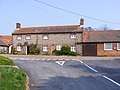
 House in Bridge Road, Great Yarmouth - geograph.org.uk - 2364486.jpg 600 × 569; 141 KB
-

-

-

-
 Houses in Factory Road, Great Yarmouth - geograph.org.uk - 2350895.jpg 640 × 480; 208 KB
-
 Houses on Augusta Street - geograph.org.uk - 3349849.jpg 640 × 478; 74 KB
-
 Ice house in Bridge Road, Great Yarmouth - geograph.org.uk - 2364465.jpg 640 × 603; 172 KB
-
 Information plaque for George II cannon at Gt Yarmouth - geograph.org.uk - 2363740.jpg 1,536 × 1,206; 815 KB
-
 IRB station slipway - geograph.org.uk - 3349850.jpg 640 × 415; 49 KB
-

-

-

-
 King's Lynn police headquarters - geograph.org.uk - 2387863.jpg 640 × 464; 182 KB
-
 Kitchener Road Cemetery, Great Yarmouth - geograph.org.uk - 2350904.jpg 640 × 480; 228 KB
-
 Kitchener Road Cemetery, Great Yarmouth - geograph.org.uk - 2350910.jpg 480 × 640; 314 KB
-
 Kitchener Road Cemetery, Great Yarmouth - geograph.org.uk - 2350913.jpg 640 × 480; 253 KB
-
 Kitchener Road Cemetery, Great Yarmouth - geograph.org.uk - 2350914.jpg 640 × 480; 299 KB
-
 Kitchener Road Cemetery, Great Yarmouth - geograph.org.uk - 2350920.jpg 640 × 638; 173 KB
-
 Kitchener Road Cemetery, Great Yarmouth - geograph.org.uk - 2350922.jpg 480 × 640; 244 KB
-
 Kitchener Road Cemetery, Great Yarmouth - geograph.org.uk - 2350923.jpg 480 × 640; 260 KB
-
 Kitchener Road Cemetery, Great Yarmouth - geograph.org.uk - 2350927.jpg 640 × 480; 273 KB
-
 Kitchener Road Cemetery, Great Yarmouth - geograph.org.uk - 2350929.jpg 640 × 480; 231 KB
-
 Kitchener Road Cemetery, Great Yarmouth - geograph.org.uk - 2350932.jpg 600 × 592; 231 KB
-
 Kitchener Road Cemetery, Great Yarmouth - geograph.org.uk - 2350937.jpg 640 × 480; 275 KB
-
 Kitchener Road Cemetery, Great Yarmouth - geograph.org.uk - 2350942.jpg 640 × 480; 245 KB
-
 Kitchener Road Cemetery, Great Yarmouth - geograph.org.uk - 2350955.jpg 470 × 640; 252 KB
-
 Kitchener Road Cemetery, Great Yarmouth - geograph.org.uk - 2350958.jpg 640 × 507; 261 KB
-
 Kitchener Road Cemetery, Great Yarmouth - geograph.org.uk - 2350965.jpg 550 × 640; 149 KB
-

-
-

-

-

-

-
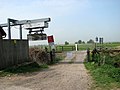
 Level Crossing close to Breydon Water - geograph.org.uk - 1919628.jpg 2,304 × 3,072; 2.5 MB
-

-
 Life belt on the edge of Breydon Water - geograph.org.uk - 2372863.jpg 640 × 608; 262 KB
-
 Little Theatre - geograph.org.uk - 3349852.jpg 640 × 475; 51 KB
-
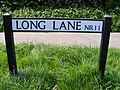 Long Lane sign - geograph.org.uk - 2364642.jpg 3,072 × 2,304; 1.64 MB
-
 Long Lane, Southrepps - geograph.org.uk - 2364654.jpg 3,072 × 2,304; 1.36 MB
-
 Matalan and restored icehouse, Southtown, Great Yarmouth - geograph.org.uk - 2405378.jpg 3,888 × 2,592; 2.77 MB
-

-
 Monuments in Gt. Yarmouth cemetery - geograph.org.uk - 2363771.jpg 700 × 525; 352 KB
-
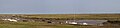
 Moorings, River Yare - geograph.org.uk - 3340266.jpg 687 × 1,024; 65 KB
-
 Morston Quay, North Norfolk.jpg 11,495 × 2,656; 5.02 MB
-
 Nelson Road North, Gt. Yarmouth - geograph.org.uk - 2363777.jpg 700 × 525; 165 KB
-
 New Inn Public House sign - geograph.org.uk - 2365293.jpg 2,304 × 3,072; 1.3 MB
-
 New Inn Public House, Roughton - geograph.org.uk - 2365291.jpg 3,072 × 2,304; 1.27 MB
-

-
 Notice Board of St. James Church, Southrepps - geograph.org.uk - 2364551.jpg 3,072 × 2,304; 1.48 MB
-
 Old Hunstanton Village Sign.jpg 540 × 720; 63 KB
-

-
 Pasta Foods factory, Southtown, Great Yarmouth - geograph.org.uk - 2405276.jpg 3,888 × 2,592; 3.2 MB
-
 Pastures in Acle Marshes - geograph.org.uk - 2372834.jpg 640 × 480; 203 KB
-
 Path to the cemetery, Great Yarmouth - geograph.org.uk - 2350883.jpg 466 × 640; 213 KB
-
 Promenade - geograph.org.uk - 3349853.jpg 640 × 449; 40 KB
-
 Quakers Lane, Norwich (old street sign) - geograph.org.uk - 2382346.jpg 640 × 480; 230 KB
-
 Quakers Lane, Norwich - geograph.org.uk - 2382343.jpg 640 × 480; 230 KB
-

-
 Restored Icehouse, Bridge Road, Great Yarmouth - geograph.org.uk - 2405366.jpg 3,888 × 2,592; 3.09 MB
-
 RNLI IRB station - geograph.org.uk - 3349854.jpg 640 × 490; 42 KB
-
 RNLI IRB station - geograph.org.uk - 3349855.jpg 532 × 640; 43 KB
-
 Sheringham Norfolk Public Art.JPG 2,304 × 1,728; 1.74 MB
-
 Sheringham rocks - geograph.org.uk - 3349868.jpg 640 × 465; 50 KB
-

-
 Slipway and beach - geograph.org.uk - 3349870.jpg 640 × 477; 54 KB
-
 Southrepps Post Office Postbox - geograph.org.uk - 2364567.jpg 2,304 × 3,072; 1.4 MB
-
 Southrepps Post Office ^ Coffee Shop - geograph.org.uk - 2364563.jpg 3,072 × 2,304; 1.3 MB
-
 Southrepps roadsign - geograph.org.uk - 2364662.jpg 2,304 × 3,072; 1.39 MB
-
 Southrepps sign - geograph.org.uk - 2364579.jpg 3,072 × 2,304; 1.19 MB
-
 Southrepps Telephone Exchange - geograph.org.uk - 2364593.jpg 3,072 × 2,304; 1.46 MB
-
 Southrepps Telephone Exchange - geograph.org.uk - 2364594.jpg 3,072 × 2,304; 1.42 MB
-
 Southrepps Telephone Exchange - geograph.org.uk - 2364595.jpg 3,072 × 2,304; 1.44 MB
-
 St Andrew, Fersfield - Wooden effigy - geograph.org.uk - 2370702.jpg 1,000 × 637; 128 KB
-

-

-

-
 St James' church in Southrepps - geograph.org.uk - 2272582.jpg 640 × 480; 108 KB
-

-

-

-

-

-
 St.James Church, Southrepps - geograph.org.uk - 2364548.jpg 3,072 × 2,304; 1.44 MB
-
 Terrace above West Promenade - geograph.org.uk - 3349857.jpg 640 × 490; 50 KB
-
 The Driftway - geograph.org.uk - 3349858.jpg 640 × 477; 54 KB
-
 The Esplanade eastwards - geograph.org.uk - 3349859.jpg 640 × 476; 38 KB
-
 The Esplanade westwards - geograph.org.uk - 3349860.jpg 640 × 483; 42 KB
-
 The public library in King's Lynn - geograph.org.uk - 2387849.jpg 640 × 495; 202 KB


_-_geograph.org.uk_-_2382346.jpg)


_-_geograph.org.uk_-_2272616.jpg)
_-_geograph.org.uk_-_2272620.jpg)


