Category:April 2014 in the East Riding of Yorkshire
Ceremonial counties of England: Bedfordshire · Berkshire · Buckinghamshire · Cambridgeshire · Cheshire · Cornwall · Cumbria · Derbyshire · Devon · Dorset · Durham · East Riding of Yorkshire · East Sussex · Essex · Gloucestershire · Greater London · Greater Manchester · Hampshire · Herefordshire · Hertfordshire · Kent · Lancashire · Leicestershire · Lincolnshire · Merseyside · Norfolk · North Yorkshire · Northamptonshire · Nottinghamshire · Oxfordshire · Shropshire · Somerset · South Yorkshire · Staffordshire · Suffolk · Surrey · Tyne and Wear · Warwickshire · West Midlands · West Sussex · West Yorkshire · Wiltshire ·
City-counties: Bristol ·
Former historic counties:
Other former counties:
City-counties: Bristol ·
Former historic counties:
Other former counties:
Deutsch: Bilder, die im April 2014 in the East Riding of Yorkshire aufgenommen worden sind. Bitte beachten Sie, dass dies weder das Datum des Uploads noch das Datum des Scannens eines Fotos ist.
English: Images/pictures taken in the East Riding of Yorkshire during April 2014. Note this is not the date of the upload, nor the date a photo was scanned.
Español: Fotografías o imágenes tomadas en the East Riding of Yorkshire durante abril 2014. No es la fecha de subida ni escaneo, sino la fecha en que las fotografías o imágenes se crearon.
Esperanto: Bildoj faritaj en the East Riding of Yorkshire en aprilo 2014. Tio ne estas la dato, kiam la bildoj estis alŝutitaj aŭ skanitaj.
Français : Photographies ou images prises en the East Riding of Yorkshire durant avril 2014. Ce n'est pas la date du téléchargement ou du scan.
Galego: Fotografías ou imaxes tomadas en the East Riding of Yorkshire durante abril 2014. Non é a data de subida nin escaneamento, senón a data na que se crearon as fotografías ou imaxes.
Italiano: Fotografie o immagini scattate a the East Riding of Yorkshire nel aprile 2014. Nota bene: la data non si riferisce né a quella di upload né a quella in cui la foto è stata digitalizzata.
Norsk bokmål: Bilder tatt i the East Riding of Yorkshire i løpet av april 2014. Merk at dette ikke er datoen for opplasting, eller når et bilde har blitt skannet.
Norsk nynorsk: Bilete teke i the East Riding of Yorkshire i løpet av april 2014. Merk at dette ikkje er datoen for opplasting, eller når eit bilete har vorte skanna.
Русский: Изображения, сделанные в the East Riding of Yorkshire в течение апрель 2014 (не дата загрузки изображения).
Українська: Зображення, зроблені в the East Riding of Yorkshire протягом квітень 2014. Зауважте, що це не дата завантаження чи дата сканування фотографії.
| April 2013 | ← | April 2014 | → | April 2015 | |||||||
| Jan | Feb | Mar | Apr | May | Jun | Jul | Aug | Sep | Oct | Nov | Dec |
| 27 | 14 | 54 | 52 | 43 | 9 | 53 | 39 | 40 | 44 | 34 | 22 |
|---|---|---|---|---|---|---|---|---|---|---|---|
Subcategories
This category has the following 2 subcategories, out of 2 total.
Media in category "April 2014 in the East Riding of Yorkshire"
The following 50 files are in this category, out of 50 total.
-
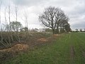
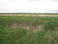
 A field drain - Asselby Marsh (geograph 3921816).jpg 1,944 × 2,592; 2.8 MB
-
 Alongside the railway (geograph 3937448).jpg 1,024 × 768; 183 KB
-
 At Loftsome Bridge (geograph 3921798).jpg 2,509 × 1,882; 2.22 MB
-
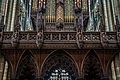
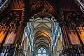
 Beverley minster (14024491186).jpg 3,821 × 2,315; 9.39 MB
-
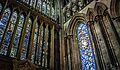
 Beverley minster (14024493846).jpg 2,592 × 3,120; 8.03 MB
-
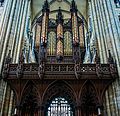
 Beverley minster (14024503736).jpg 3,872 × 2,592; 8.4 MB
-
 Beverley minster (14044417071).jpg 3,316 × 2,309; 5.89 MB
-
 Beverley minster (14044432901).jpg 3,532 × 2,064; 8.79 MB
-
 Beverley minster (14044433891).jpg 3,141 × 1,711; 6.13 MB
-
 Beverley minster (14044437481).jpg 2,517 × 2,435; 5.58 MB
-
 Beverley minster (14044441972).jpg 3,606 × 2,472; 6.56 MB
-
 Beverley minster (14047618065).jpg 3,507 × 2,474; 7.41 MB
-
 Beverley minster (14047620015).jpg 3,519 × 2,592; 8.76 MB
-
 Beverley minster (14047622435).jpg 2,978 × 2,592; 7.76 MB
-
 Beverley minster (14047635935).jpg 3,723 × 2,501; 9.03 MB
-
 Beverley minster (14047642665).jpg 3,744 × 2,582; 6.4 MB
-
 Beverley minster (14047647455).jpg 3,771 × 2,592; 8.86 MB
-
 Beverley minster (14048077724).jpg 3,834 × 2,592; 7.57 MB
-
 Beverley minster (14048085124).jpg 3,834 × 2,592; 7.76 MB
-
 Beverley minster (14048095314).jpg 2,684 × 2,592; 6.35 MB
-
 Beverley minster (14067640233).jpg 3,756 × 2,582; 9.63 MB
-
 Beverley minster (14067650493).jpg 3,872 × 2,592; 10.94 MB
-
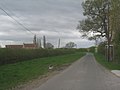 Brind Lane (geograph 3937439).jpg 1,024 × 768; 121 KB
-
 Burton Constable Hall IMG 4852 - panoramio.jpg 1,600 × 1,067; 843 KB
-
 Burton Constable Hall IMG 4943 - panoramio.jpg 1,600 × 938; 1.05 MB
-
 Drain near Wressle (geograph 3939559).jpg 1,024 × 768; 124 KB
-
 Eppleworth fields IMG 4431 - panoramio.jpg 1,600 × 1,063; 936 KB
-
 Farm track on Asselby Marsh (geograph 3921808).jpg 2,592 × 1,944; 2.32 MB
-
 Farmland around Yokefleet.JPG 2,448 × 3,264; 2.6 MB
-
 Footbridge over a small drain (geograph 3937486).jpg 1,024 × 768; 164 KB
-
 Footpath to Brind (geograph 3937472).jpg 1,024 × 768; 182 KB
-
 Green Lane (geograph 3937465).jpg 1,024 × 768; 234 KB
-
 Harvested bio-fuel plantation (geograph 3937480).jpg 1,024 × 768; 205 KB
-
 Houses on Main Street, Asselby (geograph 3921825).jpg 2,590 × 1,850; 1.66 MB
-
 Howden Parks (geograph 3937369).jpg 1,024 × 768; 140 KB
-
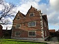 Knedlington Old Hall (Grade II* listed) (geograph 3921839).jpg 2,592 × 1,944; 2.34 MB
-
 Morrisons, Anlaby (geograph 3922930).jpg 640 × 480; 54 KB
-
 Pit alongside Brind Lane (geograph 3937446).jpg 1,024 × 768; 204 KB
-
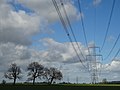 Pylons and trees on Barmby Marsh (geograph 3921803).jpg 2,592 × 1,944; 1.56 MB
-
 Rowland Hall Farm (geograph 3937455).jpg 1,024 × 768; 95 KB
-
 Rowlandhall Lane, Newsholme (geograph 3937468).jpg 1,024 × 768; 105 KB
-
 Seafront at Withernsea. (geograph 3957724).jpg 640 × 480; 41 KB
-
 The remains of High Field Station (geograph 3940759).jpg 1,024 × 768; 250 KB
-
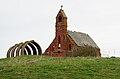 The ruined Chapel at Cottam (geograph 3930981).jpg 1,600 × 1,056; 437 KB
-
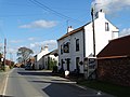 The village pub in Asselby (geograph 3921824).jpg 2,592 × 1,944; 1.6 MB
-
 View towards Brindleys Plantation from Brind Lane (geograph 3937444).jpg 1,024 × 768; 135 KB
-
 View towards Grange Plantation (geograph 3937461).jpg 1,024 × 768; 109 KB
-
 View towards Newsholme Farm (geograph 3941487).jpg 1,024 × 768; 97 KB
-
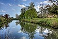
 Water treatment works by the River Derwent (geograph 3921794).jpg 2,500 × 1,875; 1.06 MB
-
 Wood Lane near Brind (geograph 3941482).jpg 1,024 × 768; 136 KB
.jpg)
.jpg)
.jpg)
.jpg)
.jpg)
.jpg)
.jpg)
.jpg)
.jpg)
.jpg)
.jpg)
.jpg)
.jpg)
.jpg)
.jpg)
.jpg)
.jpg)
.jpg)
.jpg)
.jpg)
.jpg)
.jpg)
.jpg)


.jpg)

.jpg)

.jpg)
.jpg)
.jpg)
.jpg)
.jpg)
.jpg)
_(geograph_3921839).jpg)
.jpg)
.jpg)
.jpg)
.jpg)
.jpg)
.jpg)
.jpg)
.jpg)
.jpg)
.jpg)
.jpg)
.jpg)
.jpg)
.jpg)