Category:April 2018 in York
Ok
Deutsch: Bilder, die im April 2018 in York aufgenommen worden sind. Bitte beachten Sie, dass dies weder das Datum des Uploads noch das Datum des Scannens eines Fotos ist.
English: Images/pictures taken in York during April 2018. Note this is not the date of the upload, nor the date a photo was scanned.
Español: Fotografías o imágenes tomadas en York durante abril 2018. No es la fecha de subida ni escaneo, sino la fecha en que las fotografías o imágenes se crearon.
Esperanto: Bildoj faritaj en York en aprilo 2018. Tio ne estas la dato, kiam la bildoj estis alŝutitaj aŭ skanitaj.
Français : Photographies ou images prises en York durant avril 2018. Ce n'est pas la date du téléchargement ou du scan.
Galego: Fotografías ou imaxes tomadas en York durante abril 2018. Non é a data de subida nin escaneamento, senón a data na que se crearon as fotografías ou imaxes.
Italiano: Fotografie o immagini scattate a York nel aprile 2018. Nota bene: la data non si riferisce né a quella di upload né a quella in cui la foto è stata digitalizzata.
Norsk bokmål: Bilder tatt i York i løpet av april 2018. Merk at dette ikke er datoen for opplasting, eller når et bilde har blitt skannet.
Norsk nynorsk: Bilete teke i York i løpet av april 2018. Merk at dette ikkje er datoen for opplasting, eller når eit bilete har vorte skanna.
Русский: Изображения, сделанные в York в течение апрель 2018 (не дата загрузки изображения).
Українська: Зображення, зроблені в York протягом квітень 2018. Зауважте, що це не дата завантаження чи дата сканування фотографії.
| April 2017 | ← | April 2018 | → | April 2019 | |||||||
| Jan | Feb | Mar | Apr | May | Jun | Jul | Aug | Sep | Oct | Nov | Dec |
| 259 | 316 | 31 | 88 | 195 | 127 | 1,249 | 120 | 142 | 263 | 133 | 193 |
|---|---|---|---|---|---|---|---|---|---|---|---|
Media in category "April 2018 in York"
The following 87 files are in this category, out of 87 total.
-
 144e Pacer - geograph.org.uk - 5747321.jpg 640 × 427; 277 KB
-
 31, Castlegate.jpg 4,032 × 3,024; 4.13 MB
-
-

-
 Bad Bargain Lane, near Willow Grove - geograph.org.uk - 5771101.jpg 1,024 × 768; 264 KB
-
 Bar billiard in golden ball pub of York - 1.jpg 2,592 × 1,944; 1.55 MB
-
 Bar billiard in golden ball pub of York - 2.jpg 2,592 × 1,944; 1.67 MB
-
 Bar billiard in golden ball pub of York - 3.jpg 1,944 × 2,592; 1.77 MB
-
 Bar billiard in golden ball pub of York - 5.jpg 2,592 × 1,944; 2.14 MB
-
 Bar billiard in golden ball pub of York - 6.jpg 2,592 × 1,944; 2.1 MB
-
 Bare field, north of Bad Bargain Lane - geograph.org.uk - 5771108.jpg 1,024 × 768; 234 KB
-
 Barn at Prospect Farm, Murton - geograph.org.uk - 5757371.jpg 1,024 × 768; 138 KB
-
 Bridleway and track to the Stamford Bridge road - geograph.org.uk - 5759970.jpg 1,024 × 768; 199 KB
-
 Brownhills Farm, Holtby Moor - geograph.org.uk - 5771201.jpg 1,024 × 768; 158 KB
-
 Circular bench at the northern end of Holtby - geograph.org.uk - 5761287.jpg 1,024 × 768; 236 KB
-
 Civil parish boundary, Stockwith West Moor - geograph.org.uk - 5771126.jpg 1,024 × 768; 276 KB
-
 Cliffords Tower (254053911).jpeg 2,048 × 1,285; 571 KB
-
 Cliffords Tower (40629999695).jpg 7,614 × 4,776; 19.13 MB
-
 Cliffords Tower (49814466357).jpg 7,614 × 4,776; 19.13 MB
-

-

-
 Cyclist heading north on Moor Lane - geograph.org.uk - 5759986.jpg 1,024 × 768; 148 KB
-
 Daffodils along Lords Moor Lane - geograph.org.uk - 5741083.jpg 640 × 427; 257 KB
-
 Daffodils orbiting Mars - geograph.org.uk - 5732539.jpg 640 × 427; 263 KB
-
 De Grey Court, York St John University.jpg 2,362 × 3,537; 4.69 MB
-

-
-
 Drainage ditch, north side of Holtby Lane - geograph.org.uk - 5771181.jpg 1,024 × 768; 297 KB
-
 Fairfax House Annes Bedroom.jpg 8,688 × 5,792; 30.96 MB
-
 Fairfax House Corridor.jpg 5,791 × 8,688; 19.86 MB
-
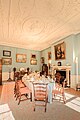 Fairfax House Dining Room.jpg 5,791 × 8,687; 24.31 MB
-
 Fairfax House Drawing Room.jpg 8,660 × 11,608; 63.4 MB
-
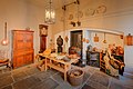 Fairfax House Kitchen.jpg 8,687 × 5,791; 25.44 MB
-
 Fairfax House Library (254358291).jpeg 2,048 × 1,365; 860 KB
-
 Fairfax House Library.jpg 8,687 × 5,791; 26.51 MB
-
 Fairfax House Saloon.jpg 8,687 × 5,791; 31.04 MB
-
 Fairfax House Stairs.jpg 8,624 × 11,576; 47.65 MB
-
 Fairfax House Viscount Bedroom.jpg 14,440 × 5,770; 53.23 MB
-
 Farmland drained by Osbaldwick Beck - geograph.org.uk - 5771087.jpg 1,024 × 576; 94 KB
-
 Farmland east of Holtby Lane Farm - geograph.org.uk - 5771170.jpg 1,024 × 768; 248 KB
-
 Farmland from York Lane - geograph.org.uk - 5746987.jpg 640 × 427; 227 KB
-
 Farmland north-east of Sandfield Farm - geograph.org.uk - 5771197.jpg 1,024 × 768; 206 KB
-
 Farmland west of Turkers Wood - geograph.org.uk - 5771161.jpg 1,024 × 768; 233 KB
-

-
 Hedged fields, south of Murton - geograph.org.uk - 5757376.jpg 1,024 × 768; 186 KB
-
 Holtby - the centre of the village - geograph.org.uk - 5761310.jpg 1,024 × 768; 173 KB
-
 Holtby Lane at Turkers Wood - geograph.org.uk - 5771138.jpg 1,024 × 768; 193 KB
-
 Holtby Moor farmland, drained by Carr Goit - geograph.org.uk - 5771230.jpg 1,024 × 768; 257 KB
-
 Inner Courtyard at the King's Manor in York.jpg 7,360 × 4,912; 22.33 MB
-
 Inside the Assembly Rooms York.jpg 2,448 × 2,448; 1.51 MB
-
 Looking towards Strensall - geograph.org.uk - 5741082.jpg 427 × 640; 234 KB
-
 Main Street - geograph.org.uk - 5747116.jpg 640 × 427; 266 KB
-
 Moor Lane, at the northern edge of Murton - geograph.org.uk - 5759964.jpg 1,024 × 768; 221 KB
-
 Murton Moor farmland drained by Osbaldwick Beck - geograph.org.uk - 5771058.jpg 1,024 × 768; 158 KB
-
 Passing the golf course - geograph.org.uk - 5741080.jpg 640 × 427; 235 KB
-
 Path in Strensall - geograph.org.uk - 5741078.jpg 640 × 427; 213 KB
-

-
 Power lines crossing Stockton West Moor - geograph.org.uk - 5771115.jpg 1,024 × 768; 181 KB
-
 Public footpath from Moor Lane to Primrose Farm - geograph.org.uk - 5759990.jpg 1,024 × 768; 180 KB
-
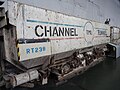 Railway museum - Channel tunnel 1.jpg 2,592 × 1,944; 2.1 MB
-
 Railway museum - Channel tunnel 2.jpg 2,592 × 1,944; 2.15 MB
-
 Railway museum - London mail rail car.jpg 2,592 × 1,944; 2.01 MB
-
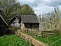
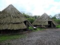 Reconstructed prehistoric village, Murton - geograph.org.uk - 5759915.jpg 1,024 × 768; 240 KB
-
 Road over Strensall Common - geograph.org.uk - 5741085.jpg 640 × 427; 202 KB
-
 Roadside tree, Holtby Lane - geograph.org.uk - 5761753.jpg 1,024 × 768; 223 KB
-
 Roman fort, from the Porta Praetoria (main gate) - geograph.org.uk - 5759891.jpg 1,024 × 768; 227 KB
-
 Rudcarrs farmland, drained by Carr Goit - geograph.org.uk - 5761757.jpg 1,024 × 768; 254 KB
-

-
 St Sampsons.jpg 3,024 × 4,032; 3.73 MB
-
 The church and houses in Church Rise, Holtby - geograph.org.uk - 5761267.jpg 1,024 × 768; 201 KB
-
 The north-western edge of Turkers Wood - geograph.org.uk - 5771150.jpg 1,024 × 768; 274 KB
-

-

-

-
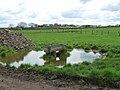 Trough on waterlogged ground, north of Murton - geograph.org.uk - 5759977.jpg 1,024 × 768; 218 KB
-
 Uncultivated field margin, Stockton West Moor - geograph.org.uk - 5771111.jpg 1,024 × 768; 227 KB
-
 University of York - library in 2018 01.jpg 2,592 × 1,944; 1.48 MB
-
 University of York - library in 2018 02.jpg 2,592 × 1,944; 1.68 MB
-
 University of York library - April 2018 - 01.jpg 2,592 × 1,944; 1.59 MB
-
 University of York library - April 2018 - 02.jpg 2,592 × 1,944; 1.61 MB
-
 University of York library - April 2018 - 03.jpg 2,592 × 1,944; 1.78 MB
-
 University of York library - April 2018 - 04.jpg 2,592 × 1,944; 2.23 MB
-
 University of York library - April 2018 - 05.jpg 1,944 × 2,592; 1.96 MB
-
 Work on Foss barrier - 2018.jpg 2,592 × 1,944; 3.06 MB
-
 Work on Foss barrier 2 - 2018.jpg 2,592 × 1,944; 2.84 MB
-
 Work on Foss barrier 3 - 2018.jpg 2,592 × 1,944; 2.36 MB
-
 Work on Foss barrier 4 - 2018.jpg 2,592 × 1,944; 3.17 MB


.jpeg)
.jpg)
.jpg)


.jpeg)


_-_geograph.org.uk_-_5759891.jpg)


_of_the_Roman_fort_at_Murton_-_geograph.org.uk_-_5759894.jpg)


