Category:Arabic-language maps
Please place all maps in Arabic in this category.
Subcategories
This category has the following 11 subcategories, out of 11 total.
Media in category "Arabic-language maps"
The following 200 files are in this category, out of 371 total.
(previous page) (next page)-
 0529121005168j0jg5b4jylwj5snftmefj.jpg 418 × 389; 22 KB
-
 052912100531u4znhzkqf4qzc.jpg 561 × 730; 71 KB
-
 1154 Tabula Rogeriana noroeste Peninsula Iberica Al Idrisi copia mas antigua.jpg 4,800 × 3,231; 6.31 MB
-
 1154 world map by Moroccan cartographer al-Idrisi for king Roger of Sicily.jpg 1,296 × 1,296; 741 KB
-
 1513 Piri Reis.jpg 2,000 × 2,753; 2.29 MB
-
 1803 World Map published in Istanbul.tif 10,805 × 7,774; 240.37 MB
-
 2006carob-ar.png 1,425 × 625; 60 KB
-

-
 800px-Arab-Israeli Map2.png 800 × 455; 39 KB
-
 Kurd scattering.jpg 1,280 × 1,149; 246 KB
-
 A Complete Portrayal of the Earth WDL131.png 1,024 × 1,051; 2.64 MB
-
 Abass-will-007.png 1,002 × 745; 102 KB
-
 Abdalwadid.JPG 1,134 × 531; 170 KB
-
 Abrahamic distribution-ar.png 1,338 × 640; 58 KB
-
 Abu mahali rihla-ar.png 800 × 414; 124 KB
-
 Adygea ar.png 731 × 635; 31 KB
-
 Agouza district map.jpg 1,056 × 719; 338 KB
-
 Al-Aaimmah bridge area-ar.png 665 × 243; 42 KB
-
 Al-Haramain Mosque.jpg 1,322 × 675; 322 KB
-
 Al-hasa.png 942 × 732; 1.95 MB
-
 Al-idrisi world map.jpg 6,828 × 5,068; 11.05 MB
-
 Al-Idrisi's world map.JPG 1,424 × 1,552; 917 KB
-
 Al-Idrisi-s world map.jpg 492 × 570; 72 KB
-
 Albers projection ar.png 1,288 × 749; 1.06 MB
-
 Antarctic-seas-ar.jpg 1,118 × 882; 123 KB
-
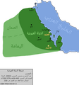
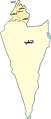
 Ar Larache Province Morocco.png 966 × 490; 68 KB
-
 Arab world map 1154.png 342 × 336; 76 KB
-
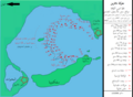
 Arabian Sea map-A.png 800 × 757; 126 KB
-
 Arabian woman Portal.png 866 × 694; 94 KB
-
 Arabic-Snider-Pellegrini Wegener fossil map.png 577 × 443; 115 KB
-
 Archaeological Sites of Horse Remains-ar.png 2,866 × 2,274; 15.65 MB
-
 AustralianMapinArabic.svg 595 × 500; 13 KB
-
 Ayyubid Dynasty ar.png 2,012 × 1,224; 346 KB
-
 Azawad map-arabic.jpg 660 × 706; 124 KB
-
 AzChiraqGuneshliYataqlari.jpg 439 × 132; 7 KB
-
 Bab el Mandeb NAS-AR description.png 1,024 × 702; 1.26 MB
-
 Bahri Dynasty 1250 - 1382 (AD) ar.png 511 × 346; 84 KB
-
 Balkan 1912-ar.svg 969 × 925; 1.73 MB
-
 Bani Khalid Invades Diriyah (Arabic).jpg 1,080 × 601; 85 KB
-
 Bantu expansion-ar.png 400 × 424; 138 KB
-
 Bataille navarine ar.png 924 × 683; 218 KB
-
 Battle of lake trasimene-ar.gif 1,280 × 983; 308 KB
-
 Battle of Santa Cruz map-ar.jpg 800 × 799; 105 KB
-
 Bay-of-Piran maritime-boundary-dispute-ar.png 2,000 × 1,863; 334 KB
-
 Bin Mohaya.jpg 650 × 640; 161 KB
-
 Bodleian Library MS. Marsh 294 f 6a.jpg 785 × 1,000; 704 KB
-
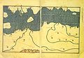
 Book of Curiosities - Sicily map.jpg 3,200 × 2,182; 4.94 MB
-
 Bordj Map.png 2,536 × 1,600; 115 KB
-
 Branches of Christianity (Arabic 2).png 811 × 518; 61 KB
-
 1581 Bunting clover leaf map-ar.png 2,961 × 2,331; 13.19 MB
-
 C952 map of ash-Sham by Ibrahim ibn Muhammad Istakhri (rotated 180°).jpg 2,224 × 3,008; 3.23 MB
-
 C952 map of ash-Sham by Ibrahim ibn Muhammad Istakhri.jpg 2,224 × 3,008; 3.23 MB
-
 Caffa and Theodoro-ar.png 700 × 470; 65 KB
-
 Cairo300.jpg 800 × 850; 247 KB
-
 Cairoeg.jpg 1,024 × 890; 248 KB
-
 Campania Provinces ar.png 1,056 × 816; 25 KB
-
 CanaanMap-ar.jpg 581 × 950; 530 KB
-
 CAR تقسيم إداري.png 423 × 281; 34 KB
-
 Cart 05.jpg 693 × 506; 79 KB
-
 Carte archéologique de l'Iraq - btv1b53212203v.jpg 7,421 × 9,127; 8.21 MB
-

-

-
 Carte peuple touareg ar.jpg 600 × 383; 85 KB
-
 Cheetah range-ar.png 488 × 394; 22 KB
-
 Chukchi Sea map ar.png 1,202 × 675; 229 KB
-
 ClimateMapWorld Arabic.png 727 × 470; 336 KB
-
 Colonizationoftheamericas-ar.png 463 × 599; 68 KB
-
 Communes Wilaya Jijel Arabe.png 1,280 × 660; 268 KB
-
 Country foreign exchange reserves minus external debt-ar.png 1,818 × 828; 196 KB
-
 Dagestan topographic map-ar.png 500 × 640; 382 KB
-
 Dagestanian avar`s.png 421 × 315; 59 KB
-
 Daira de merouana.jpg 740 × 537; 96 KB
-
 DesoukLocationInKFS2.PNG 371 × 276; 25 KB
-
 Die Portugiesenzeit (Strandes) 109.jpg 1,165 × 1,800; 376 KB
-
 Diriyah Invades Bani Khalid (Arabic).jpg 1,080 × 599; 87 KB
-
 Disciplines mind map-ar.png 1,173 × 622; 249 KB
-
 Diwaniya districts.jpg 1,593 × 1,528; 1.07 MB
-
 Djibouti-regions-ar.png 676 × 735; 95 KB
-
 Dāʼirat al-Arāḍī wa-al-Misāḥah, Trans-Jordan track map 01 (FL27925363 2366969).jpg 19,082 × 16,769; 346.6 MB
-
 Dāʼirat al-Arāḍī wa-al-Misāḥah, Trans-Jordan track map 02 (FL27925368 2366969).jpg 18,697 × 15,625; 361.67 MB
-
 Equal-Earth-Map-0-AR.jpg 19,250 × 10,150; 20.59 MB
-
 World-Map-Ismail-Hakki-Erzurumi-1756.png 357 × 573; 461 KB
-
 Esh Sheikh Muwannis.Registration block 6630. Wad en Najma & Wad en Nada (FL197694331 1134534).jpg 13,514 × 16,384; 213.38 MB
-
 Ethnic Groups In Caucasus Region 2009-ar.jpg 2,000 × 2,325; 1.66 MB
-
 Fatimid Islamic Caliphate-ar.png 994 × 544; 141 KB
-
 Ghajar highlighted-ar.jpg 742 × 860; 372 KB
-
 Gineifa station (FL35476356 2661582).jpg 17,175 × 13,249; 288.39 MB
-
 Gov-HasakeLargFont.jpg 1,060 × 751; 309 KB
-
 Grand casablanca Morocco.jpg 445 × 397; 95 KB
-
 Guelf c12-ar.jpg 600 × 614; 162 KB
-
 Guidimaka DepartmentsAR.png 776 × 600; 77 KB
-
 Gulf of Aden map-ar.png 3,333 × 2,781; 1.06 MB
-
 Haditha location map-Recovered-ar.png 876 × 660; 172 KB
-
 Halhul map.JPG 407 × 383; 28 KB
-
 Hecataeus world map-ar.png 616 × 600; 90 KB
-
 Herodotus world map-ar.png 796 × 485; 139 KB
-
 Historical map of Turkey AD 1393-ar.png 843 × 473; 123 KB
-
 IberianPeninsula Banu Qasi-ar.png 237 × 169; 74 KB
-
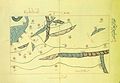
 Ibn al Wardi's atlas.jpg 1,000 × 665; 429 KB
-
 Ibn Howqal World map-001.jpg 460 × 473; 178 KB
-
 Ibn Wardi Kaaba map.jpeg 478 × 720; 81 KB
-
 Ibn Wardi mappa mundi.jpeg 720 × 569; 88 KB
-
 Islamic map of the world Wellcome L0035009.jpg 3,576 × 4,072; 2.54 MB
-
 Island of the Jewel.png 2,232 × 946; 3.25 MB
-
 Istanbul districts-ar.png 950 × 772; 111 KB
-
 Jacques-Nicolas Bellin, Vera delineatio civitatis Bassorae (FL37476699 2473381).jpg 10,350 × 9,031; 133.82 MB
-
 Jerusalem Gates.png 1,306 × 919; 263 KB
-
 Jerusalem Gates.svg 1,306 × 919; 161 KB
-
 JAO blanco AR.png 773 × 475; 17 KB
-
 Jewry-ar.PNG 950 × 417; 42 KB
-
 Khalid ajaaj.jpg 1,202 × 824; 172 KB
-
 Khalili Collection Hajj and Arts of Pilgrimage arc.pt 0626.jpg 2,500 × 3,718; 528 KB
-
 Layoune-Semara-Rio doro.PNG 250 × 250; 11 KB
-
 Mamlakat abu mahali 2-ar.jpg 478 × 499; 36 KB
-
 Mamlukes-Ayyubid Dynasty-ar.png 511 × 346; 91 KB
-
 Map assassination of Hisham Barakat.jpg 1,316 × 630; 277 KB
-
 Map Greco-Persian Wars-ar.png 663 × 532; 413 KB
-
 Map of Al Hijaz Train Lines.png 1,074 × 1,127; 1.69 MB
-
 Map of Bani Khalid Emirate.png 1,600 × 1,046; 137 KB
-
 Map of Damietta, Jacut.png 440 × 286; 77 KB
-
 Map of Jabrid Emirate.png 10,000 × 9,000; 3.98 MB
-
 Map of Jarwanid Emirate.png 9,779 × 8,280; 3.45 MB
-
 Map of Kingdom of Ormus.png 10,000 × 9,000; 2.87 MB
-
 Map of pre-Nakba Palestine framed صورة لخارطة لفلسطين ما قبل النكبة.jpg 1,280 × 1,920; 956 KB
-
 Map of Usfurid Emirate.png 9,779 × 8,280; 3.15 MB
-
 Map of Uyunid Emirate (3).png 10,000 × 9,000; 2.56 MB
-
 Map of Uyunid Emirate.png 3,737 × 4,000; 579 KB
-
 Map-Europe-Outermost-regions-ar.PNG 1,427 × 628; 567 KB
-
 Mapa do Mediterráneo de al-Balkhī (c. 921).jpg 2,971 × 3,847; 7.24 MB
-
 Mapa do Mediterráneo de al-Balkhī (c. 921; trans. de K. Miller, 1926).jpg 3,333 × 4,316; 6.51 MB
-
 Mapa do Mediterráneo do Libro de Curiosidades (1190-1210).jpg 12,599 × 8,560; 14.32 MB
-
 Mapa do Mediterráneo, al-Balkhī (921).jpg 1,080 × 1,404; 1.84 MB
-
 Mappa di Eratostene-ar.png 1,040 × 611; 887 KB
-
 Marawi.map.arabic.jpg 300 × 250; 52 KB
-
 Middle east map 920.png 1,268 × 1,080; 296 KB
-
 Muhammad al-Idrisi - Oxford transcript of V-4.jpg 2,102 × 1,450; 1.72 MB
-
 Muhammad al-Idrisi - Oxford transcript of VI-4.jpg 2,106 × 1,448; 1.65 MB
-
 Muhammad al-Idrisi - Oxford transcript of VI-5.jpg 2,105 × 1,452; 1.53 MB
-
 Muhammad al-Idrisi - Paris transcript of V-4.jpg 2,114 × 1,461; 2.02 MB
-
 Muhammad al-Idrisi - Paris transcript of VI-4.jpg 2,112 × 1,459; 1.98 MB
-
 Muhammad al-Idrisi - Paris transcript of VI-5.jpg 2,112 × 1,462; 1.9 MB
-
 Muhammad al-Idrisi - Saint Petersburg transcript of V-4.jpg 2,120 × 1,470; 1.9 MB
-
 Muhammad al-Idrisi - Saint Petersburg transcript of VI-4.jpg 2,107 × 1,458; 1.81 MB
-
 Muhammad al-Idrisi - Saint Petersburg transcript of VI-5.jpg 2,108 × 1,462; 1.96 MB
-
 Muhammad al-Idrisi - Sofia transcript of V-4.jpg 2,107 × 1,448; 1.57 MB
-
 Muhammad al-Idrisi - Sofia transcript of VI-4.jpg 2,109 × 1,456; 1.57 MB
-
 Muhammad al-Idrisi - Sofia transcript of VI-5.jpg 2,114 × 1,463; 1.94 MB
-
 Nador Province.PNG 208 × 166; 5 KB
-
 Naqab map.jpg 300 × 701; 27 KB
-
 Navarin navires ottomans ar.png 934 × 683; 153 KB
-
 NE 565ad-ar.png 533 × 351; 431 KB
-

-

-

-
 Onepiece-welt (2)-ar.png 653 × 663; 245 KB
-
 Osmanli Ortadogu.jpg 7,374 × 5,629; 9.42 MB
-
 Outre-mer-ar.png 1,480 × 740; 82 KB
-

-
 Palestine and Turkey (FL25570486 2514341).jpg 22,981 × 15,683; 477.91 MB
-
 Pangaea continents-ar.png 758 × 853; 65 KB
-
 Percentage population undernourished world map-ar.PNG 1,355 × 768; 46 KB
-
 Petite Kabylie.png 640 × 410; 29 KB
-
 Phalia Map New By Tariq Imran 3rd.jpg 1,000 × 700; 484 KB
-
 Piri Reis - Map of the City of Alexandria - Walters W658302A - Full Page-1.jpg 1,800 × 1,232; 701 KB
-
 Piri Reis - Oval World Map - Google Art Project.jpg 11,360 × 7,589; 16.88 MB
-
 Piri Reis - World Map in a Double Hemisphere - Google Art Project.jpg 12,568 × 8,349; 18.46 MB
-
 Plates tect2 ar.png 800 × 546; 1.67 MB
-
 Qais006.gif 380 × 407; 80 KB
-
 Rayons of the Republic of Azerbaijan.png 2,000 × 1,586; 190 KB
-
 RBSCLHeliopolis1951Map(publicdomain).png 512 × 512; 381 KB
-
 Re.png 1,035 × 539; 1,008 KB
-
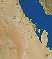
 Red Sea topographic map-ar.png 1,771 × 2,751; 4.59 MB
-
 Region Fes-Boulemane.PNG 194 × 202; 6 KB
-
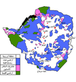 Rhodesialand Arabic.png 699 × 747; 200 KB
-
 Rojava february2014 2-ar.png 3,903 × 1,802; 413 KB
-
 Romah.jpg 800 × 942; 119 KB
-
 Romain Empire in 210 AD arabic coloured map.png 2,052 × 1,414; 175 KB
-
 Rostomi.png 588 × 748; 46 KB
-
 Sadr City April 2008-ar.jpg 1,378 × 1,164; 1.62 MB
-
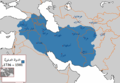 Safavid Empire 1501 1722 AD-ar.png 620 × 428; 41 KB
-
 Sahara avant le désert-ar.jpg 1,077 × 964; 452 KB
-
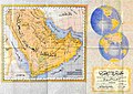 Saudi map of Persian gulf 1952.jpg 623 × 442; 127 KB
-
 Shamiya regions.png 433 × 413; 25 KB
-
 Sharqiyya arabic.jpg 1,146 × 1,291; 771 KB
-
 Shattering isochamend ar.png 1,304 × 720; 650 KB
-
 Shemal arabic.jpg 833 × 429; 301 KB
-
 Sicilia-Idrisi1154-XIIIsec.jpg 600 × 400; 50 KB
-
 Sinusoidal projection ar.png 1,449 × 473; 152 KB
-
 SmallAsteroidImpacts-Frequency-Bolide-20141114-ar.jpg 800 × 560; 236 KB
-
 SolarGIS-Solar-map-Africa-and-Middle-East-ar.png 850 × 850; 661 KB
-
 South American plates-ar.png 1,440 × 1,423; 493 KB
-
 SpreadofTTinWorld-695x423.jpg 695 × 423; 57 KB
-
 Strait of Hormuz AR.jpg 583 × 357; 106 KB
-
 Strait tiran 83-ar.jpg 996 × 1,264; 370 KB
-
 Stylized Persian Gulf.jpg 1,512 × 2,216; 1.2 MB
-
 Survey of Egypt, Cairo 01-563 (FL160994059 0934978).jpg 14,886 × 16,128; 280.95 MB
-
 Survey of Egypt, Cairo 02-584 (FL160994060 0934978).jpg 14,976 × 16,130; 273.99 MB
-
 Survey of Egypt, القدس (FL4541418 2514322).jpg 9,947 × 12,115; 137.6 MB
-
 Survey of Palestine, Al Haram (FL62919418 3525991).jpg 12,964 × 10,678; 140.1 MB
-


_ar.png)

.jpg)


.png)

.jpg)


.jpg)
.jpg)


_109.jpg)
.jpg)


.jpg)


.jpg)


.jpg)


.png)


.jpg)
.jpg)
.jpg)


_(original,_1154;_c%C3%B3pia,_c._1300).jpg)
_(original,_1154;_c%C3%B3pia,_c._1300).jpg)
.jpg)
-ar.png)


.jpg)


.png)


.jpg)
.jpg)
.jpg)
.jpg)
.jpg)
.jpg)
.jpg)
.jpg)