Category:Arapaoa Island
island in New Zealand  | |||||
| Upload media | |||||
| Instance of | |||||
|---|---|---|---|---|---|
| Location | Marlborough District, New Zealand | ||||
| Located in or next to body of water | |||||
| Highest point |
| ||||
| Area |
| ||||
 | |||||
Arapaoa Island, formerly known as Arapawa Island, is located in the Marlborough Sounds.
Subcategories
This category has the following 7 subcategories, out of 7 total.
D
- Deep Bay (4 F)
E
- East Head (Arapaoa) (1 F)
F
- Fishermans Bay (5 F)
R
- Ruaomoko Point (4 F)
T
- Te Awaiti Bay (2 F)
- Te Uira-Karapa Point (4 F)
- Tokakaroro Point (3 F)
Media in category "Arapaoa Island"
The following 11 files are in this category, out of 11 total.
-
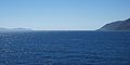 Cook Strait (New Zealand) North View.jpg 2,048 × 1,024; 1.62 MB
-
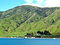 Okukari Bay.JPG 2,560 × 1,920; 8.11 MB
-
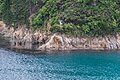
 Shore of Arapaoa Island 01.jpg 2,916 × 1,944; 4.64 MB
-
 Shore of Arapaoa Island 02.jpg 3,107 × 2,071; 3.89 MB
-
 Shore of Arapaoa Island 03.jpg 3,000 × 2,000; 3.04 MB
-
 Shore of Arapaoa Island 04.jpg 2,977 × 1,985; 5.69 MB
-
 Shore of Arapaoa Island 05.jpg 2,955 × 1,970; 5.24 MB
-
 South-eastern end of Arapaoa Island 01.jpg 3,000 × 2,000; 3.64 MB
-
 South-eastern end of Arapaoa Island 02.jpg 3,000 × 2,000; 3.82 MB
-
 South-eastern end of Arapaoa Island 03.jpg 2,936 × 2,000; 2.75 MB
-
 Southern end of Arapawa Island.jpg 1,024 × 768; 386 KB
_North_View.jpg)


