Category:Armenhoeve, Gemert
| Object location | | View all coordinates using: OpenStreetMap |
|---|
 | |||||
| Upload media | |||||
| Instance of | |||||
|---|---|---|---|---|---|
| Location | Gemert, Gemert | ||||
| Street address |
| ||||
| Located on street |
| ||||
| Heritage designation |
| ||||
 | |||||
|
This is a category about rijksmonument number 16053
|
| Address |
|
Media in category "Armenhoeve, Gemert"
The following 25 files are in this category, out of 25 total.
-
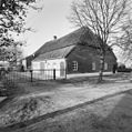
 D.804, achtergevel - Gemert - 20077024 - RCE.jpg 1,200 × 814; 239 KB
-
 D.804, voorgevels - Gemert - 20077022 - RCE.jpg 1,200 × 813; 210 KB
-
 D.804, zijgevel - Gemert - 20077023 - RCE.jpg 1,200 × 812; 299 KB
-
 Exterieur gedeelte gevel met deur - Gemert - 20326775 - RCE.jpg 1,190 × 1,200; 286 KB
-
 Exterieur overzicht - Gemert - 20326751 - RCE.jpg 1,181 × 1,200; 291 KB
-
 Exterieur overzicht stalgedeelte - Gemert - 20326779 - RCE.jpg 1,192 × 1,200; 385 KB
-
 Exterieur overzicht stalgedeelte, voorgevel - Gemert - 20326778 - RCE.jpg 1,172 × 1,200; 359 KB
-
 Exterieur paardenstal, betonnen stalraam - Gemert - 20326799 - RCE.jpg 1,197 × 1,200; 403 KB
-
 Exterieur paardenstal, betonnen stalraam - Gemert - 20326801 - RCE.jpg 1,195 × 1,200; 397 KB
-
 Exterieur stalgedeelte, achtergevel - Gemert - 20326780 - RCE.jpg 1,192 × 1,200; 413 KB
-
 Exterieur stalgedeelte, linker zijgevel - Gemert - 20326776 - RCE.jpg 1,192 × 1,200; 467 KB
-
-
 Gemert Rijksmonument 16053 Armenhoeve, Kromstraat 37B.JPG 3,648 × 2,736; 4.14 MB
-
 Interieur overzicht paardenstal - Gemert - 20326785 - RCE.jpg 1,195 × 1,200; 322 KB
-
 Interieur paardenstal, detail gebintstijl - Gemert - 20326793 - RCE.jpg 1,197 × 1,200; 354 KB
-
 Interieur paardenstal, gebintstijl - Gemert - 20326790 - RCE.jpg 1,200 × 1,200; 330 KB
-
 Interieur stal met gebintstijl - Gemert - 20326782 - RCE.jpg 1,192 × 1,200; 270 KB
-
 Interieur stal met houten wand - Gemert - 20326781 - RCE.jpg 1,197 × 1,200; 291 KB
-
 Interieur stal met kalkzandsteenwand - Gemert - 20326784 - RCE.jpg 1,188 × 1,200; 325 KB
-
 Kop- en zijgevel (oost-noord gevel) - Gemert - 20454518 - RCE.jpg 1,200 × 900; 157 KB
-
 Kop- en zijgevel (zuid-west gevel) - Gemert - 20454519 - RCE.jpg 1,200 × 900; 118 KB
-
 Kop- en zijgevel - Gemert - 20454521 - RCE.jpg 1,200 × 900; 129 KB
-
 Voor- en rechter zijgevel - Gemert - 20077015 - RCE.jpg 1,200 × 788; 251 KB
-
 Voorgevel - Gemert - 20077014 - RCE.jpg 1,200 × 788; 219 KB
-
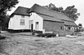
 Zij- en kopgevel - Gemert - 20454520 - RCE.jpg 1,200 × 900; 138 KB


_-_Gemert_-_20454518_-_RCE.jpg)
_-_Gemert_-_20454519_-_RCE.jpg)


